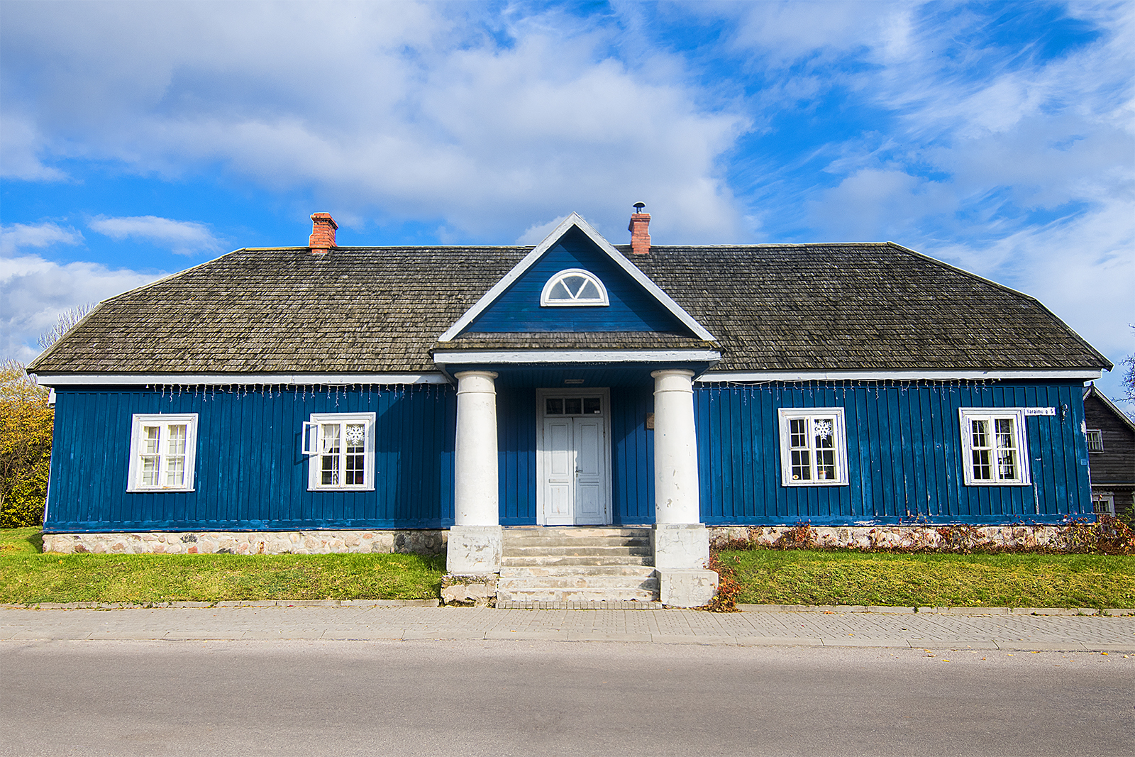
 Senieji Trakai Castle Site and Vytautas Road
1
Senieji Trakai Castle Site and Vytautas Road
1
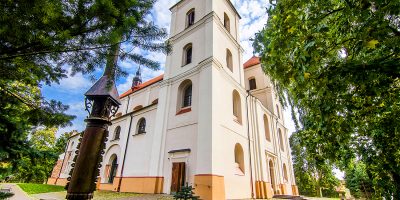
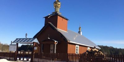
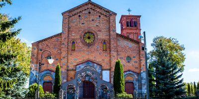
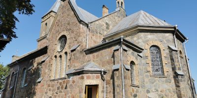
 Senieji Trakai Church of the Annunciation and St. Benedict
2
Senieji Trakai Church of the Annunciation and St. Benedict
2
 Monastery in Senieji Trakai Castle Site
3
Monastery in Senieji Trakai Castle Site
3
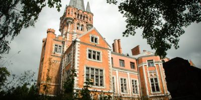
 Orthodox Church of the Nativity of the Most Blessed Virgin Mary
4
Orthodox Church of the Nativity of the Most Blessed Virgin Mary
4
 The plaque to commemorate the 200th anniversary of the Napoleonic march
5
The plaque to commemorate the 200th anniversary of the Napoleonic march
5
 Trakai Basilica of the Visitation of the Blessed Virgin Mary
6
Trakai Basilica of the Visitation of the Blessed Virgin Mary
6
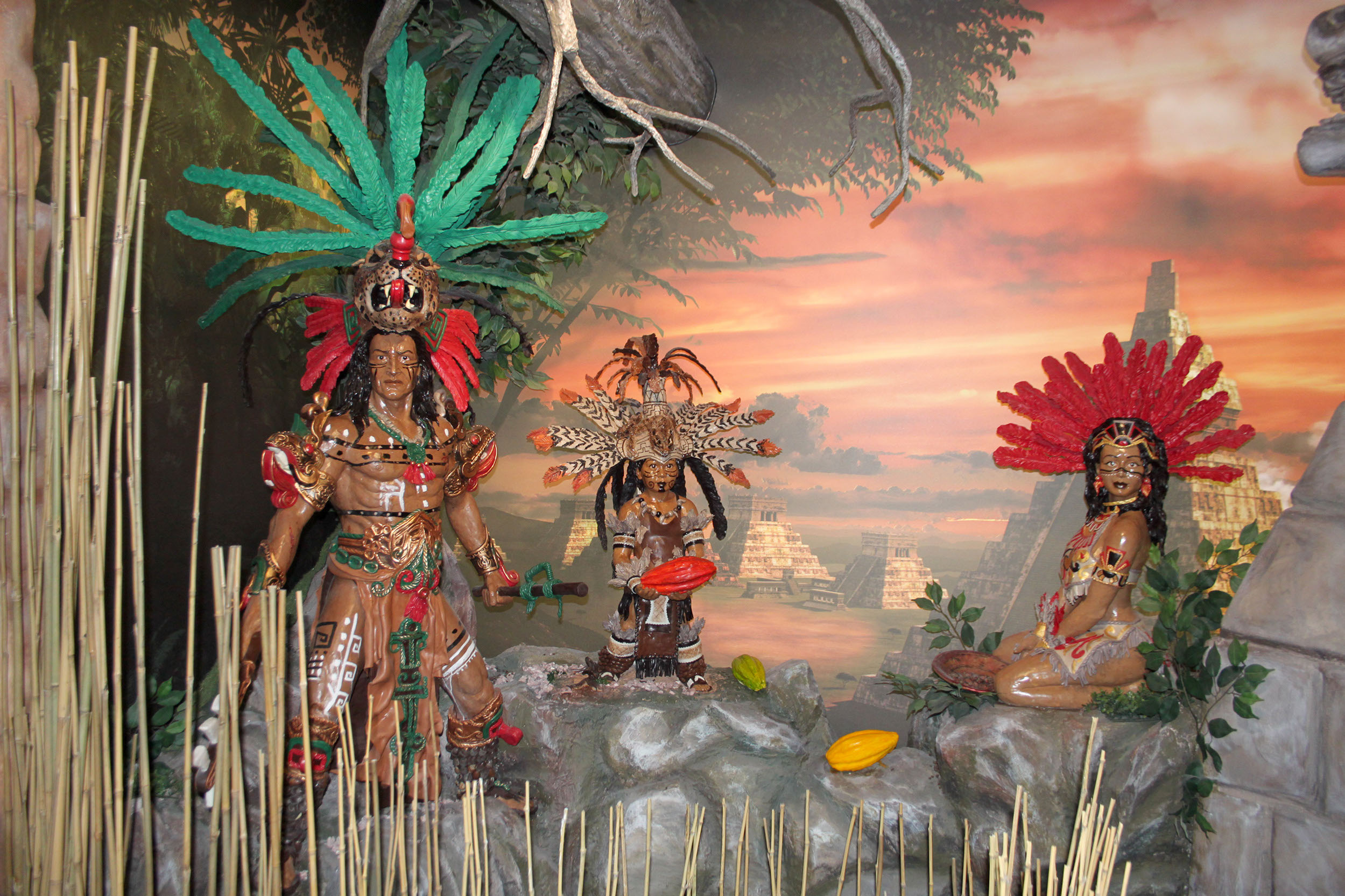
 AJ Chocolate Sculptures Museum
7
AJ Chocolate Sculptures Museum
7
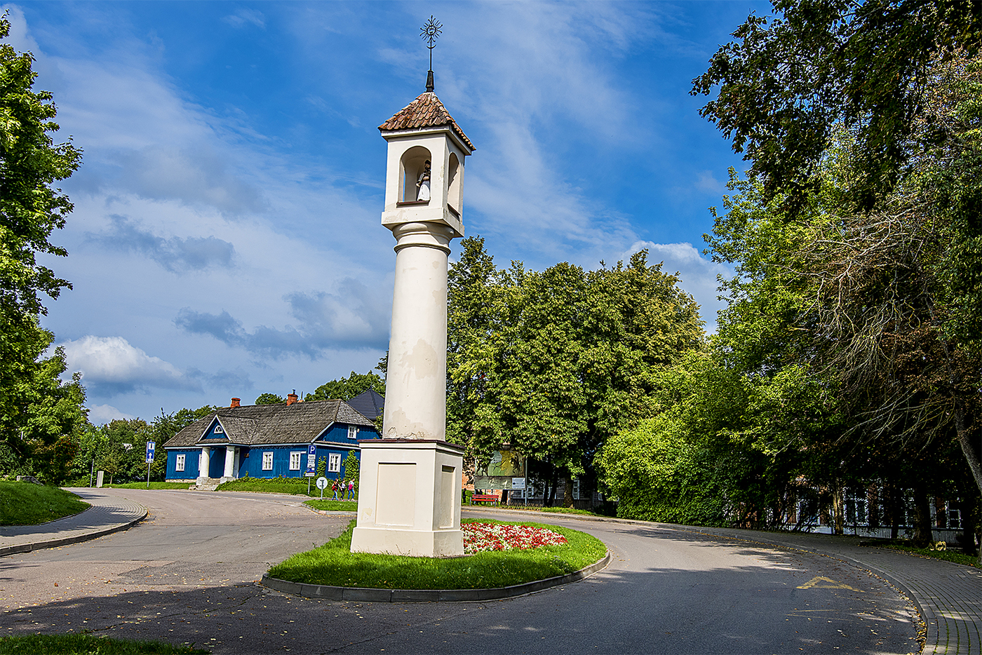
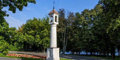 St. John of Nepomuk Roadsite Pole
8
St. John of Nepomuk Roadsite Pole
8
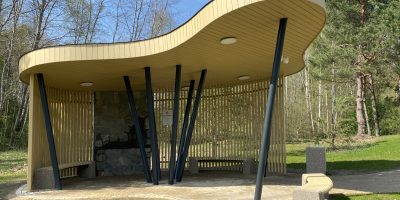
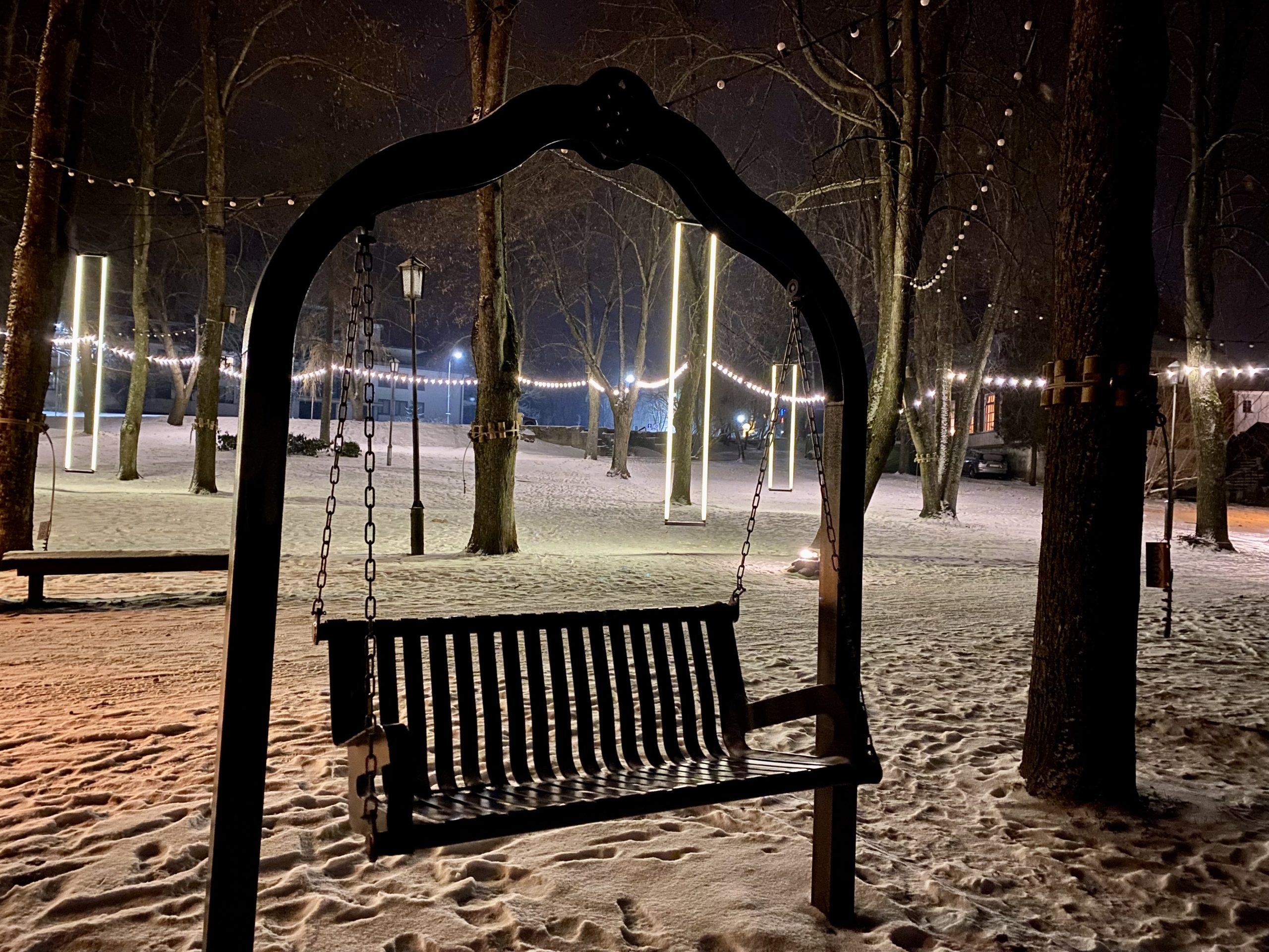
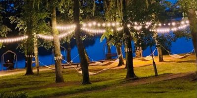 The Swing Park
9
The Swing Park
9
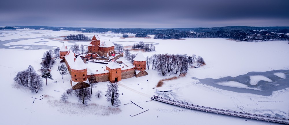
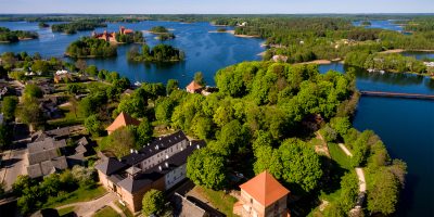 The Complex of Trakai Peninsula Castle and Other Structures
10
The Complex of Trakai Peninsula Castle and Other Structures
10
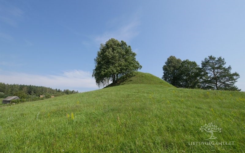
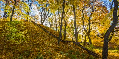 Sacrifice Hill
11
Sacrifice Hill
11
 The Former Dominican Monastery
12
The Former Dominican Monastery
12
 Peninsula Castle and Liturgical Art Exhibition
13
Peninsula Castle and Liturgical Art Exhibition
13
 Karaites’ street called the Small Town (Mažasis miestas)
14
Karaites’ street called the Small Town (Mažasis miestas)
14
 Former Russian Imperial Post Office
15
Former Russian Imperial Post Office
15
 S. Shapshal Karaite Ethnographic Museum
16
S. Shapshal Karaite Ethnographic Museum
16
 The Karaite School
17
The Karaite School
17
 Trakai Kenesa
18
Trakai Kenesa
18
 Karvinė, Karaimka or Kopūstinė Island
19
Karvinė, Karaimka or Kopūstinė Island
19
 Vytautas the Great Monument in Karaites’ (Karaimų) Island
20
Vytautas the Great Monument in Karaites’ (Karaimų) Island
20
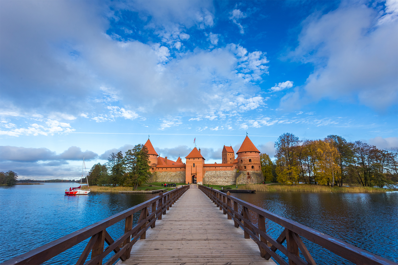
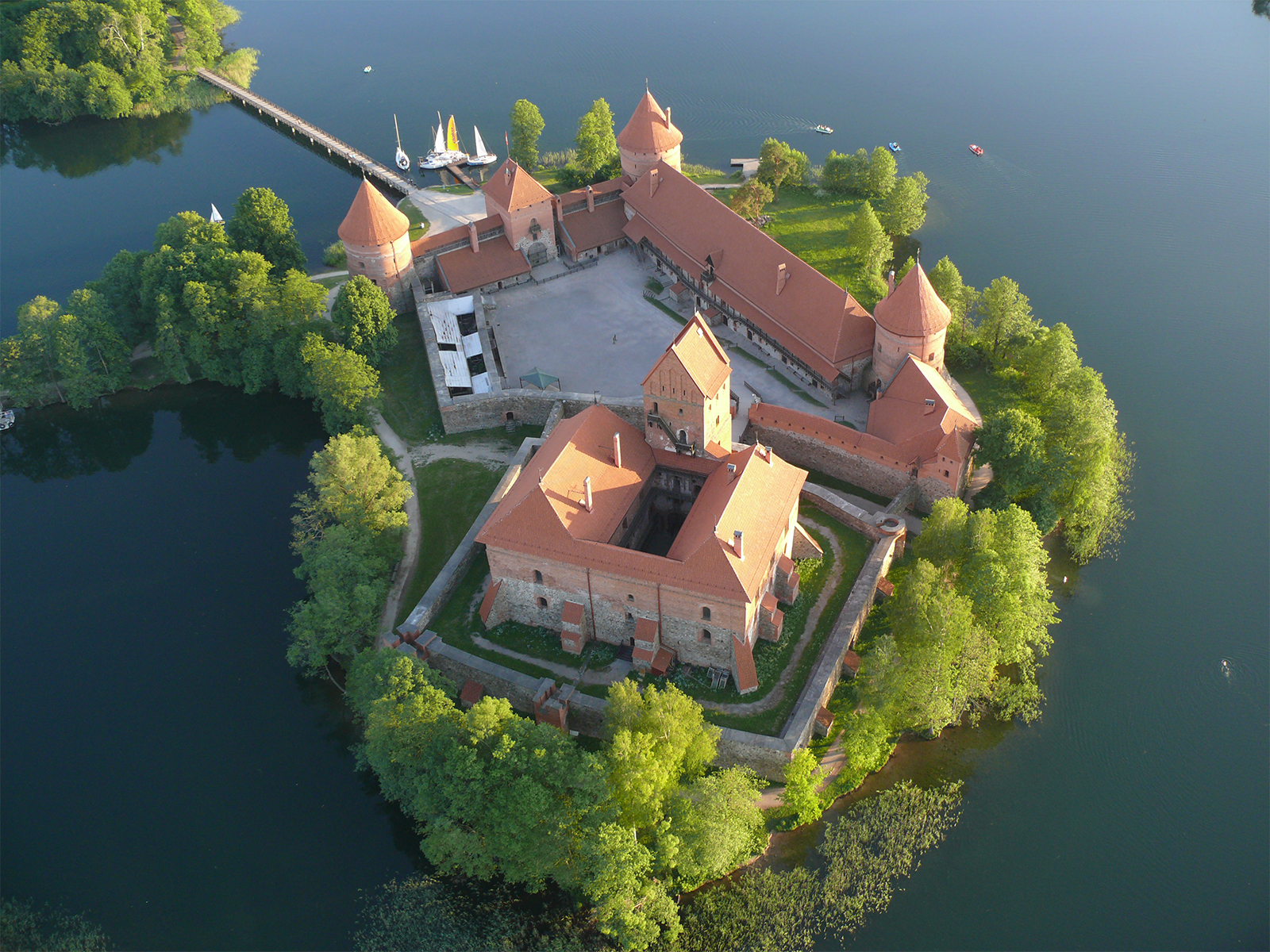
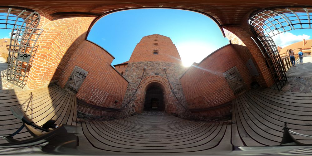
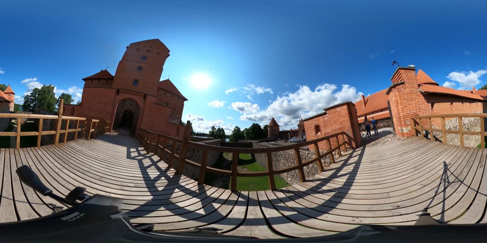
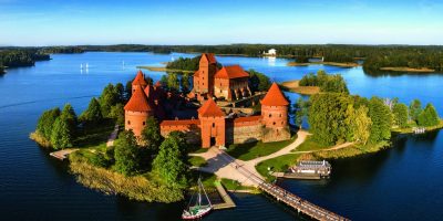 Trakai Island Castle
21
Trakai Island Castle
21
 Lake Galvė
22
Lake Galvė
22
 The Karaite Bridge
23
The Karaite Bridge
23
 Royal Fields or Karaite Fields
24
Royal Fields or Karaite Fields
24
 Daniliškės Old Believers' Church
25
Daniliškės Old Believers' Church
25
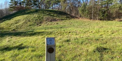
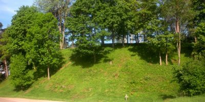
 Bražuolė Mound
26
Bražuolė Mound
26
 The Hill of Angels
27
The Hill of Angels
27
 The Potato Road
28
The Potato Road
28
 Užutrakis Manor House
29
Užutrakis Manor House
29
 Rykantai Church of the Saint Trinity
30
Rykantai Church of the Saint Trinity
30
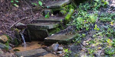 Saidžiai Spring
31
Saidžiai Spring
31
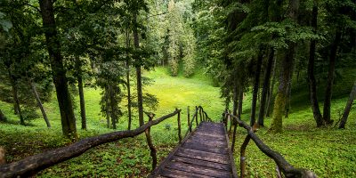
 Varnikai Cognitive Walking Way
32
Varnikai Cognitive Walking Way
32
 The place of Holocaust in Varnikai
33
The place of Holocaust in Varnikai
33
 Varnikai Mound
34
Varnikai Mound
34
 Natural mineral water pump-room (“bivouette")
35
Natural mineral water pump-room (“bivouette")
35
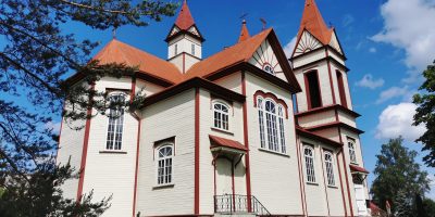
 Lentvaris Church of the Annunciation
36
Lentvaris Church of the Annunciation
36
 Lentvaris Manor
37
Lentvaris Manor
37
 A Chapel in Žukiškės
38
A Chapel in Žukiškės
38
 Church of the Holy Heart of Jesus in Rūdiškės
39
Church of the Holy Heart of Jesus in Rūdiškės
39
 Žuklijai Mound
40
Žuklijai Mound
40
 Gojus Blessed Virgin Mary Chapel of Patient Health
41
Gojus Blessed Virgin Mary Chapel of Patient Health
41
 Vytautava St. Anthony Of Padua Church
42
Vytautava St. Anthony Of Padua Church
42
 The Onuškis St. Apostle Philip and Jacob Church
43
The Onuškis St. Apostle Philip and Jacob Church
43
 Dusmenai St. Apostles Simon And Jude Thaddeus Church
44
Dusmenai St. Apostles Simon And Jude Thaddeus Church
44
 Church of St. John the Baptist in Paluknys
45
Church of St. John the Baptist in Paluknys
45
 Sinkhole of Strėva
46
Sinkhole of Strėva
46
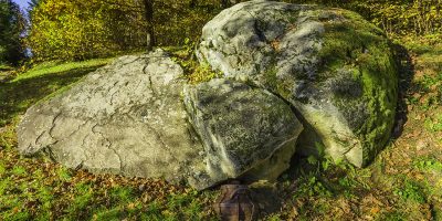 The Sign-Inscribed Stone of Nikronys
47
The Sign-Inscribed Stone of Nikronys
47
 Aukštadvaris Transfiguration Of Christ Church
48
Aukštadvaris Transfiguration Of Christ Church
48
 Aukštadvaris Mound
49
Aukštadvaris Mound
49
 The Devil’s Pit
50
The Devil’s Pit
50
 Aukštadvaris (Verknė old riverbed) spring
51
Aukštadvaris (Verknė old riverbed) spring
51
 Lavariškės Mound
52
Lavariškės Mound
52
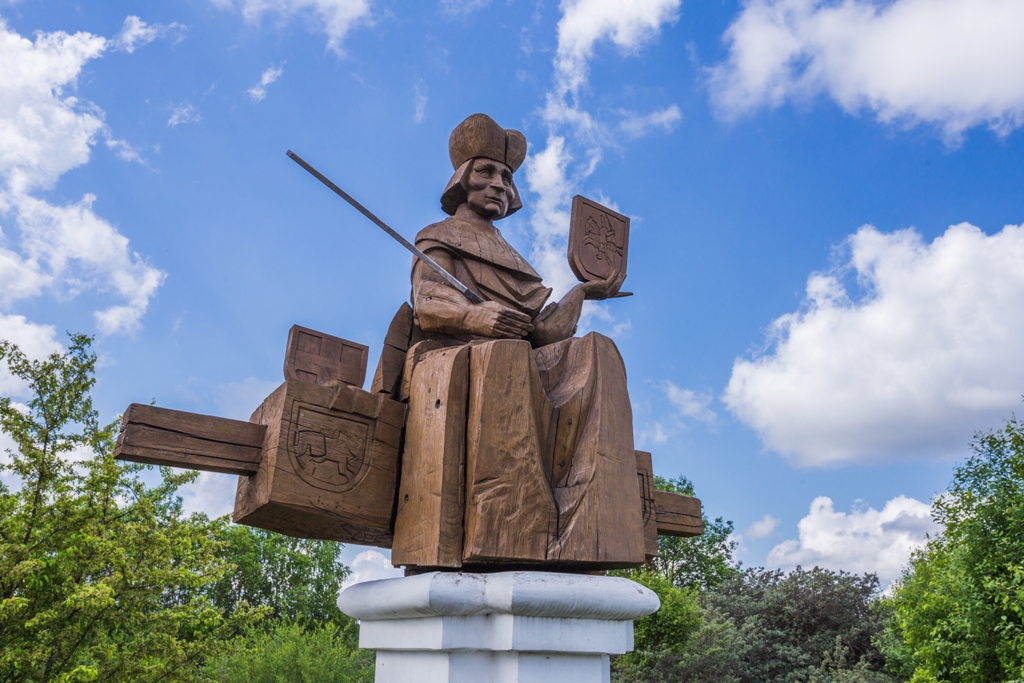
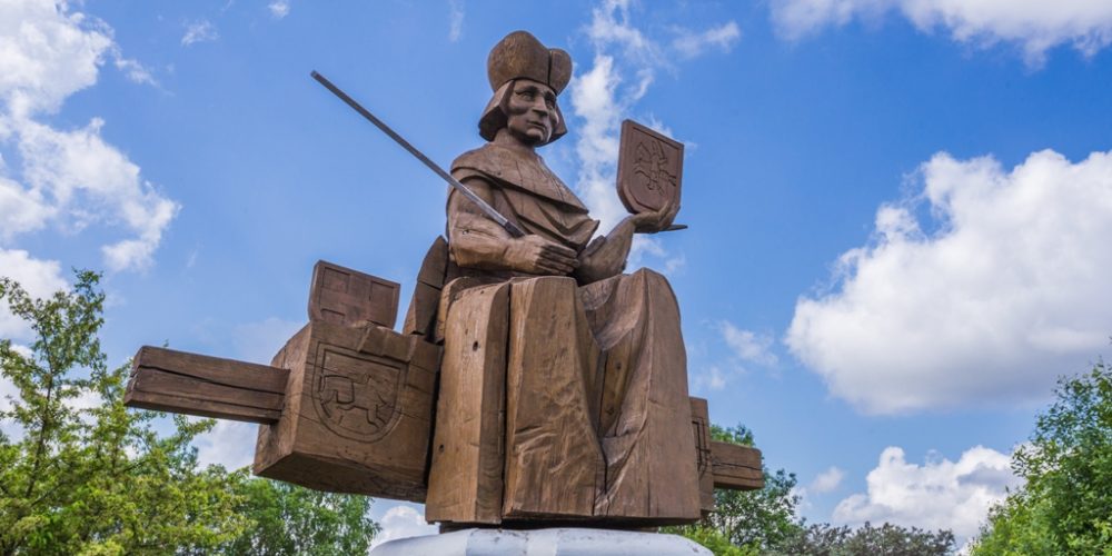
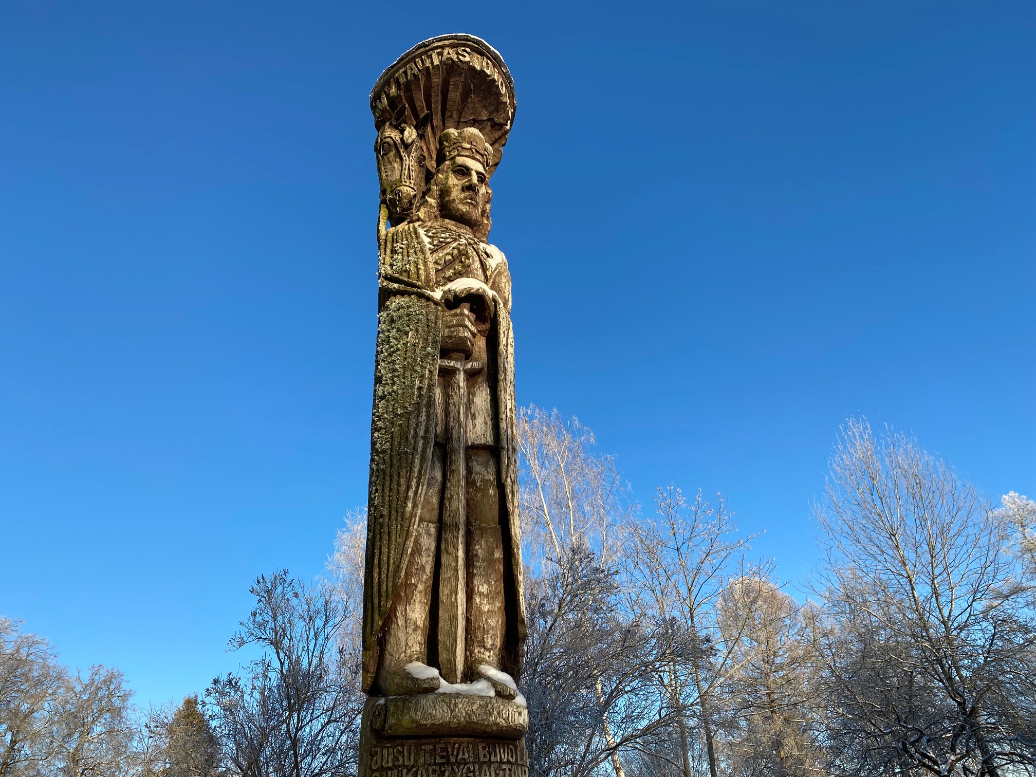
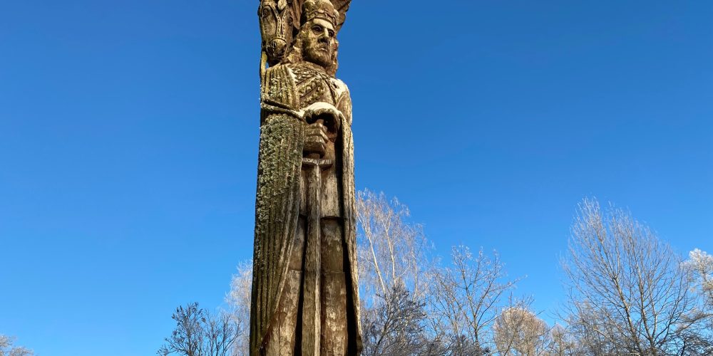
GPS: 54.617188,24.969886 (wooden sculpture of Grand Duke Vytautas).
Address: Pilies str. 1, Senieji Trakai village, Trakai district.
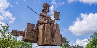
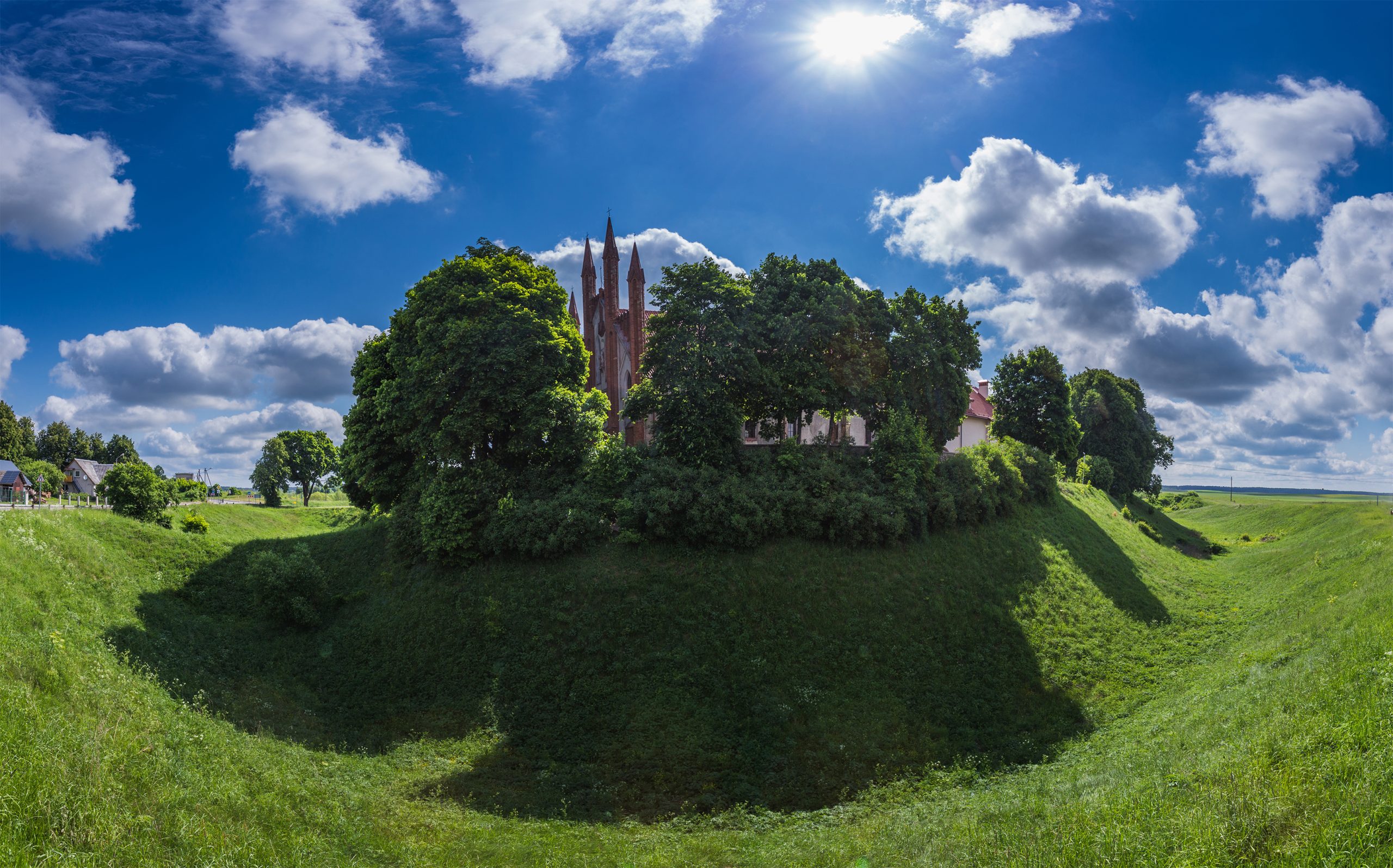
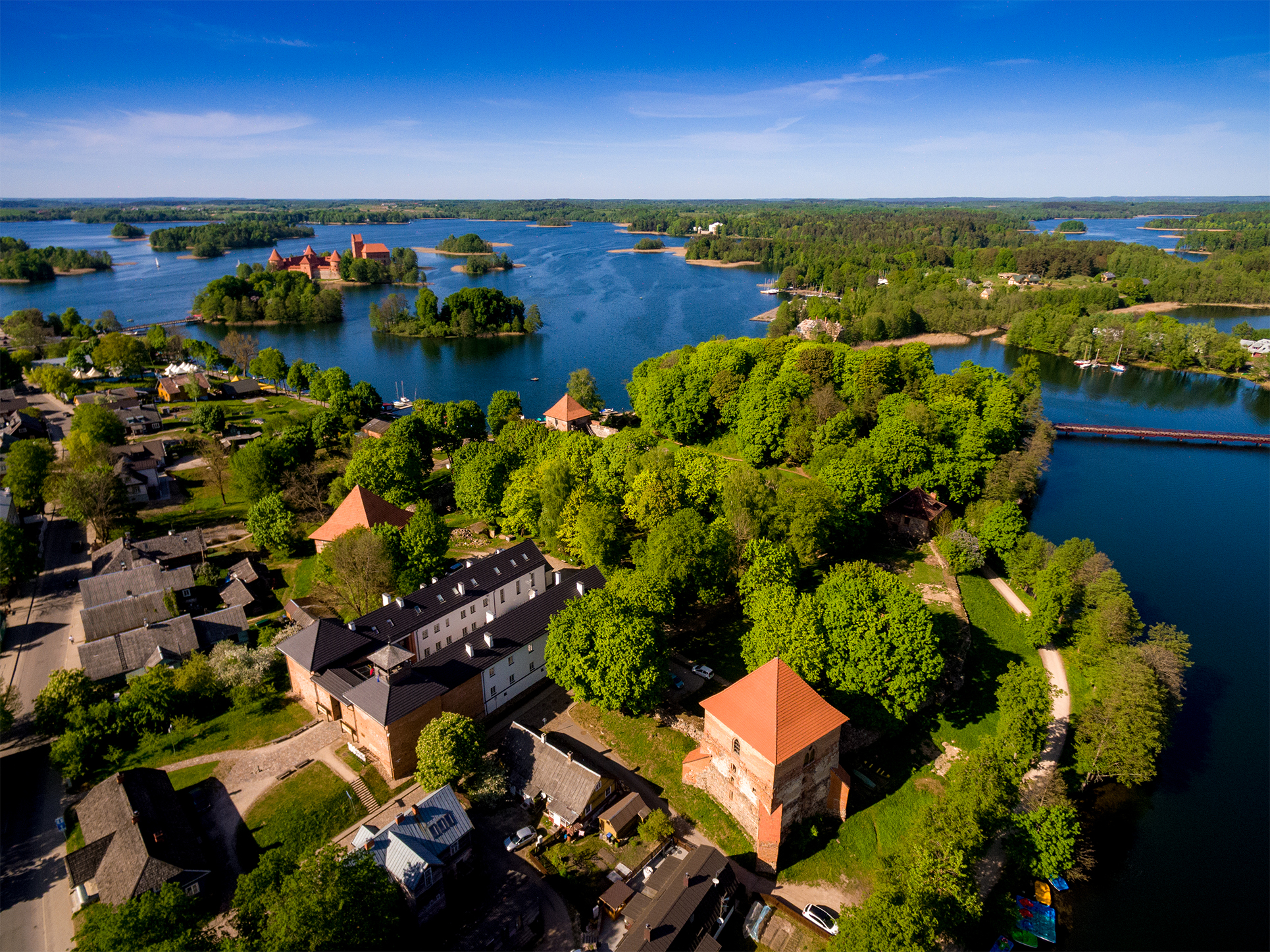
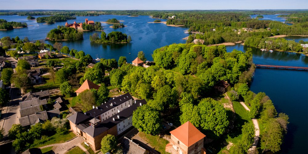
...Once upon a time Grand Duke Gediminas of Lithuania, who lived in his native Kernavė at the time, set out to hunt in woods on the other side of the River Neris. He saw a beautiful hill in the plains surrounded by oak trees. The duke was mesmerised by the magnificent place and decided to build a castle here. This is how a castle came to be built at the beginning of the 14th century and a new town, which we now call Senieji Trakai, quickly began to form around it. Gediminas made it Lithuania's capital, even though this lasted for just a short time.
It is worth knowing that Trakai derives its name from the word ‘trakas’ (track), meaning ‘a raised place in the forest’. The old forest and woods have disappeared, but the memory of the old landscape has remained engrossed in the name of the area.
Today's archaeologists tell us that these surrounding areas were inhabited a very long time ago. There is some proof that close to a small lake (now marsh) a large settlement was functioning in the first millennia BC. In an effort to preserve the area, Senieji Trakai was given the status of an archaeological preserve. Excavations unearthed some interesting artefacts from various periods: animal remains, knives, keys, tips of crossbow arrows and others. Archaeologists even found small scissors. It is speculated that these were the ones used by Birutė, the legendary wife of Duke Kęstutis, mother of Grand Duke Vytautas!
During the wars with the Teutonic Order the number of castles in the Grand Duchy of Lithuania increased. One of Lithuania's oldest masonry castles, Senieji Trakai Castle, was very conveniently situated in a strategic area. A castle built on a small hill fort was surrounded by a trench full of water. Written sources of the 16th century reveal a curious detail that the castle was accessible only by boat. Even much later (19th century) maps of the castle sites showed the existence of a drawbridge.
Senieji Trakai Castle is the birthplace of Grand Duke Vytautas. According to chronicles, the year 1350 marked the birth of one of the most prominent future Lithuanian historical personalities who was born into the family of Duke Kęstutis and Priestess Birutė. At the time when the highly esteemed Duke Vytautas was the ruler, Lithuania expanded from the Baltic sea to the Black sea!
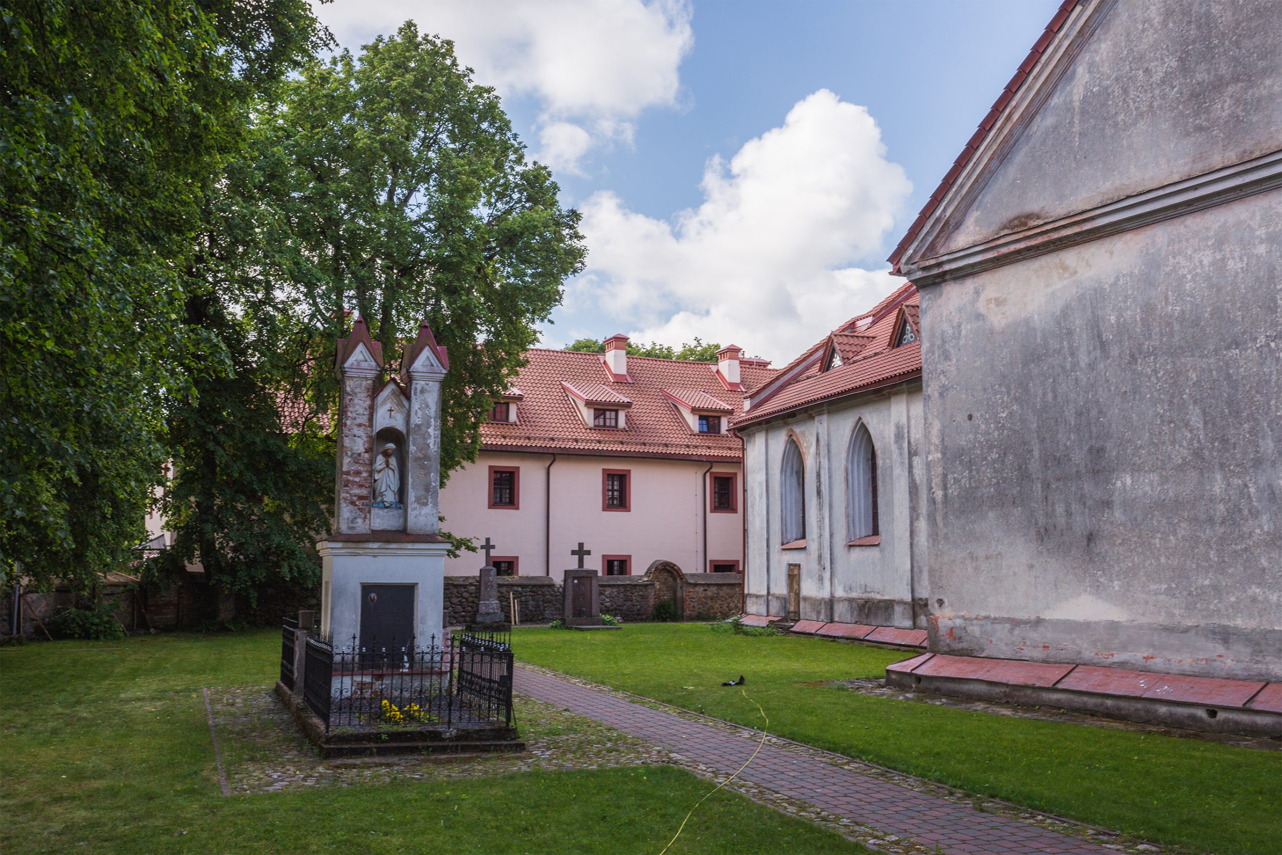
When Vytautas relocated to the new castle in Naujieji Trakai, Benedictine monks were given responsibility for his native Senieji Trakai Castle. That is how one of the first monasteries in Lithuania was founded!
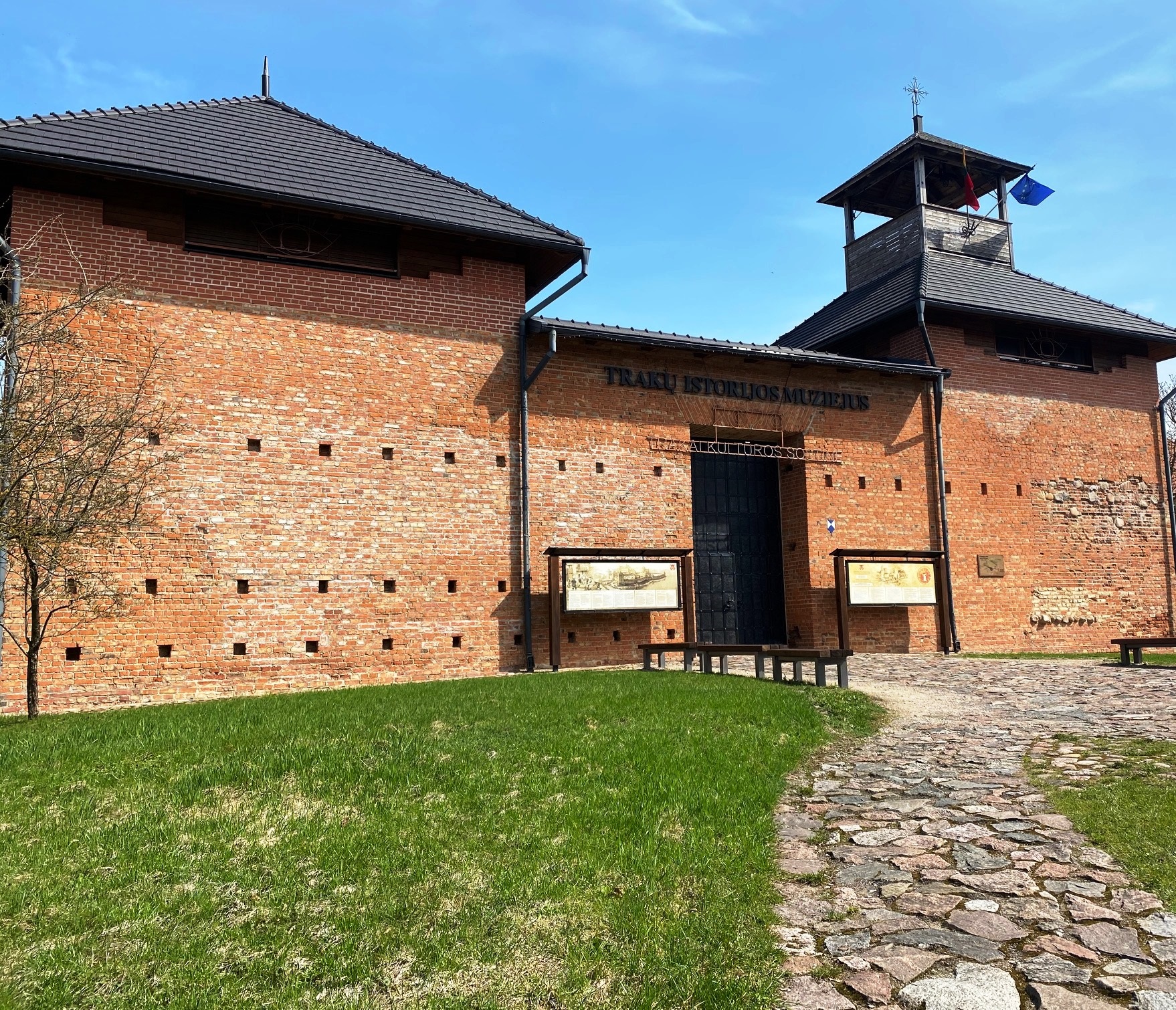
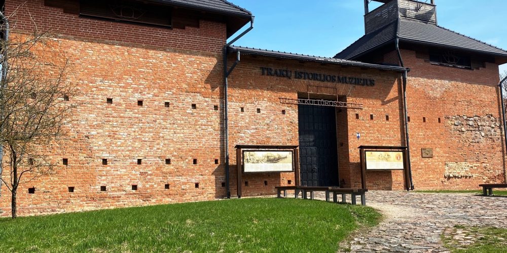
Castle Site of Senieji Trakai
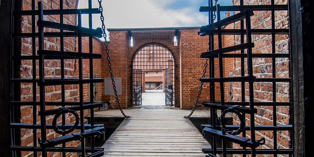
The castle site of Senieji Trakai is situated on a small hill and holds the status of a state-protected cultural monument. This castle as well as the Peninsula Castle were first mentioned in written sources in the 14th century and are considered enclosure type castles. It was surrounded by a trench up to 35-40 m wide and up to 8 m deep and protected by a 10-m high defensive wall.
Beginning in 1316 Senieji Trakai served as the capital of the Grand Duchy of Lithuania for seven years. After the prophetic dream of Duke Gediminas about an iron wolf and when Vilnius became the new capital, this place served as the capital of Trakai duchy and the Samogitian elderate. Lithuanian sub-monarchs made the castle their residence and took on the responsibility of protecting and defending Lithuania's western borders.
When the country was fighting with the Teutonic Order, Senieji Trakai Castle suffered numerous attacks and attempts to destroy it. A fatal battle occurred with the order in 1391 when the castle was almost completely destroyed and has never been rebuilt since. From then on, the defensive role of Senieji Trakai was diminished.
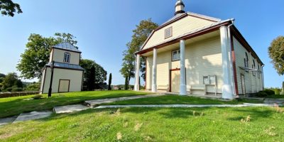
Invited to his native castle by Grand Duke Vytautas around 1410, monks from Tyneco (near Krakow) founded a monastery here. The duke built them a wooden church and allocated them a dessiatin (ed.Old Russian measurement) of land along with two lakes. The monastery operated until the mid-19th century when it was closed by the administration of the Russian empire.
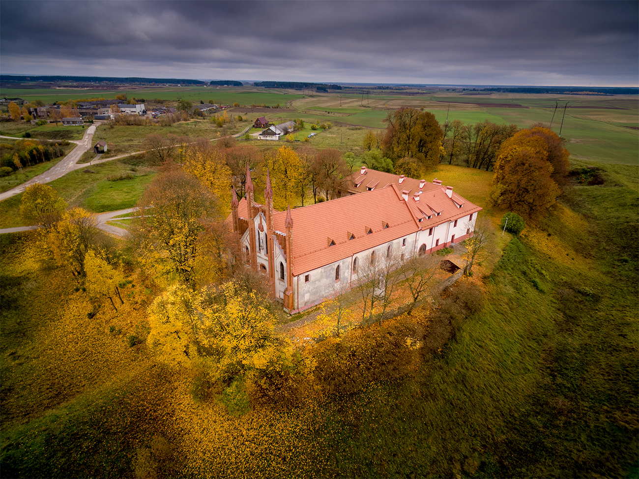
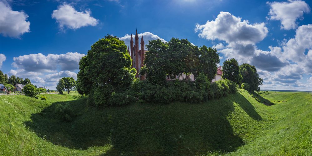
Today the top of the old castle site is occupied by a monastery and neo-gothic style church ensemble rebuilt at the turn of the 18th and 19th centuries. Linden trees that are more than 100 years old adorn the slopes of the hill fort. Senieji Trakai street village is nestled around the old castle site and has the status of an architectural sanctuary.
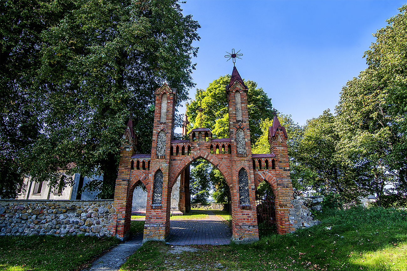
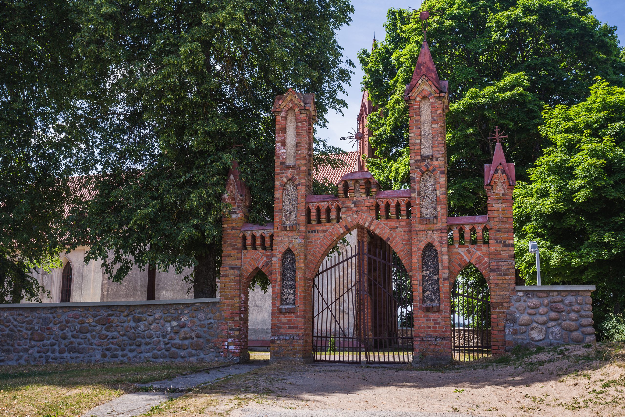
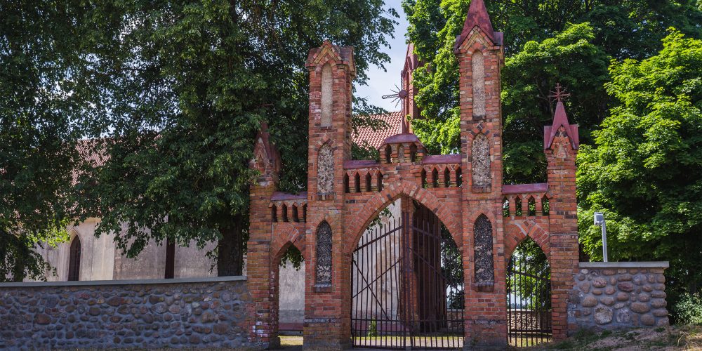
Vytautas the Great road
History lovers are very familiar with the road leading towards Senieji Trakai. Commemorating the 570th anniversary of the death of the duke, Trakai Historical National Park Management decided to revive the symbolic Vytautas the Great road. The community of Senieji Trakai participated in this project. In the year 2000, the road was officially opened to the public – the Trakai–Senieji Trakai route included nine stops, nine wayside shrines that symbolise important events and achievements in the life of Vytautas the Great. Road maps of Vytautas the Great Road showing the exact places for every shrine cross can be found at the tourist information centre and on the internet.
Travellers first encounter a roadsite pole dedicated to Saint Jurgis built at the earliest, in 1998. This sculpture stands on a small hill with a beautiful vista to Trakai Island Castle, Trakai Basilica, and reflects the Great Duke's militant character, the fierceness of his battles and victories. The place marks the beginning of the road to the historical capital of Lithuania – Senieji Trakai. Saint Casimir's wayside shrine tells the story of Vytautas the Great as a builder of castles and churches. And the arrival of Benedictine monks to Senieji Trakai is commemorated with the wayside shrine of Saint Benedict.
A couple riding on a horse symbolises ‘The escape to Egypt’ and serves to remind about the arrival of Karaites in Lithuania. The woman holds a basket with cucumbers and tells us that it was the Karaites who introduced cucumber and how to grow it into Lithuania. The historical princess of Egypt, Saint Catherine of Alexandria, the patron saint of students reminds us about Vytautas’ campaign to send youth to study in western Europe and the first Lithuanian student at Krakow University was Mykolas who came from Senieji Trakai!
Near the entrance of Senieji Trakai stands a sculpture honouring the duke's parents Kęstutis and Birutė. They hold a crown from Vytautas which never reached them. ‘A Suffering Pieta’ recalls a painful time when Kęstutis was killed in Krėva castle. This roadsite pole is held in special esteem by locals– they maintain a beautiful flower bed around it and frequently pray here. There is a sculpture of Blessed Virgin Mary with Baby Jesus in the old castle place which symbolises the purity of motherhood and love of the homeland.
Finally, the last wooden sculpture built depicts a sitting Duke Vytautas with a sword in one hand and Lithuania's statehood symbol Vytis – in another.
Address: Pilies str. 1, Senieji Trakai village, Trakai district.
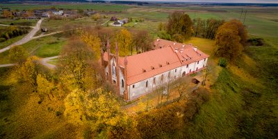
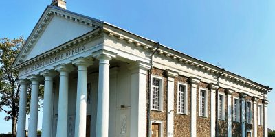
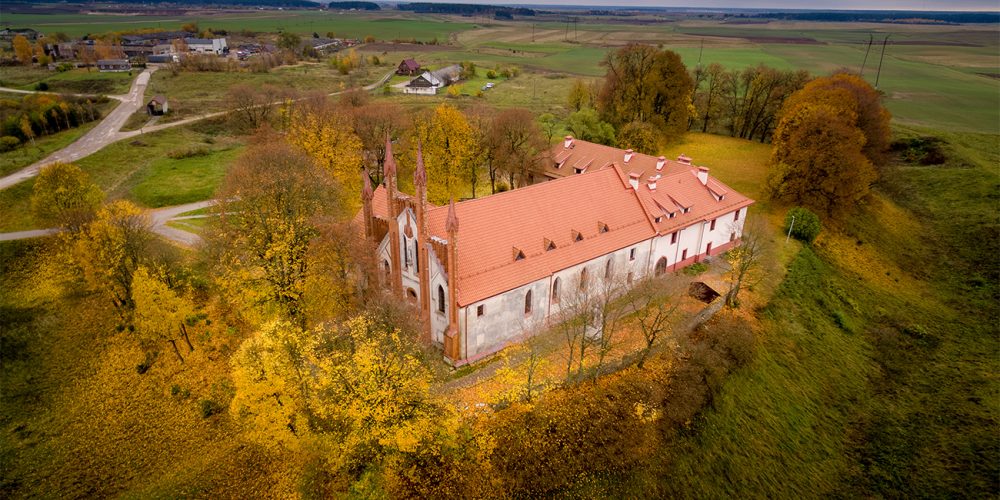
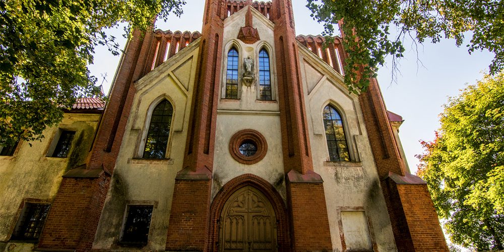
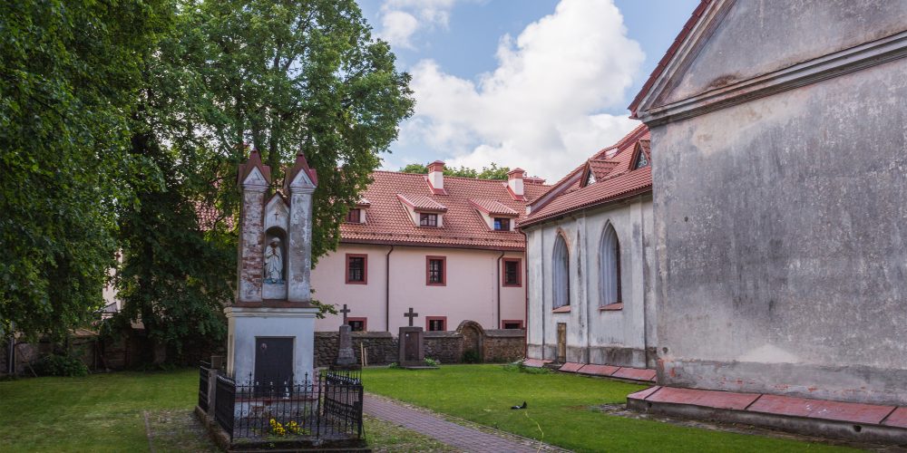
In the place of the former Benedictine monastery, a neo-gothic style church designed by Apolinaras Mikulskis was built at the end of the 19thcentury. The main façade towers reflect its special elegance and grandeur.
The interior of Senieji Trakai Church of the Annunciation and St. Benedict is lovely but simple and has Benedictine iconography. Visitors can enjoy unique sculptures and paintings in three chapels and nine altars. Several things are especially noteworthy: the St. Augustine and St. Benedict sculptures along with side altars dedicated to St. Benedict and his twin sister St. Scholastica.
One of the notable art works in the church is the 18th-century painting by Simonas Čehavičius, depicting St. Benedict. Another valuable piece is the 17th-century painting depicting Blessed Virgin Mary with the Infant in her arms. In the past the church also had a portrait of Vytautas the Great…
In the church’s courtyard stands a wayside shrine dedicated to the Blessed Virgin Mary with the Infant in her arms. This is one of the nine wayside shrines, created along the symbolic Vytautas the Great road. A sculpture in the ancient site of Senieji Trakai castle symbolises the purity of motherhood and love for the motherland. Some people point to the parallel between priestess Birutė, holding her son Vytautas in her arms.
Benedictine Brethren
The Benedictines were founded in the 6thcentury, and it is the oldest Catholic monk order. The Regula (set of conduct rules for Christian monks) of St. Benedict of Nursia was the start not only of the Benedictines, but also of the monastic tradition of the whole Western Church. Benedictines pay special attention to the search for God in prayer, silence, and solitude. The founder of the order himself spent three years in solitude and serenity in a desert in a mountainous area in the middle of Italy. Everybody knows Saint Benedict’s slogan Ora et labora– ‘Pray and work’.
Benedictine monks, who live according to the Regula and life of the saint, spread the Christian faith and civilisation in Europe. Saint Benedict was declared the patron saint of Europe for his role in creating the Christian identity.

Address: Pilies str. 1, Senieji Trakai village, Trakai district.
By the beginning of the 15th century, Senieji Trakai Castle had lost its defensive role, because Naujieji Trakai Island Castle (today simply called Trakai Island Castle) was already built and gained the status of the primary defensive castle. Thus, Vytautas the Great invited Benedictine brothers from Tyniec, a town not far from Krokow (today territory of Poland) to his native castle.
The duke built them a wooden church and allocated them a dessiatin (ed. Old Russian measurement) of land along with two lakes. The monastery operated until the mid-19th century when it was closed by the administration of the Russian empire.
The monks practiced a contemplative way of life, dedicated a lot of time to prayer, meditation, and other spiritual practices. They taught in the estates they were assigned to. Alongside the abbey, they founded a parish elementary school.
Benedictines were educated, and they paid special attention to education – this is confirmed by the fact that at the end of the 18th century there were even 769 books in the monastery’s library. According to historical data a book cost 8 gold coins, while some of them cost as much as 30 gold coins.
The monastery was rebuilt numerous times, because its wooden construction began to decay and was once even destroyed by fire. A new masonry monastery building was erected in its place in the 18th century. But after some time, the monastery was closed, and Benedictine brothers relocated to Nesvizh.
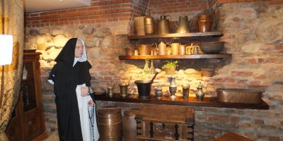
Senieji Trakai monastery that was given the name of Annunciation is now occupied by the congregation of the Sisters of Saint John. The nuns opened a retreat house in the restored medieval castle and invite believers to participate in Catholic religious recollection and meditation practices. The Sisters also organize other religious events, take care of local youth, and once even housed participants of a bard festival.
Monday are ‘desert’ (retreat) days for the Apostolic Sisters of Saint John. It is a day of total solitude and prayer. The monastery is open on all the other days. Masses are celebrated, and adoration of the Blessed Sacrament takes place.
Address: Vytauto str. 32, Trakai.
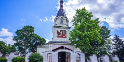
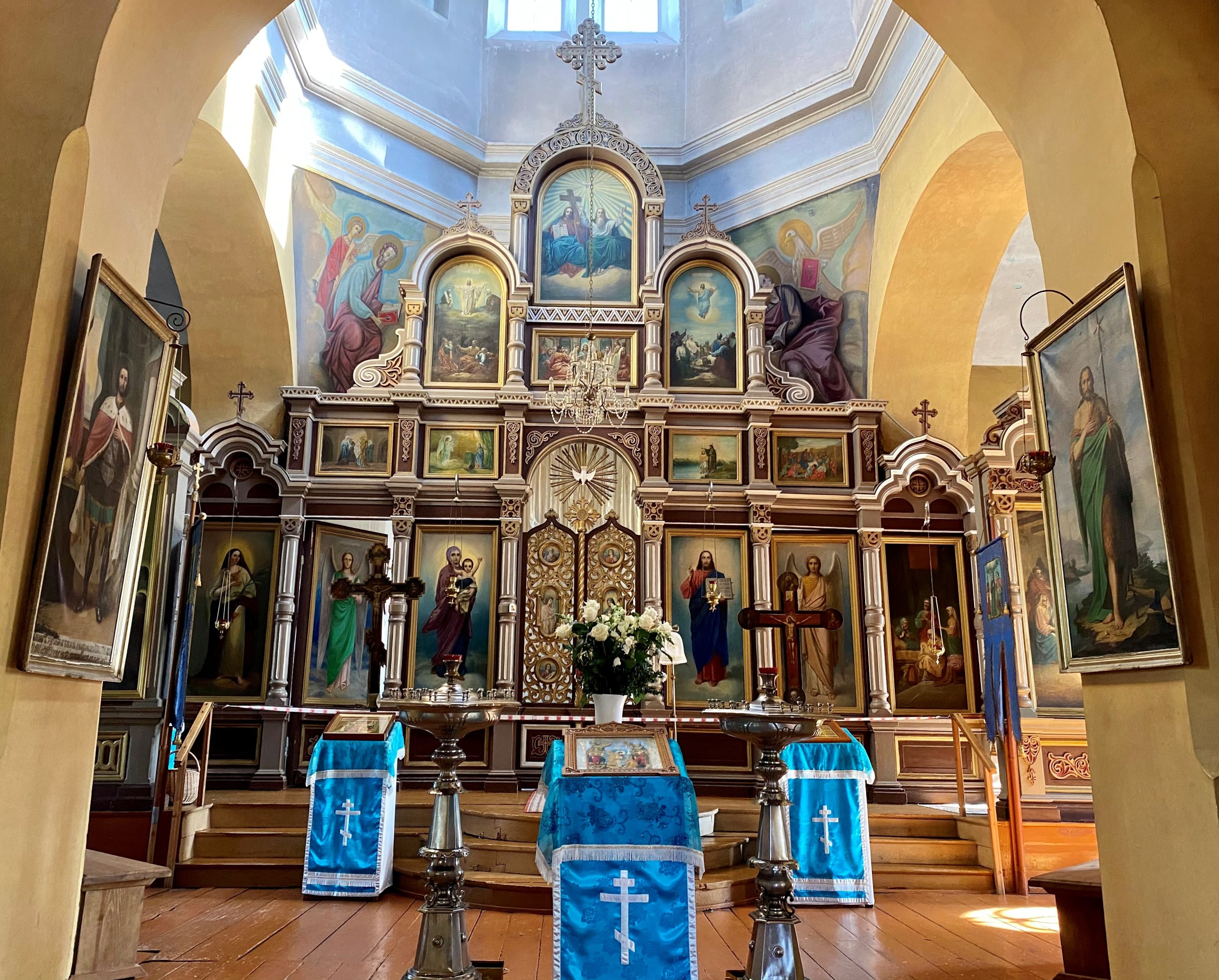
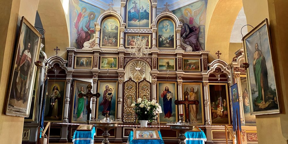
The Orthodox Church of the nativity of the Most Blessed Virgin Mary stands in the centre of the town at the corner of Maironis and Vytautas St. It has one tower in addition to the bell tower.
A decision was taken to build an Orthodox church in Trakai in 1861. Tsarina Maria Aleksandrovna gave 6,000 roubles to build the church and STR. Adelson, the builder of the Kaunas and Paneriai railway tunnels donated 50,000 bricks. Work began in 1862 after the State Chamber of property engineer A. Polozov was appointed to supervise labour. Polozov used a traditional design for the church. The brick building is standard in form and has no individual features. Work was begun with a ceremony on August 18 1862 and the building was consecrated on Sept. 22 1863 with then name of an Orthodox church which used to stand in the southern part of the town.
The tsarina gave Polozov a golden bejeweled watch in recognition of his work on the church and this was presented to him by the governor general of Vilnius, M. Murav’ev. The church had no bell tower and a design was made in 1868 by Samoilov. The church was built in 1863 in commemoration of the defeat of the Polish-Lithuanian Uprising. The church suffered during the First World War when the church towers and roof were destroyed by Germans shooting at Russian positions within the town.
Now this Orthodox church harmoniously integrates into the architectural mosaic of Trakai. It stands on one of the hills of the peninsula, at the intersection of Vytauto and Maironio streets. Anyone who wishes can admire not only the external architecture of the church, but also the vaulted and modestly decorated interior space.
The church is functioning and belongs to the Russian Orthodox community.
Address: Vytauto str. 33, Trakai.
Two corps of the French army (the 4th Italian and the 6th Bavarian) marched through Trakai and its environs in the beginning of 1812. The city defended itself against the French, although the town's some manor estates were looted, the Dominican-owned Rykantai manor estate was destroyed, the buildings of the Dominican monastery were looted and burned as well.
The pastor Andrius Čiurška-Čerskis organized the protection of the church property from the robbing soldiers of Marshal Louis (Louis Nicolas Davout). When soldiers showed up at the church, a bell started to ring to cause all the towns people to defend the church. In this way, the priest saved the miraculous image of Blessed Virgin Mary and other Trakai Church of the Visitation of the Blessed Virgin Mary treasures.
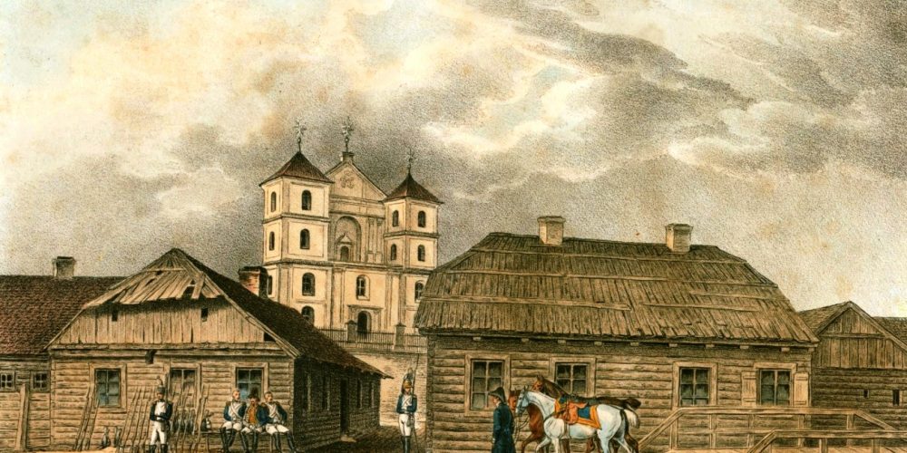
In 2012 Trakai city municipality established a decorative memorial plaque to commemorate this occasion.
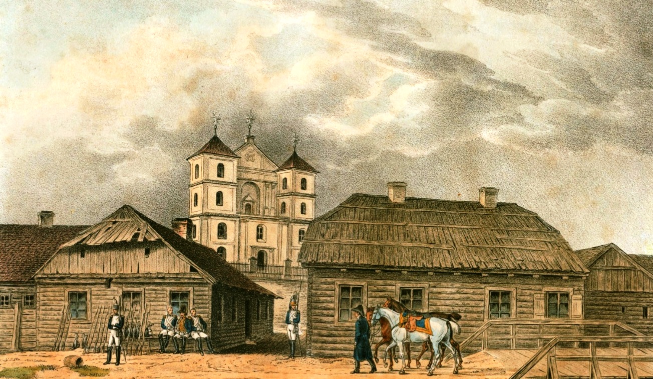
A plaque to commemorate the 200th anniversary of the Napoleonic march was set up in exactly the same place from which on 4th of July, in 1812 German painter Albrecht Adam (1786-1862) painted Trakai Church of the Visitation of the Blessed Virgin Mary. Exactly on that day, in front of the square of the present municipality, was established the headquarters of the 4th Corps of Napoleon's Army, headed by General, Italian Vice-King Eugene De Boarne.
The sculptural composition of the plaque is a copy of the image of that lithographic painting. Standing up to the plaque, you can compare how much the view has changed in 200 years. The view has practically not changed, only there is no wooden bridge over the stream and the stream itself…
Address: Birutės str. 5, Trakai.
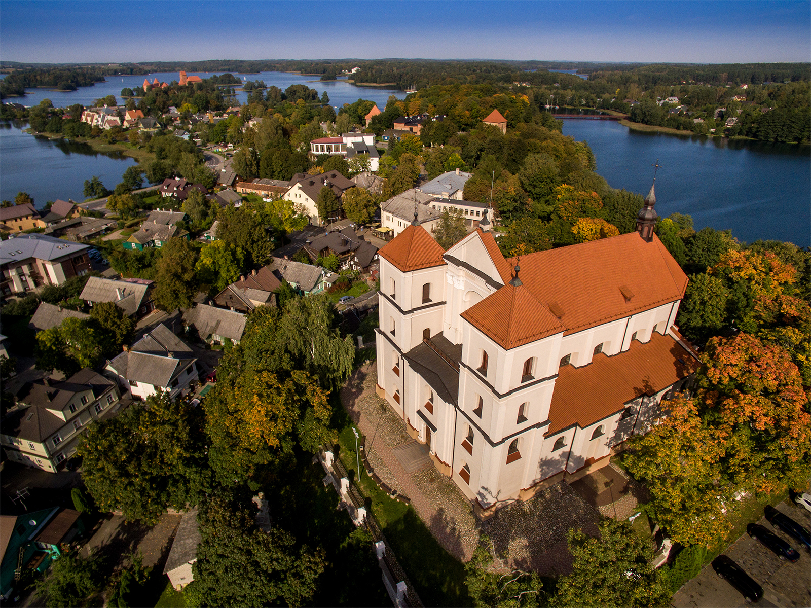
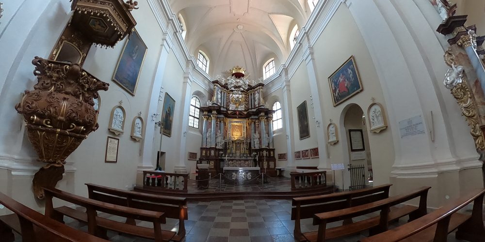
The Basilica of the Visitation of the Blessed Virgin Mary stands in Trakai peninsula surrounded by lakes. This church that equals Trakai Island Castle in terms of size and grandeur, was consecrated in 2017 as a basilica, a title given only to certain churches granted special privileges by the Pope.
There are 8 basilicas in Lithuania: Cathedral Basilica of St. Stanislaus and Ladislaus in Vilnius, Saints Peter and Paul Cathedral and Christ’s Resurrection Basilica in Kaunas, The Basilica of the Nativity of the Blessed Virgin Mary in Šiluva, Krekenava Basilica of the Assumption of the Virgin Mary, Marijampolė Basilica of St. Michael the Archangel, The Holy Mother Mary Visitation Church in Žemaičių Kalvarija, and Trakai Basilica of the Visitation of the Blessed Virgin Mary. There are about 2,000 temples consecrated as basilicas.
The Basilica of the Visitation of the Blessed Virgin Mary, founded by Grand Duke Vytautas in the 15th century has an irregular shaped form with harmoniously intertwined Gothic and Baroque features. Opened fresco fragments in the walls of the church recall the Byzantine-era style that was used in Trakai Island Castle.
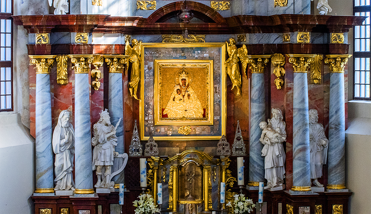
The Basilica is a treasure trove of sacred and fine art – there are easel paintings, memorial monuments, various relics, wine glasses, 18th-century candlesticks, a sanctuary lamp and more. A painting, depicting Mary, Mother of God is especially important since it is widely known for its miracles and graces. This first gold crowned painting officially blessed by Pope Clemence XI during the period of the Grand Duchy of Lithuania was given the title Protector of the Sick. Interestingly, the painting is revered by Catholic, Orthodox, and Muslim communities alike.
From 1st September 2017 to 8th September 2018, Trakai Basilica celebrates the coronation of the Basilica’s famous painting; 2018 was declared the year of Trakai Mother of God, patron saint of Lithuania while the new Basilica’s bells, blessed in 2017, are a solemn reminder of the festive year.
Every year the Trakai temple is visited by many faithful not only from Lithuania. Special celebrations, such as the annual Žolinės (Feast of the Assumption) and Trakinės (Trakai Mother of God image coronation celebration), attract pilgrims from neighboring countries and elsewhere. The festival faithful partake in a procession from the Gates of Dawn to the Trakai Basilica, a distance of nearly 30 kilometres.
Trakai Basilica
Spiritual centre of Trakai, the Basilica of the Visitation of the Blessed Virgin Mary, has an exclusive history. It was never closed, never served another faith community nor was it used for any purposes other than religious.
This church is not only a unique monument of religious and Lithuanian cultural history. Special criteria of Domus Ecclesiae, a decree of Divine Worship and Liturgy, was used in the process of granting the very honorable title of basilica. The criteria are applied both for the building itself and the living Church – its flock of believers. The exclusive historical importance of the church for the region and the country were acknowledged, as was the solemnity of the building and religious community’s dissemination of faith and love.
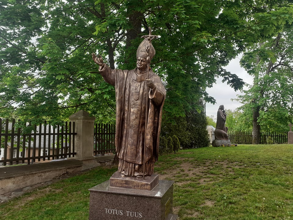
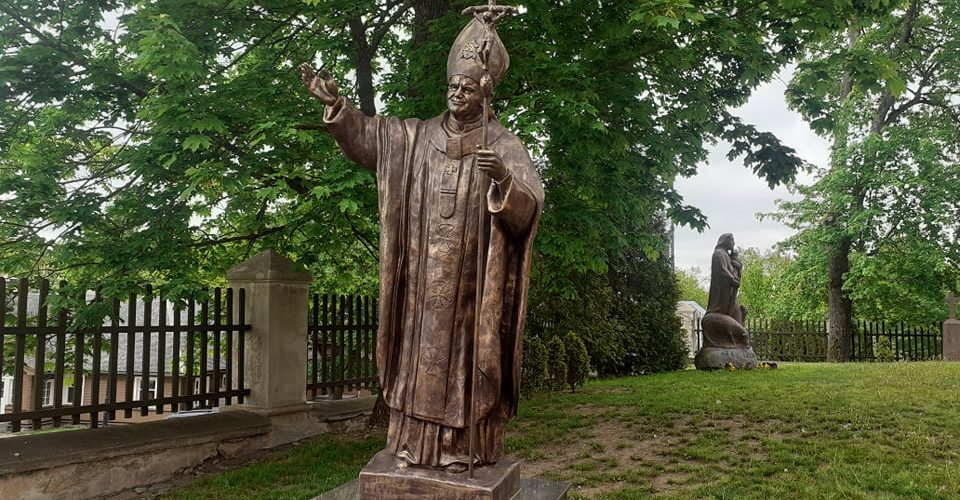
The title of basilica also underlines the church’s special ties with the Pope, since Trakai Basilica has had the Mother of God Image in the main altar for 600 years and 300 years ago Pope Clemence XI bestowed the image with the crowns. It is also important to note that there is a monument of Pope John Paul II, consecrated in 2015, in the churchyard of Trakai Church of the Visitation of the Blessed Virgin Mary.
The title of Basilica also carries with it the obligation to lead other churches by an active social life, pastoral care, and organisation of liturgical ceremonies. Basilicas allow people to familiarize themselves with Papal documents and are visited by pilgrims and those who yearn for spiritual guidance.
Masses in the Basilica of the Visitation of the Blessed Virgin Mary are celebrated daily in Lithuanian and Polish.
Mother of God Image
The image of Blessed Virgin Mary with the Infant in her arms was widely known throughout the Grand Duchy of Lithuania well before it received recognition from the Pope. From the very beginning of the 17th century people began applying votes to the image, for example, small heart-shaped articles and chaplets made of precious metals, as thanks for graces received. It is estimated that today there are over 400 votes applied to the Mother of God image!
This original 15th-century painting with Gothic features holds a special historical meaning. The underside of the image has an inscription denoting that it is a gift from the Byzantine Emperor Manuel II Palaiologos to the ruler of Lithuania Grand Duke Vytautas to commemorate his baptism. The same inscription also says it is Mother of God Nikopea, which in Greek language means ‘the victorious’. It is believed Nikopea helped the emperor to break the Persian siege and return to Constantinople at the beginning of the 12th century and this was the reason why Byzantine emperors made this Mother of God theirs and their capital’s patron saint.
The miraculous image in the main altar of Trakai Basilica was repainted several times throughout the centuries. After examination by restorers it became clear that an earlier image of Mary was in the Gothic style, Blessed Virgin Mary was standing, without a scarf, and possibly with a crown of roses on her head. The image probably appeared to be too large for the new altar and therefore the lower part was cut off, the background was etched and painted gold anew, the figure of Mary was repainted in the Byzantine style, and a golden crown that once adorned the image itself, now hangs above the picture. The image of Mary with the Infant fascinates with its rims made of forged silver tin and golden wreaths gifted by the Pope. The finely etched golden background that dates back to the juncture of the 15th and 16th centuries was shaved and also etched anew.
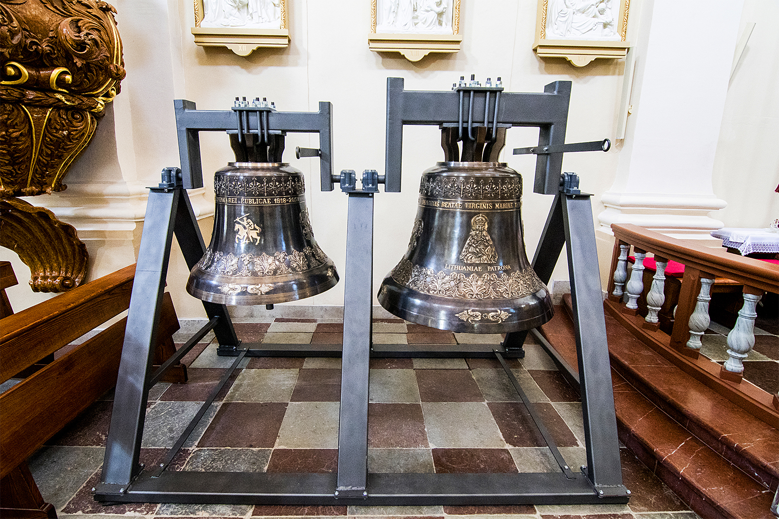
The Bells
In 2017, the jubilee year, when the main altar of the Basilica was consecrated, new bells were solemnly blessed as well. They were cast in the famous foundry run by the Kruševski brothers in the Polish town of Węgrów. The main bell is dedicated to Trakai Mother of God, patron saint of Lithuania. It weighs an astounding 700 kilograms! The second one, a little bit smaller, marks the centenary of the restoration of Lithuania’s independence.
Address: Vytauto str. 4, Trakai.
Museum has 4 rooms with chocolate exhibits. Each room is different. Most of the sculptures are life-size.
The exhibitions will be renewed every few years.
Working hours:
Monday – Friday 8.30 a.m. – 8.00 p.m.
Saturday 10 a.m. – 9 p.m.
Sunday 10 a.m – 8 p.m.
Entrance fee:
5 Eur. / adults
2.5 Eur. / children under 10, seniors
Tickets can be purchased on-spot
Contacts:
Ph. +370 655 71 143
www.ajsokoladas.lt
info@ajsokoladas.lt

Address: The crossing of Vytauto and Karaimų streets.
The roadsite pole with a statue of St. John of Nepomuk is one of the most important highlights of the town of Trakai. This roadsite pole is 14 metres in height and it is located at the heart of Trakai, i. e. at the crossing of two main streets, Karaimų and Vytauto, in the centre of the former Townhall square. Written sources testify that a brick column was there as early as the middle of the 17th century.
A roadsite pole of a classical style with the statue of the patron of fishermen and water-encircled cities is an important and much adored symbol for the residents of Trakai region. After the uprising of 1863, the tsarist government ordered that the saint‘s sculpture be removed and offered a substantial remuneration for the job. The local residents are said to have resisted the order and refused to comply. However, a rogue grabbed a knife and was ready to destroy the sculpture, but he fell off the ladder and broke his leg. Trakai chief of police had to invite the Cossacks to tear down the sculpture of the Saint.
In 1935, a new sculpture of St. John of Nepomuk was installed on the roadsite pole. It was created by Vilnius sculptor,Stanislaw Horn–Poplawski. The statue was threatened again in the post-war years. Finally, diligent atheists took the wooden Nepomuk off the roadsite pole and threw it into the lake! When the employees of Trakai museum found out about this, they found the sculpture deep in the lake’s waters, brought it to the surface and stored it safely in the museum storage facility. Four clocks were installed on the pillar as replacements for the statue, but they broke down shortly after: they all showed different time.
Today, we can see a restored sculpture of St. John of Nepomuk on the roadsite pole. The statue of the patron of Trakai was proudly returned to its original location in 1990.
Legends Speak Out
Many legends are told about the roadsite pole of St. John of Nepomuk. One of them says that in the 18th century, when the owner of Užutrakis Manor, Laurynas Odinec, was sailing on the lake, there was a sudden storm and the boat started sinking. The landlord recalled St. Nepomuk and started praying to him wholeheartedly asking for support. The storm calmed down then as quickly as it had started. Odinec was saved, and he was very grateful to the Saint for his narrow escape. To express his gratitude, he erected the sculpture of the Saint in the middle of the Market Square.
Another story tells about the grief of the local residents when the tsarists government took the statue off the roadsite pole. The people started to believe that each spring the waters of Lake Galvė would claim one human life if St. Nepomuk was not returned back to the pillar. In time, the story was somewhat modified: it was said that the lake was ice-free in winter and the ice did not melt in spring unless the lake received its victim.
Life of St. John of Nepomuk
John of Nepomuk was born around 1340 in Czechia, close to the small town of Pomuk (today’s Nepomuk) near Prague. When he grew up, he studied theology and Canon law at the universities of Prague and Padova.
When he turned 40, Nepomuk was ordained a priest and was later appointed to serve as a Canon of St. Vitus Cathedral in Prague, a member of the Capitula. Joan, wife of Czech King Waclaw IV of Luxemburg, used to confess her sins only to this priest. The story goes that King Waclaw, being suspicious about his wife‘s fidelity, tried to make Nepomuk reveal the secret of the confession. The priest, however, did not obey the King and fell into disgrace.
Soon, a debate erupted in the Kingdom about the influence of the Church on the State. John of Nepomuk defended the seniority of the Archbishop of Prague, Jan Jenshtein, against King, Waclaw the IV, which angered the King more than ever. The King ordered the arrest of the priest, his interrogation, torture and murder. He is believed to have been dropped with his hands tied from the arched Charles bridge into the Vltava River on 19 March 1393. That is why Nepomuk is believed to be the patron of bridges and the guardian against water-related calamities.
Later, people started to worship him as a martyr, the defender of the seal of the confession. In 1721, Pope Innocent XIII declared John Nepomuk as Blessed, and in 1729, Pope Benedict XIII canonised him, i. e. proclaimed him a saint.
Patron of Trakai
It was the Jesuits who brought the cult of St. John of Nepomuk from Czechia to the Lithuanian-Polish Commonwealth of the 18th century. Soon, the name became one of the best-known and most revered. Notably, the then ruler Augustus II selected St. John of Nepomuk to be the patron, i. e. the guardian and the paraclete, of the state alongside St. Stanislaw and St. Casimir. The Brotherhood carrying his name was established in Vilnius, and several churches were named after him. Utena area is known not only for its numerous lakes, but also for the number of roadsite poles with his statue. The saint is often called by his diminutive name Jonelis by locals.
The Day of St. John of Nepomuk is on 16 May. He is considered the patron of all Czechs, priests, river sailors, rafters and bridges, the protector from floods and all water-related calamities. St. Nepomuk is believed to be the saviour of the drowning man, of the unfairly accused and convicts. In 1935, he was proclaimed the patron of the town of Trakai.
St. Nepomuk is usually depicted in paintings wearing a white surplice or a rochet, i. e. a white, knee-length ecclesiastical vestment-worn by Roman Catholic prelates, bishops and canons. He often holds a book, a crucifix or a palm branch in his hand, which is a Christian symbol of martyrdom, victory of the soul over the body, or heaven. Another exclusive attribute of St. John of Nepomuk in visual arts is the nimbus with five little stars. The sign is a reminder of the legend telling that when the Saint was dropped into the waters of the Vltava, the stars started twinkling in the river.
Address: Karaimų str. 1A, Trakai.
There is very cozy Swing Park in front of St. John Nepomuk Roadsite Pole. This is the favorite place of all Trakai residents. It’s so good to be here at any season time. The park is always full of good emotions and romantic mood. The joy of swinging available not only for children but and for adults as well.
We invite you to come and try to fly through the air for yourself!
Address: Kęstučio str. 4, Trakai.
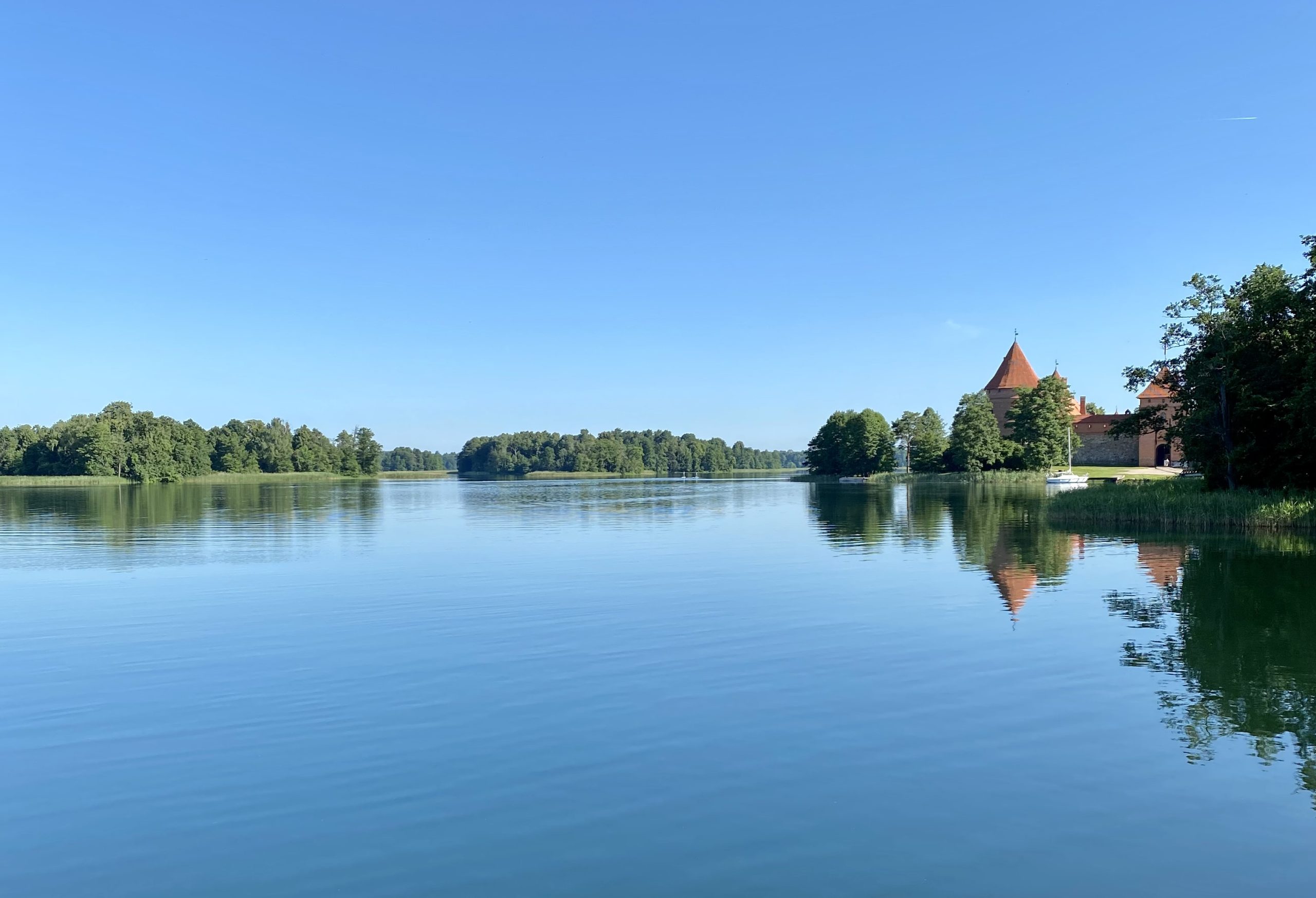
Trakai region is rich in its abundance of stunningly beautiful lakes and has been heralded for centuries because of its three castles. The first one, nearly four kilometers south of Trakai old town, is the old Trakai Castle – birthplace of Vytautas the Great built by Duke Gediminas. Naujieji Trakai Island Castle presents itself as a masterpiece of 15th-century defensive architecture of the Grand Duchy of Lithuania! At the time this castle along with Trakai Peninsula Castle stood as proof of Lithuania’s economic and military might.
It is worth noting that this Island Castle built in gothic style and surrounded by lakes is unique not only to Lithuania, but to Central and Eastern Europe as well! Meanwhile, the Peninsula Castle, much bigger in size, was one of the largest 15th-century enclosure castles of Lithuania. At the time it was not only bigger in size but more important in its role than the one built on the island.
As time went on, the role of Trakai Peninsula Castle changed. At the time an extremely important defensive castle became the place of residence of Lithuania’s grand dukes and their sons. At one time it served as a prison for high profile enemies of Lithuania, a Dominican monastery opened at the end of the 17th century, and the Russian empire made it a place for police and the court. Finally, the Gestapo operated from there during WWII and the KGB converted it to a prison after the war.
Today the restored Peninsula Castle belongs to Trakai historical museum and is open to the public. The exposition of sacred art opened in 2005 and has more than 200 unique exhibits that reveal the church of the time. Everyone who visits here will learn about the monstrance, chasuble, albarela, and so on.
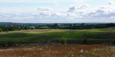
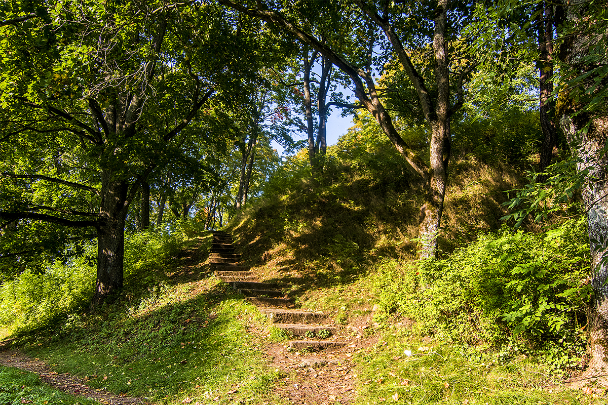
Sacrifice Hill is the highest point on the peninsula, 1 of 1,000 hill forts in Lithuania. Full of deciduous trees, the 17-m high hill fort allows visitors to enjoy some of the most beautiful views – Trakai lake which surrounds the peninsula and the red gothic style Island Castle.
According to a legend, the name of the hill finds its roots in sacrificial pagan ceremonies that took place at the time. During mid-19th century excavations a perforated spoon was unearthed. According to Count Eustachy Tyszkiewicz its purpose was to scoop blood during ceremonial procedures dedicated to pagan gods.
An annual medieval celebration held in the peninsula territory is noted for its exclusive atmosphere. Ancient craftsmen, traders, knights, choral ensembles sometimes even witches – all of them together create an atmosphere where the curious visitor can get to know their craft and its intricacies.
Peninsula Castle
The knowledge about Trakai Peninsula Castle comes from limited written sources. They tell us that the castle was constructed before the end of the 14th century. Also called the Main Castle, it was part of Trakai and Vilnius defensive complex system. Surrounded by Lakes Galvė and Luka (Bernardinai), the castle, fortified with masonry defensive walls, for a while was bigger in size and played a more important role than the Island Castle which is better known and more popular with today’s visitors.
The 15th century marked the decline in importance of the Main Castle. Castle lands were parceled away to the nobles and the castle itself became a prison for high-ranking state enemies and other convicts. The story tells that some time later city dwellers began taking apart the castle walls for the construction of their own houses.
Peninsula Castle stands as one of the largest enclosure castles in Lithuania. These types of castles had an inner courtyard surrounded by defensive walls with embrasures, towers, and gates. Such castles were usually constructed in hard to reach places, surrounded by water. Bodies of water, steep embankments, deep trenches were meant to prevent enemy soldiers from entering those castles.
Address: Kęstučio str. 4, Trakai.
The spectacular Trakai landscape, abundant in lakes and rivers, is distinguished not only by its natural heritage, but also by its rich cultural and historical heritage. On the peak of the peninsula on the west bank of Lake Luka (Bernardinai), stands a hill fort. It rises 17 metres above the ground and is called Sacrifice Hill – although there is no known reason for the name. There are very few trees on the top of the hill and thus it offers a wonderful view of the spectacular landscape of Trakai Peninsula Castle and its surrounding lakes.
A hill fort is a hill with a castle which is or once was at the top of it with a visible dyke made of soil. Interestingly, in Lithuanian the word “pilis” (Eng. a castle) is derived from the word “pilti” (Eng. pour). Sacrifice Hill is one of about 1,000 hill forts found on Lithuanian territory.
The main function of Sacrifice Hill, like most other mounds, was to protect the castle and the surrounding settlement. The locals as well as troops would gather on the platform at the top of the hill to defend themselves from attackers. The estimated length of the platform is about 45 metres and it is 17 metres wide. The mound’s safety is further ensured by the 18-metre-wide and 3-metre-deep ditch surrounding it.
The Trakai Peninsula Castle and its defence complex, including Sacrifice Hill, are barely mentioned in the written sources. It is believed that the nearly 20-year-long construction of the Peninsula Castle took place in the 14thcentury and was carried out by the Grand Duke of Lithuania Kęstutis. Before the construction of the Peninsula Castle, the residence of the Grand Dukes of Lithuania was the Old Trakai Castle, located 3 km from the town of Trakai.
In 2005, according to the order of the Minister of Culture of the Republic of Lithuania, Sacrifice Hill became a state-protected site. Presently, various events take place at the foot of the hill fort including the Medieval Festival, equestrian competitions, old car exhibitions and so on.
Origin of the Name of Sacrifice Hill
The hill fort located on the territory of Trakai Peninsula Castle has been called Sacrifice Hill since ancient times. Although, it is still a mystery how this name came about.
According to a well-known legend, the hill was used to make sacrifices to the pagan gods. Count Eustachy Tyszkiewicz who explored this hill in the middle of the 19th century, discovered a perforated spoon. According to the archaeologist, this spoon was used to collect the victims’ blood in sacrificial rituals.
Later, other archaeologists examining the perforated spoon established that it was a much earlier product. Therefore, no reliable sources have been found to prove that Sacrifice Hill was indeed once a pagan sacrificial site.
The Hill Fort as Defensive Structure
The main purpose of the mound was to defend, therefore, people always sought to install mounds in areas protected by a variety of natural barriers. From the defensive perspective, hills protected by surrounding bodies of water or steep slopes were especially useful and suitable for hill fort construction.
The height and steepness of the hill’s slopes were important signs of the mound’s inaccessibility. Additional protection of the castle was ensured by the construction of natural obstacles like man-made ground piles or ditches. Indeed, climbing the 17-metre-high Sacrifice Hill can be a serious challenge. Fortunately, today you can use steps that have been added to the south west slope to climb the hill and enjoy the view.
Today, it is especially difficult to find a mound in Lithuania that would still have its original appearance. Often you need to use your imagination to picture their former steepness, ditches and barriers. Alternatively, try to imagine the significant weight of the armour and weapons that knights had to carry. Incredibly, a knight’s armour could weigh anywhere up to 40 kg.
Address: Kęstučio str. 4, Trakai.
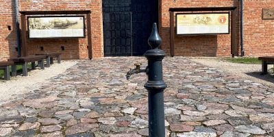
The Dominican friary buildings are in the Trakai Peninsula Castle, 100 m north of the beginning of Karaimų g at the end of Kęstutis st in the Trakai Island and Peninsula Castles Cultural reserve. Fragments of the mid-nineteenth-century friary garden survive in the castle.
Following a resolution of the Commonwealth Sejm in 1768 in 1779 the Dominicans began building a three-nave church with two towers on the main western front on both sides of the southern defensive ditch in the first yard of the Peninsula Castle. It was 46 m long and 28 m wide. When building the church they tore down the bricks of the castle gate tower and some of them were used for the foundations. The main entrance stood on the other side of the castle moat, that is in the town while the chancel stood in the castle yard.
Work on building the church was begun by the architect Augustyn Kossakowski and continued by Marcin Knakfus. Construction work was halted as money ran out and in 1812 it was stopped by the war against Napoleon. Work resumed around 1820. Because of a shortage of money reconstruction started in 1823-26 and the southern nave was used to build the two-storey cellared friary and part of the north-west nave was used for the chapel which was consecrated on Aug. 4 1822 in honour of St Michael the Archangel. The central nave of the incomplete church was used as the friary yard. Both buildings had two-slope roofs. A wooden turret was built on top of one of the incomplete towers as a bell tower. Reconstruction work was devised by Prior L. Glowicki. In the castle yard was a friary storehouse, ice house, wooden steward’s office, a stables and barn. The friary had three gardens.
The friary complex comprised two two-storey quadrangular buildings. The church walls were 2.6-3.2 m thick and made of brick that was laid in renaissance style. Very large bricks were used (30-31 cm long x 15 wide x 7.2-7.5 cm high. Old wall paintings survive in the chapel – the side altars and a frieze were painted. The high altar and cross recorded in an inventory do not survive. The walls were painted with narrative depictions and this and the decorative friezes and panels have survived in the southern wing of the friary.
The friary buildings are not of any clear style, the facades are flat and plastered, the sole decorative elements are the profile cornices above the second floor and the pillars on the yard façade by the entrance door.
On June 16 1864 the tsar’s governor general ordered the closing down of the friary. A gentry protection agency was housed in the southern corpus while the other became home to the Trakai police cells, an archive and the home of guards and civil servants. A park was laid out in the friary territory in the mid-nineteenth century.
After World War One only the southern corpus was used and a store was built in the chapel. The abandoned eastern building began to decay.
Work began restoring the friary around 1960. At first only fragmentary preservation work was carried out. After work done in 1988-99 the buildings have been used for the Trakai History Museum administration. Work continues and at present the wall paintings in the chapel are being restored and there are plans to open an ecclesiastical art exhibition here.
Work is being done here according to the Trakai Island and Peninsula Castles Reserve directed maintenance and use programme as approved by the Lithuanian minister of culture in 2000. the building belongs to the Republic of Lithuania.
Address: Kęstučio str. 4, Trakai.
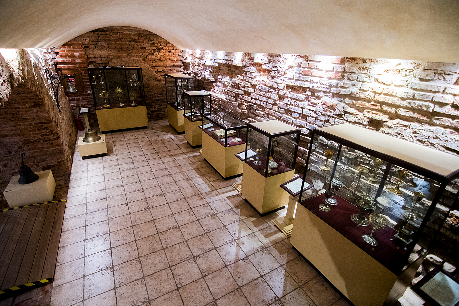
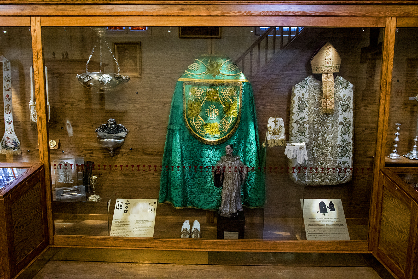
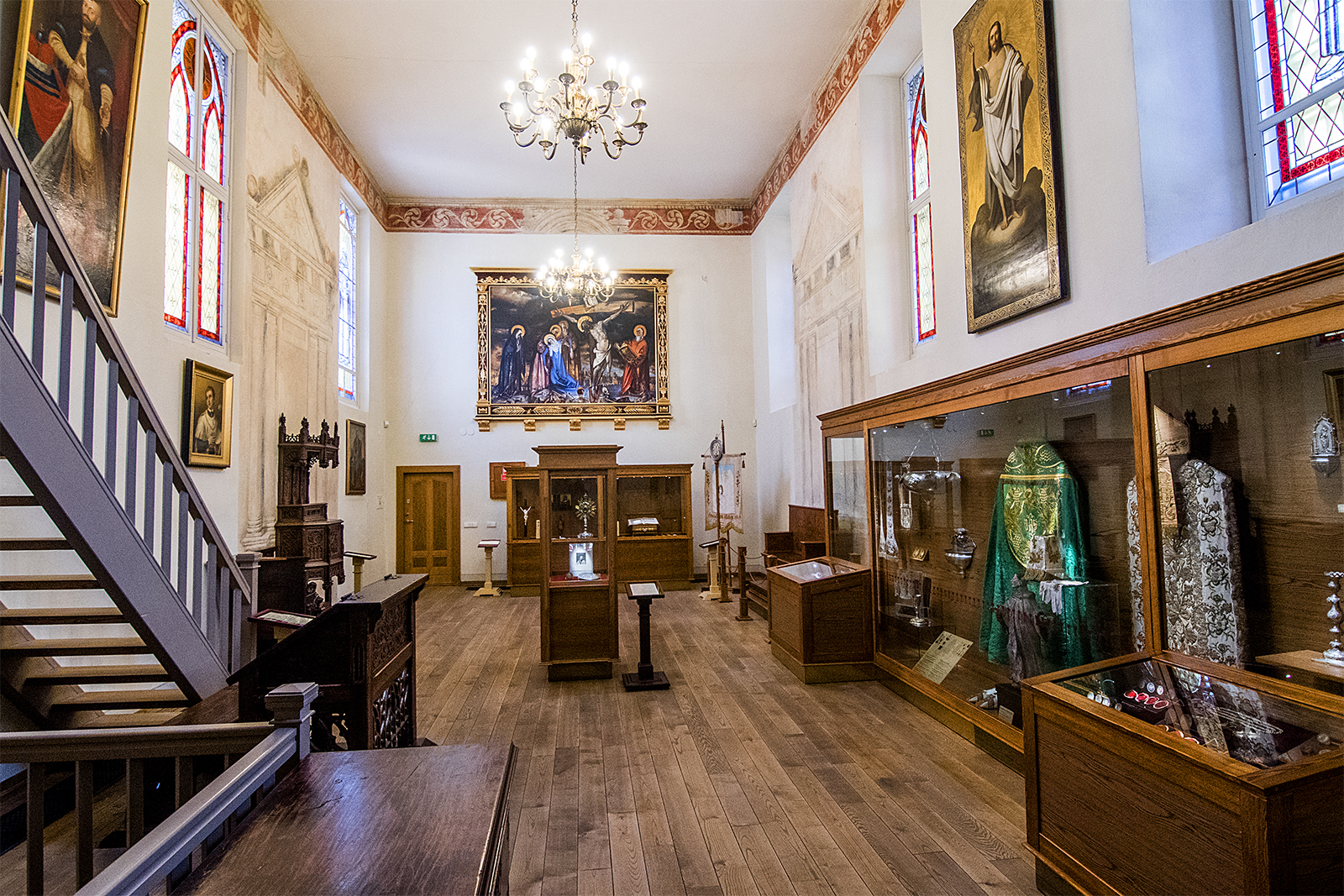
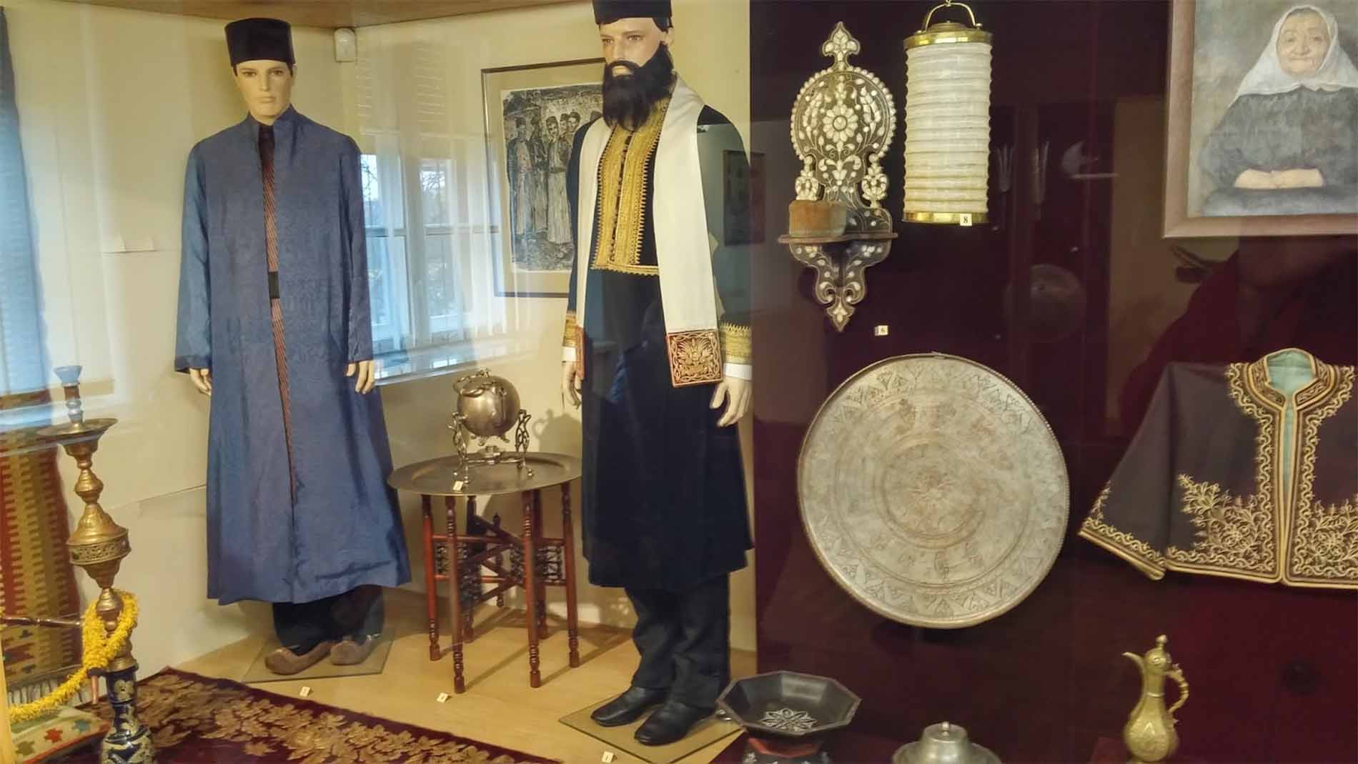
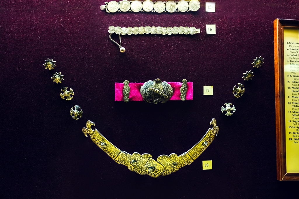
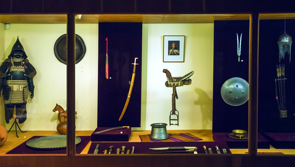
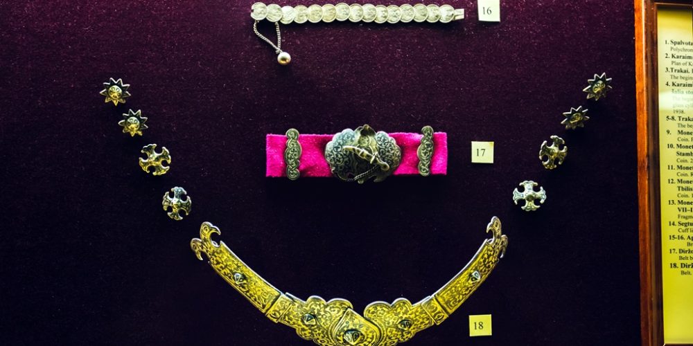
The Liturgical Art Exhibition was opened in 2005 on the territory of the Trakai Peninsula Castle, in the chapel of the former Dominican Monastery, and is a branch of the Trakai History Museum. Visitors are invited to take a closer look at various attributes of church heritage that represent sacral and cultural value, which include religious paintings as well as utensils that once belonged to the monks.
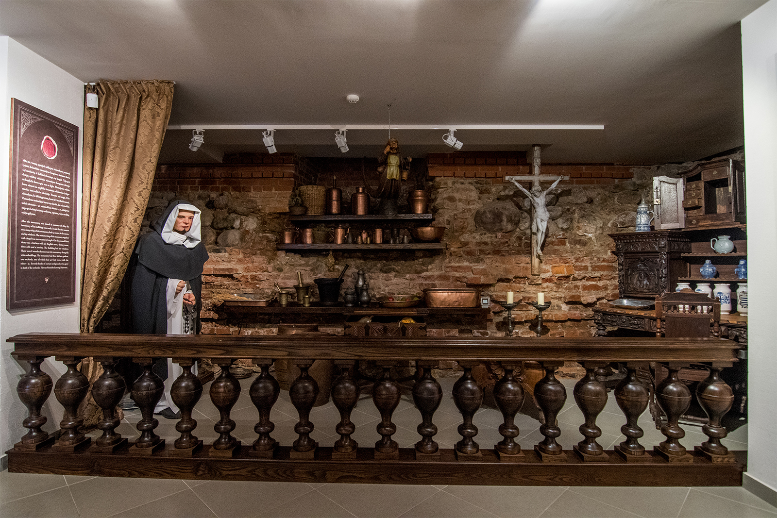
The area inside the former monastery complex was adapted to display valuable works of art. Today’s exhibition of church art comprises more than 200 liturgical works, valuable visual art works and various sacral objects representing the life of the church. Take a closer look at the monstrance decorated with the picture of the Blessed Virgin Mary of Trakai with the Infant, a unique 1709 stamp of the Trakai Dominican Monastery, a communion cup produced by Vilnius goldsmiths in the second half of the 16thcentury, and other ecclesiastic pieces such as liturgical objects, priests’ vestments, baptism coins, church stamps, distinctors worn by priests, and so on. Albarels, found among other exhibits, are dishes used in herbal and medical practice for holding medicinal ointments. A fragment of the monastery kitchen has been recreated in the restored cellar under the chapel, where pieces of the monastery’s everyday life and various objects used by the order’s monks are on display.
Today, Masses are no longer celebrated in the chapel, but thanks to the Liturgical Art Works Exhibition this cultural and historical monument has once again acquired its sacred spirit.
The Dominican Order and the History of the Monastery
The Dominican Order, or the Order of Preachers, was founded by the Spanish priest, Saint Dominic of Guzman, in the 13thcentury. In Latin, Domini canis mean the ‘Hounds of the Lord’, and one of the symbols of the Order is a white black-spotted dog holding a burning torch in its mouth. The friars were immersed in contemplation; they used to create schools and universities where they would teach. Their goal was to preach the Gospel and study. The most commonly used symbols of the Dominicans are the lily, the book, the rosary, the star and bread.
Trakai Peninsula Castle was built by Grand Duke Kęstutis of Lithuania at the end of the 14thcentury and was one of the largest castles in Lithuania. Perhaps that was the reason why it was called the Great Castle. It was used for various purposes throughout the centuries. First, it was the Grand Duke’s residence, and then it was converted into a prison for high-ranking foreign captives and enemies of the state. At the end of the 17thcentury, the Peninsula Castle was given to the Dominican Order.
In the second half of the 18th century, the friars began building a classic style church with two towers. Unfortunately, due to a lack of funds the church was only built up to the height of the ground-floor windows. At the beginning of the 19th century, the unfinished building was reconstructed into a monastery and a chapel. In 1882, the Chapel was consecrated in the name of the Archangel Michael. The monastery’s complex consisted of 11 cells, a sacristy, a school, a bell tower, a dining room with a kitchen, stables, gardens and flower beds looked after by the friars.
Shortly after the uprising of 1863-1864, the tsar’s government closed the monastery and handed it over to the police detention centre. In the period between the two wars, the premises were used as the court archive and police offices. When Vilnius District was occupied by Poland, the building was taken over by the Polish Border Police. After the Soviet occupation it was handed over to the KGB and police: a number of political prisoners were jailed there.
The territory of the Peninsula Castle was damaged many times. However, in the 1960s efforts to preserve Trakai cultural heritage objects were initiated, which in turn sparked interest in the Dominican structures. In 1990, Trakai History Museum Administration moved into the partially renovated premises of the former Dominican monastery. The Sacral Art Works Exhibition was opened in the former monastery’s chapel in the summer of 2005. The permanent exhibition revitalised the space and filled it again with the religious Spirit.
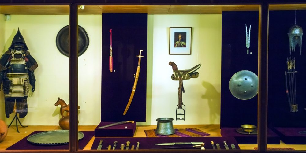
The Liturgical Art Works Exhibition established in the restored chapel of the Dominican monastery gives visitors an opportunity to have a closer look at the priests’ ceremonial clothing and special accessories. A cope, the most adorned and significant liturgical garment symbolises the Lord’s boundless love, purity of the clergyman, their righteousness as well as the grace of the Holy Spirit. You can also take a closer look at a pair of bishop’s sandals, previously calledcampagi, the mitre(traditional, ceremonial headdress of bishops made from the most expensive materials and worn during important ceremonies), etc.
One of the most adorned and important elements of Catholic liturgical ceremony is the monstrance.It is used for the exposition of the Blessed Sacrament. For this reason, they are often made of precious metals and are richly decorated with various gemstones. Visitors can also have a closer look at different parts of the monstrance as well as a chalice, a goblet used to sanctify the Eucharistic wine and bread during Mass.
The Liturgical Art Works Exhibition has many valuable pieces. The Dominicans Worshipping the Risen Christpainting should be mentioned among the most notable paintings. According to historians, it portrays the founder of the Dominican Order, Saint Dominic himself. Other important works include the portrait of St. Casimir, who came from the Gediminas dynasty that ruled over Lithuania as well as the portrait of Vytautas the Great.
The exposition includes many sculptures depicting St. Casimir, St. Florian (the patron of fire-fighters, who miraculously saved a burning house with one bucket of water), St. John of Nepomuk (the patron of Trakai and those suffering from water-related accidents). The highlight of the exposition is one of the rarest sculptural compositions found in the Lithuanian folk art titled The Last Supper.
Church Bells
Since ancient times the ringing of church bells has symbolised the scaring away of evil spirits. Bells at the top of high towers invite people to get together and celebrate holidays, pray and unite in times of misfortune.
In Lithuania, the craft of bellfounding dates back to the 14thcentury. Bells cast by Jonas Delamarsas, a distinguished 17thcentury bell founder, spread their heavenly sounds from the towers of Vilnius Cathedral, St. Peter and St. Paul’s Church, Pažaislis Monastery and many other belfries until this day.
Unfortunately, the czarist army destroyed many of the old bells when Lithuania was annexed by the Russian Empire in the 18th century. The craft of Lithuanian bell-casting started to decline, while church bells brought in from Kaliningrad, Russia, Poland and Latvia became increasingly popular. Today, the Liturgical Art Works Exhibition provides an opportunity to see several 18-19th century church bells cast in Vilnius, Prussia, Riga and in Western Europe.
Address: Karaimų str. Trakai.
GPS: 54.64501, 24.93580
The town of Trakai has long been known for the harmonious coexistence of various ethnic and religious groups. This still echoes today as you take a walk around the town reflecting the presence of different architectural traditions. It is one of the greatest distinctive features that make Trakai so unique.
Another characteristic that attracts tourists to Trakai is its Karaite community. It is an undoubtedly unique Turkic ethnic group who adheres to a distinct branch of Judaism. It is believed that the Karaite religious doctrine emerged in the 13th century in Mesopotamia. The Karaite community has preserved their religious beliefs, customs, traditions, and, most importantly, their language, throughout the centuries of their history in Trakai. For this reason, people sometimes describe Trakai as the Karaite capital of Lithuania and of the world.
It all started in around 1398 when Vytautas, the Grand Duke of Lithuania, brought some 380 families belonging to this ethnic group to Trakai after his victorious battle in Crimea in the 14th century. After settling in Trakai, the Karaite community formed two distinct groups – warriors and civilians. The warriors protected the castles and the bridge leading to Trakai Island Castle. Interestingly, some of the civilian Karaites served as clerks and translators for the grand duke.
However, a greater part of the civilian Karaites cultivated land, grew vegetables, engaged in small crafts and trade, ran inns, chartered state customs and engaged in other important activities, such as acting as intermediaries in cases where the Grand Duchy of Lithuania wanted to ransom the captives held by the Turks.
Over time, the Karaites earned trust from Vytautas the Great and other rulers of Lithuania. The rulers, in turn, granted certain privileges to the Karaite community as a gesture of gratitude. One of such privileges was the Magdeburg right (the right of self-government). A surviving record of 1441 testifies to this fact. These privileges granted to the Karaites by Lithuanian ruler Kazimieras Jogailaitis created a unique situation in the history of Lithuanian town governance: Two separate, mutually independent communities governed under the Magdeburg right existed in Trakai for several centuries.
One of them was the Karaite residential area of the town called the Small Town (Mažasis miestas). Under this privilege, it was treated as an autonomous town with its own official stamp and treasury. Here, the Karaites could build their own house of worship to practice their religion called Karaism. Karaism is a word that has a deep and interesting meaning as it comes from the Semitic word karą meaning “to read”, “to read aloud” or “to study” the Bible – the Old Testament, to be its adherent or follower. The Karaites diligently adhered to their cultural practices, traditions and customs.
During that period, the Karaites’ street looked very different than it looks today. It stretched across the highest ridge of the hill through the centre. It was flanked on both sides by the Karaite farmsteads located next to each other. A residential building stood adjacent to the street with outbuildings located behind it, and behind them, gardens stretched all the way to the lake. The gardens located along the lake made the landscape across the lake look very open and empty, and only the residential houses sitting on the highest point of the landscape were visible.
The Karaites’ street visitors can now explore the only exposition in the European Union providing an insight into the culture of this ethnic group. It is home to the Karaite house of worship called kenesa, the oldest one in Lithuania and one of just three existing Karaite houses of worship in the world that the residents and visitors of Trakai can admire on any given day.
All of the Karaite houses share one unique feature harking back to the period of their construction. It is still visible to this day. Each traditional Karaite house has three windows overlooking the street. Legend has it that following the Battle of Žalgiris, Lithuanian Grand Duke Vytautas decided to reward all the foreigners who fought on his side and helped him achieve the victory. The Tatars had already been allowed to settle in Vilnius and to build a mosque in Lukiškės Square in Vilnius.
Then it was the Karaites’ turn to be rewarded. A grey-haired old Karaite man approached Vytautas.
“Long may you reign, our wise and righteous lord!”
“Thank you for your kind words, my loyal foreign ally,” the ruler said to him. “Now it’s your turn to ask for a reward on behalf of your nation for your loyalty and bravery. I will do what is within my power to make your wishes come true.”
“I know, my Lord, that this victory was very hard and it will take a long time for our wounds to heal. I will not ask for gold, silver or land, as you have already rewarded us. I would like to make one request, though. Could you please grant us permission to build new houses in the Small Town so that each of them has three windows overlooking the street?”
Vytautas was surprised at receiving such an unusual request. He then asked the old man:
“And you risked your lives for this?”
“No, my Lord,” the old man replied. “Not for this. We risked our lives for the sake of peace because a bad peace is better than a good war. And our request would mean that everyone who sees a house with three windows knows that God is worshiped in that house, that we are always loyal to the Grand Duke and that guests are always welcome at this house.”
Vytautas liked what he heard, and, as a gesture of gratitude for their loyalty, gave exclusive permission to the Karaites to build houses in Trakai with three windows.
Address: Karaimų str. 5, Trakai.
The former post office stands at the intersection of Karaimų and Kęstučio str. The main façade faces Karaimų str. In the south the plot bounds on Kęstučio str. and on the north with Karaimų str. 7.
The long one-storey building has a symmetrical rectangular layout with a porch on the south-western side. From the porch doors lead into the tambour and on each side two lines of rooms stretch out. The foundations are of stone and brick and plastered. The walls are of cut logs and are covered with perpendicular planks on the exterior that are painted. The roof is semi-arched; the rafters and supports are joined together by wooden fixtures.
The façade has four oblong four-part windows at varying intervals with figured piping. In the middle of the main façade is an early 1930s’ porch with two simplified Tuscan brick columns that support a triangular pediment that has a circular window. The area beneath the roof is decorated with a narrow cornice.
The old post office is a typical early nineteenth-century Trakai town building. It was built in 1810 by the Dominicans who used to be in the Peninsula Castle. After the friary was closed down in 1864 the building was handed over to the Trakai District police HQ. The roof was made of wooden tiles and the façade had 11 windows. Two outbuildings stood in the yard. In 1887 the house was given to the Vilnius Post and Telegraph District. In 1895 the architect Aleksandr Polozov surveyed the building and took charge of repair work. After the repairs the house looked almost the same as it does today except that the porch was wooden, closed and the area beneath the roof was decorated with carvings. There were eleven rooms in two lines with a kitchen in then centre. The house was repaired in 1899, 1911 and 1923-25. In 1925 there was a services’ and general hall, telegraph and archive and five living rooms. It is thought that the brick porch columns were built in the 1930s. The post office worked until 1960 and after that the building was adapted for other administrative functions.
The plot is relatively even and slightly raised above current street level, there is a stone-paved yard that leads to former outhouses.
The building was completely overhauled in 1985-86 with the same building materials and techniques and in keeping with the original layout and façade architectural forms (including the brick stoves). This is the site of the Trakai Historical National Park Management. In effect the building has not changed its (administrative) function.
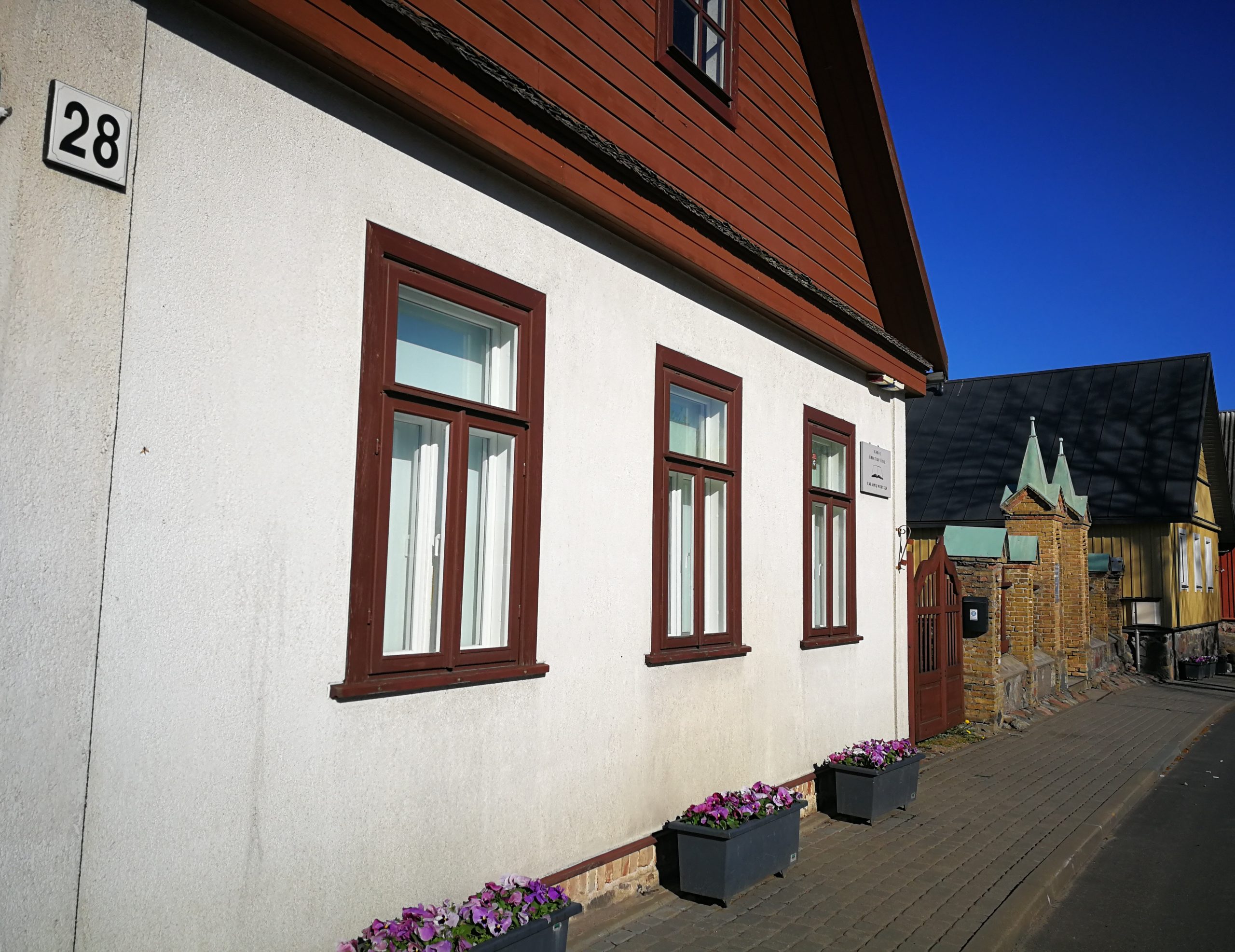
Address: Karaimų str. 28, Trakai.
The first Karaite school aimed at religious studies was built in 1576 near the Karaite temple (kenesa) in Trakai. Despite the school’s religious affiliation, the students were also taught their mother tongue, the Karaim language, which belongs to the Turkic family of languages. The Karaim language emerged in the 9th–10th centuries on the basis of the languages of the Turkic tribes (the Khazars, Kipchaks–Cumans or Polovcians) who lived in the Khazar Khaganate. After adopting the Karaite religion, these tribes, united by a common religion and language, formed a Karaite ethnic group.
The school was rebuilt after it was destroyed by fire in 1879. The school had 2 teachers and it was attended by 27 boys. One of the teachers taught religion. The treasury allocated 400 roubles for the school, and an identical amount was donated by the Karaite community. The school operated for as long as four decades before it was closed for good in 1940 after experiencing some painful losses due to the cataclysmic events of the 20th century.
The use of the Karaim language has since gradually declined and the number of Karaite speakers began to decrease. Attempts were made to ameliorate the situation by carrying out underground education during the Soviet period. Mykolas Firkovičius (1924–2000), a senior clergyman and chairman of the Lithuanian Karaite religious community, was particularly active on this front. Thanks to him, the Karaim language lessons became open to the public and legitimate from 1988 onwards, following the start of the Reform Movement of Lithuania and especially after the Restoration of Lithuania’s Independence created more favorable conditions for reviving national culture. It was during this period that he wrote the first Karaim language textbook.
By that time, the Karaim language had already attracted a great deal of interest from Turkology scholars due to its phonological, grammatical and lexicological aspects. However, the scholarly attention and the legitimate lessons did not have any significant effect on the situation. Today, Lithuania is the only place in the world where the Karaim language is still spoken. However, the use of the Karaim language is almost entirely confined to elderly persons. According to census data as of 2018, there are only 30 people who use the Karaim language in Lithuania. The Karaim language has been included in the UNESCO Atlas of the World’s Languages in Danger of Disappearing.
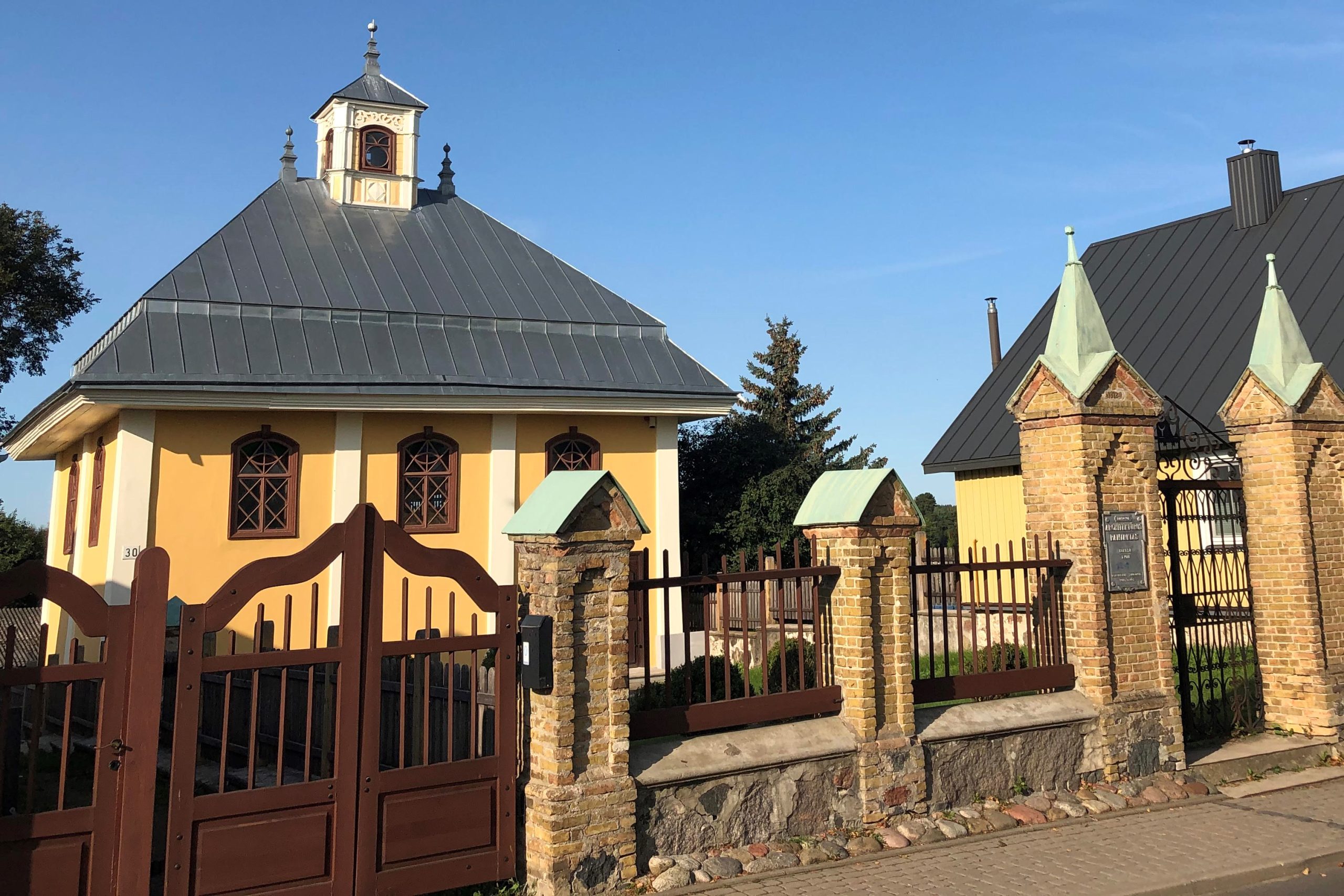
On 9 October 2008, Karaite religious leader, hazzan, consecrated the rebuilt building in which a Karaite school and a religious centre was opened. The building is an interesting architectural solution. White as a swan, it has a three-level roof which slightly descends from the street towards Lake Totoriškės. Each part of the building has a separate entrance. The building is surrounded by a fence with widely spaced pickets. This beautiful building is like a calling card for other Karaite buildings with each having three windows overlooking the street. Once inside the building, visitors can check out the amazing interior of the 18th century hall with its walls made of natural logs, the ceiling with timber cross beams and the ancient rural lanterns used as an imitation of oil lamps. Every detail here preserves the spirit of the past.
It is important to note that the Karaite community’s efforts to preserve their language have yielded some positive results as the domestic and liturgical use of the language has undoubtedly helped to preserve its richness and uniqueness and contributed to its survival. Moreover, an international Karaim language camp takes place each year in Trakai, attracting Karaites or their descendants from across the world. The goal is to preserve Karaite culture and the Karaim language and to promote continued value of Karaite culture and active interest in the Karaim language, in this way ensuring that it continues its existence in our modern world.

GPS: 54.64963, 24.93323
There is an island near Trakai Island Castle called Karvinė, Karaimka or Kopūstinė which is connected to the town and the castle by the bridges. This location has as many as three different names due to the unique stories behind them. For example, the first name, Karvinė, suggests that the fields on the islands were used as pasture where the Karaites used to graze their cattle. The residents of that period regularly witnessed a unique sighting of cows and horses swimming across the lake and goats being carried in boats to the island.
The second name, Karaimka, is a reminder of the fact that the Karaite warriors used to stand there guarding Trakai Island Castle during the reign of Vytautas the Great. This suggests that this island served as a sort of outpost for the castle. However, we have no knowledge about any buildings that existed on the island. The only known fact is that a manor house that stood in this island was purchased by Ivanas Sapiega in 1520. The latter also owned Bažnytėlė Island located nearby.
The third name, Kopūstinė (Lith. Cabbage), originated from the fact that the Karaites, known for their excellent gardening skills, also grew cabbage in this island. Since the Karaites had a knack for growing vegetables, they often used vegetables in their cuisine. They were particularly fond of cabbage and they used it as an ingredient in various Karaite dishes. For example, finely chopped fresh cabbage is added to kibinas to make this dish juicier. And it is a well-known fact that kibinas (kybyn or plural kybynlar in the Karaim language; kibinai in Lithuanian) is one of the most famous dishes in Karaite culture and the whole world.
Besides kibinas, Karaite cuisine is also known for fresh cabbage soup, sauerkraut soup, cakes, cabbage cakes, stews, salads and, of course, kiubėtė – a greasy pastry dough pie with filling. The kiubėtė filling is usually made from fish or minced meat with vegetables. The top of the cake can be enjoyed with broth, and the rest can be eaten as a second course. Beef or mutton, seasoned with vegetables and herbs, are commonly used for the meat filling. But you will not find pork in the Karaite cuisine because the Karaites do not eat it.
Also, there are many potato dishes in the Karaite cuisine such as biok, a Karaite version of kugelis. The dish is baked in a similar way to the Lithuanian kugelis, except that fatty beef or lamb cut into small pieces is added to the grated potato mass.
In fact, Lithuanian and Karaite cuisines have a number of similarities: in our culture it is popular to eat cepelinas, meanwhile Karaites eat kopta (grated potato dumplings). To prepare kopta, you need to cook a thick soup using beef or lamb bones and adding pearl barley and beans or a lot of carrots. When the soup is almost finished cooking, grate some raw potatoes, add finely chopped lamb or beef to the grated potato mass, shape it into dumplings and pour them into the soup. The cooked soup is placed in the oven to simmer.
It will not be an overstatement if we say that the Karaite people have been famous for their hospitality since ancient times. So great and sincere is their hospitality that there are even legends about it.
One of them is about the fortress of Chufut-Kale near Bakhchysarai, from which the first Karaites came to Lithuania. Legend has it that when the fortress was surrounded by an enemy, the townspeople decided not to fight with guns but with hospitality. The hostesses prepared a lot of food, and the elders opened the gates leading to the fortress and invited the weary and hungry enemy inside. The enemy’s soldiers realized that they could not attack a nation that met them not with a weapon but with bread and salt.
Besides the Karaite hospitality, there are also legends of the delicacy of their dishes. Legend has it that a Muslim clergyman who tasted a Karaite stew was so astonished by the deliciousness of the dish that he was lost for words. This is how the name of the eggplant and tomato stew, imam baildy, came to be. In Lithuanian, this means something like “an imam in awe”.
It is worth mentioning that every summer, in August, the Kopūstinė Island hosts the Kopūstinė Fair and the Feast of the Assumption of the Virgin Mary. The Kopūstinė Fair breathes new life into the old festive traditions which attract a great deal of interest from visitors from Lithuania and abroad. During the celebration, participants and guests are treated to Gaspadinės Kopūstienė (Hostess Cabbage Soup).
Address: Karaimų Island, Galvės lake.
GPS: 54.64967, 24.93338
Vytautas the Great was one of the most famous figures in the history of Lithuania. It is with good reason that Vytautas the Great has been glorified to this day – under his rule, Lithuania’s borders stretched from the Baltic Sea to the Black Sea.
On 16 July 1994, an oak monument immortalizing the memory of Vytautas the Great created by folk artist Ipolitas Užkurnis was unveiled on an island in Lake Galvė on the way to Trakai Castle during the convention of the Vytautas Club to mark the anniversary of the Battle of Žalgiris.
Lithuanian Grand Duke Vytautas has a special place in the hearts of Trakai residents and members of the Karaite community. Returning from a successful military campaign in Crimea near the Black Sea, Vytautas brought with him some 400 Karaite families. They settled in the old capital of Lithuania, Trakai. Some of them, the brave warriors, were supposed to help defend his castle from Crusader attacks, and the rest were given land so that they could cultivate it and engage in gardening.
Scholars often wonder what might be the exact reason behind Vytautas’s decision to bring Karaites with him but there is no definite answer to this question. There are two possible hypotheses: some believe that the Karaites were taken as a form of contribution for the war lost, whereas other claim that the Grand Duke was fascinated by the Karaite warriors who demonstrated great bravery while fighting on the side of Khan and brought them with him because he wanted to had them settled in the sparsely populated regions of the country and act as loyal servants and guardians of the country’s western borders. Some fragments of historical records suggest that there was a separate Karaite unit who served exclusively for the Grand Duke. There was a large number of Karaites in the army in later centuries as well. A joint unit of Tatars and Karaites even fought in the Battle of Žalgiris.
Their military talent can probably be in part explained by the fact that military traditions always played an important role in the Karaite society. Even the coat of arms of the Karaites depicts a two-horned spear (senek) and a shield (kalkan). It is noteworthy that the Karaim language has retained a large number of military terms that other Turkic peoples have replaced with loanwords.
It is also interesting to note that the Karaites who settled in Lithuania formed a separate community called gymat (džymat). The legal status of the community and its individual members was governed by the privileges granted to them by the rulers.
The first deed that established the legal status of the Karaites in Lithuania was the 1441 privilege of Grand Duke Kazimieras Jogailaitis which granted the Karaites of Trakai the same Magdeburg right that had already been granted to Vilnius, Trakai and Kaunas. They were given the right of self-government to be exercised by themselves or the wójt elected from amongst the members of the Karaite community. The Karaites were only subordinate to their wójt, and the latter was accountable to the ruler. These rights were later revised and expanded by subsequent Lithuanian rulers. Thus, the Karaites felt they were well supported and protected.
Special respect that the Karaites have had for Vytautas is reflected in Karaite art which depicts him in a poetic light and treats him as a significant figure. The Karaites refer to Vytautas as “Vatat Bijumi” which means “the king who destroys his enemies”.
The fables portray him as a wise, brave, noble-minded and powerful ruler. Lithuanian Grand Duke Vytautas always had good relationship with the Karaites and many Karaites even have his portrait on their walls. Not only Vytautas but also his horse, to whom miraculous powers have been attributed, are surrounded by a sacred halo in the Karaite stories.
Legend of the Grand Duke’s miraculous horse Legend has it that the Karaites’ street was once in danger of being wiped out by lake flooding. Gripped by fear, the Karaite women climbed into a boat and set off to ask the Grand Duke Vytautas for help because their men were out fighting in the battle, and they were all alone and powerless against the elements. After hearing out the women, Vytautas promised to help them. Shortly, his horse headed to the Karaites’ street and drank all the flood water, protecting the street from the flood. People were in awe and tears of joy streamed down their faces. After returning home, the women praised and glorified the grand duke and his miraculous horse. The horse, overfilled with water like a giant mountain, slowly trotted out of town towards the Karaite Fields, the bridge almost collapsing from his weight. At the place where the horse stopped to rest, Puvus Lake (Čirik giol‘) emerged. To this day it stands as a reminder of the miraculous horse.
Address: Karaimų str. 43C (Galvės lake, Pilies Island), Trakai.
Magnificent Trakai Island Castle is situated in one of the many islands on Lakė Galvė. It is a masterpiece of Lithuanian medieval defensive architecture and the only water castle in Eastern Europe. It is believed that the construction of the Island Castle was initiated by Lithuanian ruler Kęstutis in the late 14th century and was completed in the early 15th century by his son, Lithuanian Grand Duke Vytautas. The castle consists of a convent-type palace with a keep and a forecourt. The castle was built as a fortress. After it lost its defensive status following the Battle of Žalgiris, it was used as the grand duke’s residence.
Trakai was a thriving town in the early 15th century. It attracted large numbers of merchants, honorary guests, foreign envoys who were all greeted at the representative hall of Trakai Island Palace. Jogaila, King of Poland and the cousin of Lithuanian Grand Duke Vytautas, visited the castle as many as thirteen times between 1413 and 1430.
However, after Grand Duke Vytautas’s death, the castle was gradually abandoned and its role declined at the beginning of the 16th century. During the war with Sweden and Russia, Trakai Island Castle sustained significant damage and it was not rebuilt after these events. This period marked the beginning of the castle’s decline as its maintenance was gradually discontinued and by the 18th century it was completely dilapidated.
However, the situation changed in the period following World War II. Concerns were finally raised regarding the physical condition of the castle. Thanks to the restoration work that has been carried out since, the symbol of Trakai and Lithuania regained its 15th century appearance. After the restoration of Lithuania’s independence, the castle regained its status as a place for hosting honorary guests’ visits and signing important agreements.
The purpose of Trakai Island Castle changed in 1962 when it passed into the hands of Trakai History Museum which operates the castle to this day. The castle houses various expositions and is used as a venue for exhibitions and events. Each year, the castle attracts thousands of visitors from around the world not only for its magnificent appearance and rich historical past but also because of the fact that it has something for everyone, whether you want to admire the architecture, explore historical exposition or the museum’s collections.
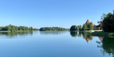
Address: Karaimų str. 53B, Trakai.
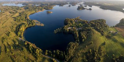
It’s not for nothing that Trakai is called lake country. Trakai District has nearly 200 lakes. Many of them border the town of Trakai itself: Galvė, Luka (Bernardinai), Nerespinka, Totoriškės, Gilušis, Lovka, Babrukas, Skaistis, Akmena and other lakes, big and small. It seems as if water reigns in the area, and land obediently gives way to it. All of Trakai’s lakes are beautiful, but none compare to the wonderful Galvė. This is one of the largest lakes in the Trakai region and one of the deepest in Lithuania. Its shores are carved with numerous bays, and its waters are dotted with 21 islands. The picturesque Lake Galvė is a favourite among water-based tourists, divers and holiday makers and rowers and sailing teams train and compete in it as well.
There is an old legend that the lake will not freeze up until it has taken its toll by way of a drowning man. In order to prevent such miseries from happening, the people threw stone heads into the water to 'appease' the lake. Two of those heads were found under water.

Address: Karaimų str. 57A, Trakai.
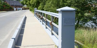
GPS: 54.65002, 24.92693
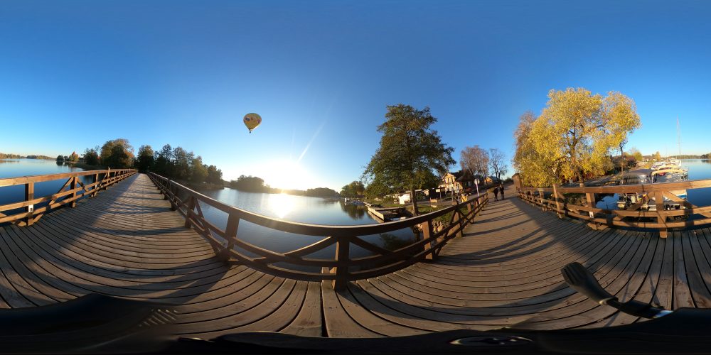
While recorded mention of the bridges of the town of Trakai dates back to as late as the 16th century, these bridges have a history that is worth exploring and remembering. First knowledge about the Karaite Bridge, also known as the Iron Bridge, which connects the strait between Lake Galvė and Lake Totoriškės dates back to 1515 when voivode of Trakai, A. Astikas, purchased two manor estates near the bridge. Reference to this bridge was also made in 1570 when Žygimantas Augustas approved the Magdeburg right for Trakai.
Since Trakai, like the rest of the Grand Duchy of Lithuania, was home to different ethnic (Lithuanians, Karaites, Tatars, Russians, etc.) and religious groups from the late 16th century, the town was divided based on the borders of the areas populated by these groups.
In oral tradition, the Karaite part of the town was described as the area stretching “from the pole to the bridge”. This phrase refers to the part of the town stretching from John of Nepomuk wayside shrine (the Karaites call it “the pole” perhaps due to the fact that there are no saints in their religion) to the so-called Karaite Bridge or Iron Bridge across the strait between Lake Galvė and Lake Totoriškės.
The new privilege granted by Žygimantas Augustas stated that following the collapse of the bridge across Lake Galvė (from Kaunas side, i. e. at the northern end of the town), the town dwellers were responsible for rebuilding it. As a compensation for the funds spent on building the bridge, the town was granted the right to collect bridge charges: one coin for a single carriage, and two coins for a two-horse drawn carriage. The charge was not to be collected from people belonging to “the knightly class” crossing the bridge. This helped to fund the rebuilding of the bridge which took place in 1584.
However, in 1611, the townspeople of Trakai made a request asking permission to increase these charges as the bridge repair works required a considerable amount of funds. Their request was granted and from that point onwards two coins were collected for a single-horse drawn carriage. As agreed, the collected funds were used for the bridge repair works so that the merchants travelling between Vilnius and Kaunas would not sustain undesirable losses. It is noteworthy, that this request was not without grounds. It suggests that the former charges set for crossing the bridge were not sufficient perhaps due to the fact that the number of merchants travelling across Trakai decreased. Otherwise, there would not have been repeat references to the same orders included in the ruler’s subsequent letters. For instance, in 1620, Zigmantas Vaza ordered the merchants of Kaunas, Vilnius and Panemunė region to travel through Trakai. Fines were to be imposed on those who disobeyed the order.
Over time, maintaining the bridge still posed challenges, especially during the times where the strait between Lake Galvė and Lake Totoriškės was wider so the bridge became a town-wide issue.
For example, the wooden bridge was susceptible to decay and there was a high risk of accidents so part of the bridge was dismantled. A recorded mention appeared in 1833 stating that following such type of accident, a project for constructing a new bridge was initiated.
As mentioned previously, the Karaite Bridge was also called the Iron Bridge but the fact that it had to undergo repairs so frequently hardly justifies this name. For this reason, in 1845, the reporter of Druskininkų Šaltinių Undinė raised a question as to why the Trakai Bridge was called the Iron Bridge, and he guessed it was because a small amount of iron was used in constructing the bridge as one could hardly describe the bridge under construction as made of iron.
In 1863, the Tsar’s army dismantled the bridge completely to protect themselves from insurgents. A few years later, in 1868, trees were designated in the forest for the purpose of rebuilding the bridge; however, they were still not brought to the site by 1871 thus the site remained empty.
It is believed that it was only a few years later that the new bridge was built. Embankments were made on each side of the bridge to make it shorter. During that period, trips to Kaunas led through the road that ran along the western shore of Lake Totoriškės.
Today, we see a short, tall, durable bridge built during the Soviet period after implementing complex earthworks to raise the ground level, and the old, low and long wooden bridge became part of our memory.
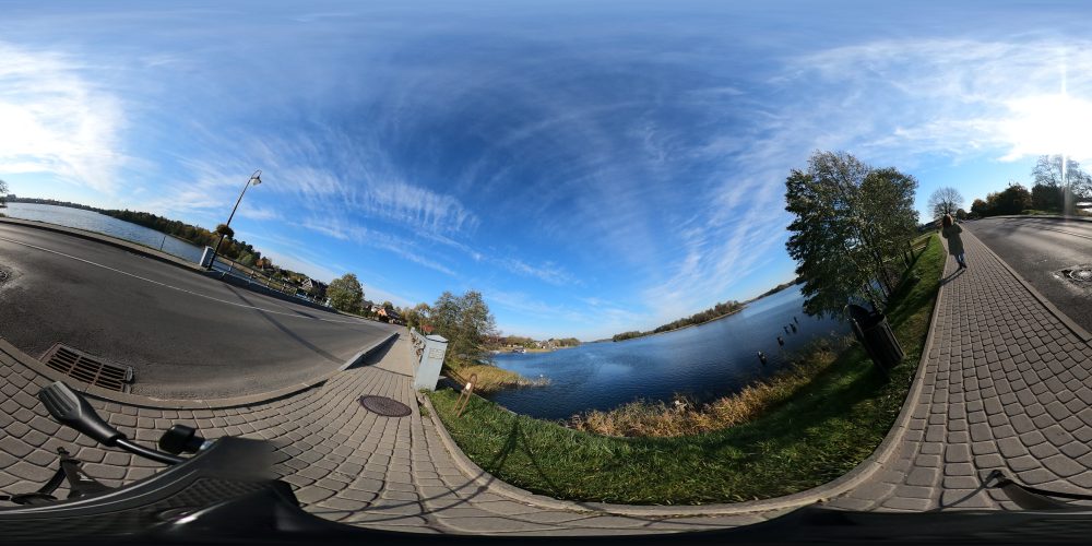
GPS: 54.65775, 24.89642
The Royal Fields, or Karaite Fields, emerged after the Karaite ethnic group moved to Lithuania in the 14th century and the Karaite warriors continued the traditions of their ancestors and parents by serving in the army units of the Lithuanian Grand Duke Vytautas, protecting Trakai Island Castle and guarding the state borders of Lithuania. As a reward for their excellent service, Vytautas donated more than 300 ha of land to the Karaite community. The land was used by the Karaites for more than 500 years.
It was agreed that a specific strip of farmland would be assigned to each family and the family would not be entitled to sell it. After the land owner’s death, the land was transferred to another family at the community’s decision. These strips of land were located in the northern part of Trakai. Since they belonged to the Karaites under the rulers’ privileges, they were called the Royal Fields. Interestingly, the location of these fields is still visible today near Trakai. Any elderly member of the Karaite community could show an exact location of the strip of farmland that his or her parents, grandparents or great-grandparents used to cultivate.
Besides the community land granted by the rulers, some Karaites had small manor estates, folwarks or plots of land granted to them. However, these areas of land around Trakai were purchased by voivodes in the 16th–17th centuries, and after the Lithuanian rulers abandoned Trakai as their place of residence, the town saw a decline in terms of its farmland activities. As a result, gardening became the main source of livelihood for the Karaites, with their famous Trakai cucumbers being their main produce. There is a Karaite proverb that says “He who cultivates the garden, drinks bitter water” giving the idea of just how hard the gardeners worked.
However, their hard work definitely paid off, as the members of the Karaite community were praised not only for being virtuous warriors and guards but also for being excellent craftsmen and gardeners, who brought first cucumbers to Lithuania and who cultivated various herbs and spices. It is believed that while making their way to Lithuania and not knowing what conditions they were going to face, the Karaites brought with them various plant seeds. It proved to be a very smart decision which later brought them fruitful results.
Over time, the cucumbers of Trakai gained so much appreciation from people that Jonas Krivka even published what could almost be considered as a scientific study on cucumbers. He claimed that the Karaites classified their cucumbers based on their size and shape. Crooked ones were to be consumed by the Karaites themselves. These were called “the little ones”. The cucumbers that were brought to the market had to meet more strict criteria: they had to be the same size. They were placed into damp sacks on the evening before the market day, and early in the morning before the break of day, they were transported to Vilnius using horse-drawn carriages.
The Karaites also produced pickled cucumbers and used an interesting procedure for this purpose. They poured some brine on them, placed them into barrels, nailed them up and threw them into the lake where a special enclosure was located near the shore so that the undercurrent would not move the barrels further away from the shore. The pickled cucumbers were left in the lake until spring. The Karaites would then cut the ice and take out the barrels. After several months of sitting in the lake, the pickles were very well fermented and very delicious.
The Karaites had yet another tradition worth mentioning. Describing the cucumber seedlings affected by spring frost, the Karaite women used the phrase: “the cucumbers went to Kaunas”. They would then try to save the cucumber seeds by wrapping the seeds in a damp cloth and placing them into their bosom so that they could sleep with them, snuggled warmly. It did not take long for the seeds to sprout.
Unfortunately, the cucumber seeds stopped sprouting during World War II and the famous Trakai cucumber was lost. The Karaites managed to produce a different variety of cucumber, an improved version of Trakai cucumber, but this one was not as good as its predecessor.
The Karaites practised a number of other agricultural ritual celebrations such as the traditional harvest festival Orach toju (the Sickle Festival). It was usually celebrated at the end of the summer after the main grain harvest. The celebration included making a wreath from the ears of all the cereal plants cultivated by the farmers. The wreath was carried to the town in a solemn procession all the way to the Karaite house of worship, kenesa. Here it was consecrated and hung on the wall of the kenesa in front of the altar. The wreath was left to hang in the kenesa until the next year’s harvest. On this occasion, a pie was made and Karaite krupnik was brewed. People entertained themselves and sang at the festive table before resuming work.
Such celebrations were held until World War II. The last wreath was made from the harvest of 1938 and it was hung in the Kenesa of Trakai. It still hangs there to this day.
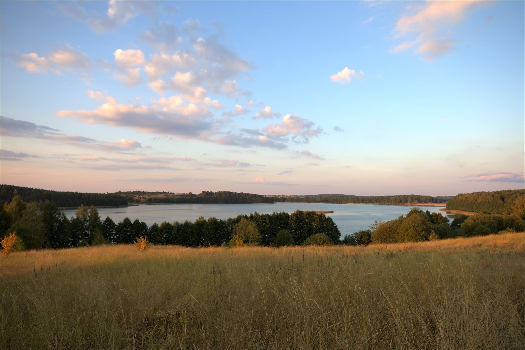
Address: Daniliškės village, Trakai district.
GPS: 54°40'42.7"N 24°48'40.6"E
Old Believers settled in Lithuania after the reform of the Russian Orthodox Church of Patriarch Nikon during the reign of Russian Tsar Alexei Mikhailovich. The church was headed by the Tsar of Russia, and at the same time any inequalities found in church books and rites were being changed and eliminated. In 1656, the church assembly separated opponents of the reform, the Old Believers, from the Russian church. Persecuted by ecclesiastical and secular authorities, the Old Believers retreated to deserts, forests, or fled abroad. Some of them came to Lithuania, which has long been famous for its tolerance for other religions. One of the places where they settled was the village of Daniliškės, in the lands belonging to landowner Riomeris. In the 19th century, there were at least 47 villages in Trakai County where Old Believers lived.
Previously, Daniliškės was a large Old Believer village, inhabited by only a few Catholics. The community of the Old Believers of Daniliškės village consisted of 116 people. This is also evidenced by the cemetery situated near the village containing tombstones with double crosses, and names engraved in monuments which you will rarely hear today. The Daniliškės Old Believers community is the oldest such community in Vilnius region, formed in the 18th century. It originally belonged to the branch of the Feodosiya, and from the middle of the 19th century to the Pomory.
One of the thirteen Lithuanian Old Believers' prayer houses, built in 1817, still stands in the middle of the village to this day. Until 1825, this Orthodox church was also used by the Old Believers of Vilnius. The church suffered greatly during World War I. In 1931, a new wooden church with a bell tower was built on a concrete foundation. In 1937, it had 194 members. The church was closed down during the Soviet period, but was restored and renovated in 1990. The Orthodox church had a spacious prayer hall and residential rooms for the priest's family. It was also served by members of the community living in the Onuškis and Stakliškės areas.
The village of Daniliškės is losing its residents with currently only a few Old Believers' families living in it. However, it is still a very important place for the Lithuanian Old Believers' community, since Old Believers living in other parts of Lithuania come to the orthodox church of this village to attend its rites and bury their dead in the nearby cemetery.
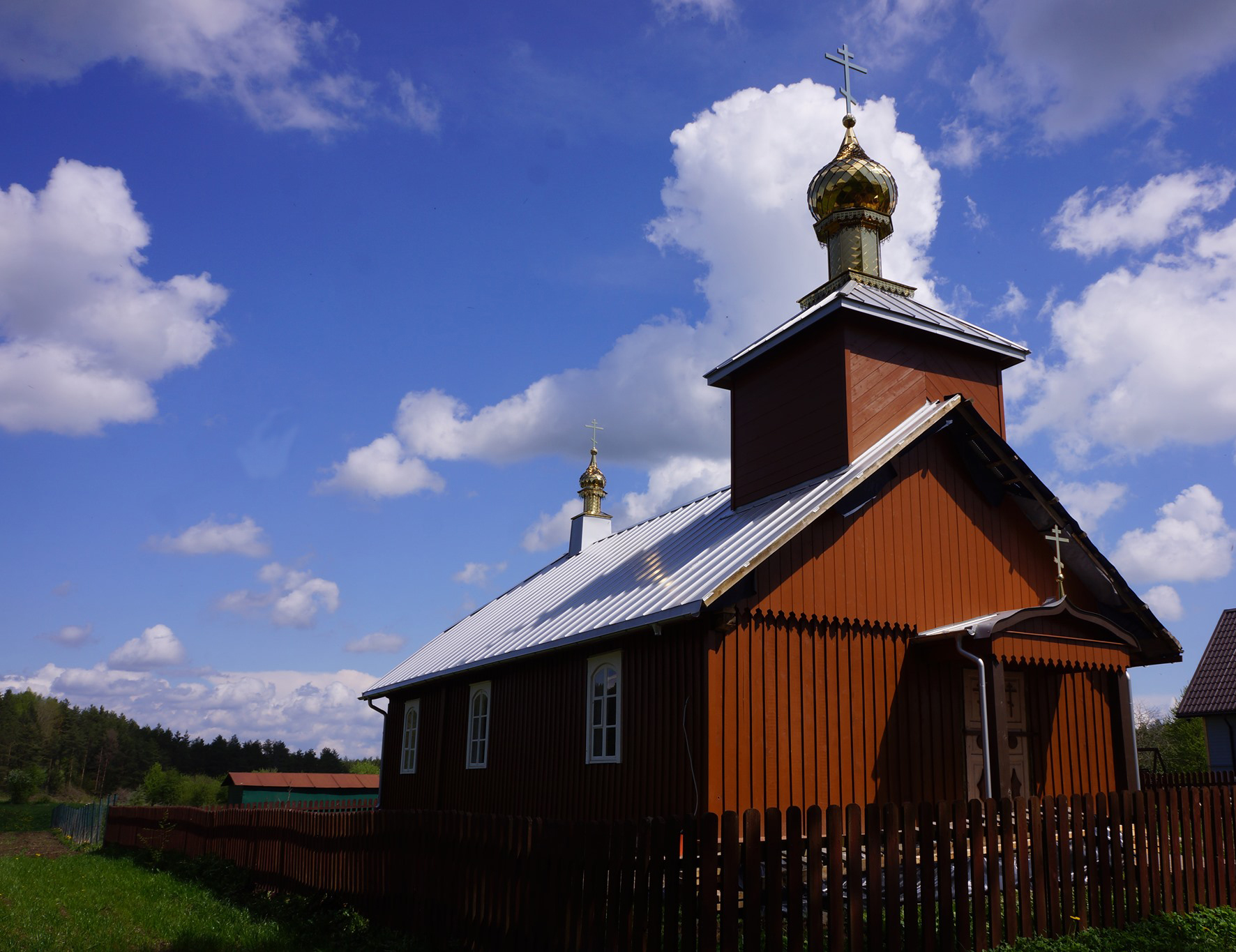
GPS: 54.680916, 24.892727
A beautiful Bražuolė Castle Hill is an important witness of our country‘s historical events. The mound is situated only five kilometers away from Trakai Castle close to the bed of the River Bražuolė.
A wooden castle, that formed a part of Vilnius defense system, stood on this hill in the Medieval times. In the 13th-14th centuries the fortress was even one of the largest centres of the region. Jogaila, the Grand Duke of Lithuania and the King of Poland, resided here for a while. It is known that on 6 July 1382 he entered into a short-termed Brazuole agreement with the Teutonic Order whereby both parties agreed to abstain from attacking each other for three months. But nobody knows if they held to their promise…
If we had a chance to go back to the ancient times, we could see that the fortress is surrounded with a wooden defense wall. We could also see its tower, and would notice the edge of the household building that was designed for defense. We would also meet on our way the working people. Judging by a large number of the stone work axes that were found under the unearthed turf of the castle hill, their everyday life must had been very difficult…
An old settlement was situated close to the hill. This place was perfect for people to live as they had very good access to Lake Akmena and Lake Galve that are situated nearby. If you had a chance to go back to those days, you could see the contemporary women washing their laundry in the lakes with their skirts lifted up to prevent them from being soaked by the water, and the men watering their horses at the lake.
There also were tumuli nearby Bražuolė Castle Hill in the 9th-12th centuries. They were used as the place of burial of the cremated remains of the deceased local people. It is regrettable that only the remains of the old graves, that are called Kapčiai, have survived into the present…
The old people remember that the neighborhood of Bražuolė Hill had always been very beautiful, and this beauty can also be seen today. If you want to make sure that this is true, you should climb up the steep slopes of the hill that overlooks the beautiful panorama!
Sourse: © lietuvosgamta.lt
Photo: © lietuvosgamta.lt
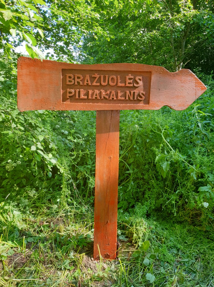
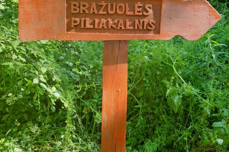
Address: Angelų kalvos str., Būda village, Trakai eldership.
This is a place for fostering human devotion and spirituality. It is spotted with plenty of finely crafted wooden angel sculptures, wrought sun-like crosses and life trees decorated with traditional national symbols. In 2009, Dominyka Dubauskaitė-Semionovė and Lolita Piličiauskaitė-Navickienė, initiators of the idea of the Hill of Angels, proposed the project in order to honour the celebration of Lithuania’s 1000thanniversary and the 600thanniversary of the Basilica of the Visitation of the Blessed Virgin Mary in Trakai. Plans were made to place ten angels on the Hill where each of them would represent a different century. The kindness and generosity of people interested in the idea surpassed all possible expectations of its initiators. As a result, 18 angel sculptures found a new home on the Hill! The Hill of Angels is today also referred to as the Path of the Millennium Signs.
Today, the area of 4.3 hectares hosts over 40 magnificent sky-greeting wooden angels of all sizes and oak road crosses with sculptures of saints on them. Every angel on the Hill seems to embody one of the human truths, fundamental human or Christian values. The angels embody the notions of Life, Truth, Peace, Serenity of the Spirit, Empathy, Sacrifice, Love, Health, Joy, Gratitude, Hope, etc. The angels include those that are the patrons of families, science, spiritual tranquillity, the Baltic road, etc. Surely, your angel is on the Hill too, and you must pay him a visit.
Among the many wooden angel sculptures there is one that is human height. It is the Angel of Kindness inviting everyone to embrace him and enjoy this lovely feeling.
The oak angel sculptures were created by Lithuanian and foreign artists and reflect traditional wood carving and cross-crafting. Angels created from other materials appear on the Hill, too. In 2015, the Angel of Orphans was created with a head made of granite. In 2017, the Angel of Librarians, made out of metal, also joined the collection.
Sculptures give meaning to the ideas embraced by their donors and reflect the message carried by the angels. It is an ongoing project that aims to fulfil the spiritual needs of people. Everyone is invited to participate in its development by providing special meaning to his/her thoughts, prayers or important moral values.
The Hill of Angels is an open and free space that can be visited at any time of the day. It offers a magnificent view of a landscape filled with forests and lakes. The majestic Trakai Castle, the lakes surrounding Trakai, Trakai Basilica of the Visitation of the Blessed Virgin Mary, the Orthodox St. Mary’s Nativity Church and other historic, cultural and natural gems are visible in the distance.
What else makes the Hill of Angels so special? If you take a bird’s eye view of the Galvė lakes, they look like an angel with its wings spread. The Angel’s legs and body are shaped by lakes Galvė, Totoriškės and Luka (or Bernardinai), the spread wings – by lakes Skaistis and Akmena, and the Hill of Angels is the Angel’s head!
The Legend of the Hill of Angels
When God was creating the region of Trakai, he was assisted by the Angel of Compassion. Prolonged rain filled the imprints of God’s fingers in the ground with water forming many lakes of different shapes. The Angel of Compassion was mesmerised by the beauty of the crystal-clear waters, the abundance of fish and breathtakingly colourful birds diving in the waves. He was flying above the lakes chasing dragonflies having forgotten all about his work.
The angel’s brothers became concerned and turned to God, thinking that the Angel of Compassion had lost his head because of these lakes and had forgotten about his daily duties. The Creator calmed them with a wave of his hand and said: in the spot where one is able to see three places where God is worshipped, the Angel of Compassion will regain his head! With that, the earth started trembling, the heavens started shaking, and suddenly a hill appeared in one spot. All the surrounding lakes joined it forming the Angel’s body and wide-spread wings.
Centuries later, people climbed up the hill where the three places of God’s worship could be seen: the church, the Orthodox church and the Island Castle. People really liked this hill, so they started bringing wooden angels here. As soon as the first angels appeared on the hill, the Angel of Compassion woke up and realised that the Hill of Angels was his lost head from God’s prophecy. The Hill symbolises his lost head that was covered by a wooden angel’s wing. He admired the beauty of the Hill and as he was ready to return to God he said: “There will be more and more angels on the hill. They will protect Trakai and all of Lithuania, and Trakai will become a path to spread kindness and love!”
The Vision of the Hill of Angels
The Hill of Angels is an expression of civic engagement, through which the two authors sought to realise their two goals: to honour the celebration of the 1000thanniversary of the first mention of the name of Lithuania and the 600thanniversary of Trakai Basilica of the Visitation of the Blessed Virgin Mary. Today as the number of the angels on the Hill continues to grow, this place will hopefully bring together and unite local people, families, professional and other communities. A number of the angels on the Hill are the patrons of teachers, librarians, soldiers, special investigation service officers, journalists and members of other communities as well as angels that remind people of their loved ones.
Each visitor will undoubtedly find his/her spirit at ease here while praying or enjoying time in a unique place of unity of art and soul.
Sacred Music Festival
Chants Resound on the Hill of Angels’ is a sacred music festival organised by the Hill of Angels community. Each year, the sounds of folk chants and songs ringing over the spectacular Trakai landscape rise to the sky encouraging people to pray and thank God for Hope, Peace, Love, Power of Spirit, and all other Christian values.
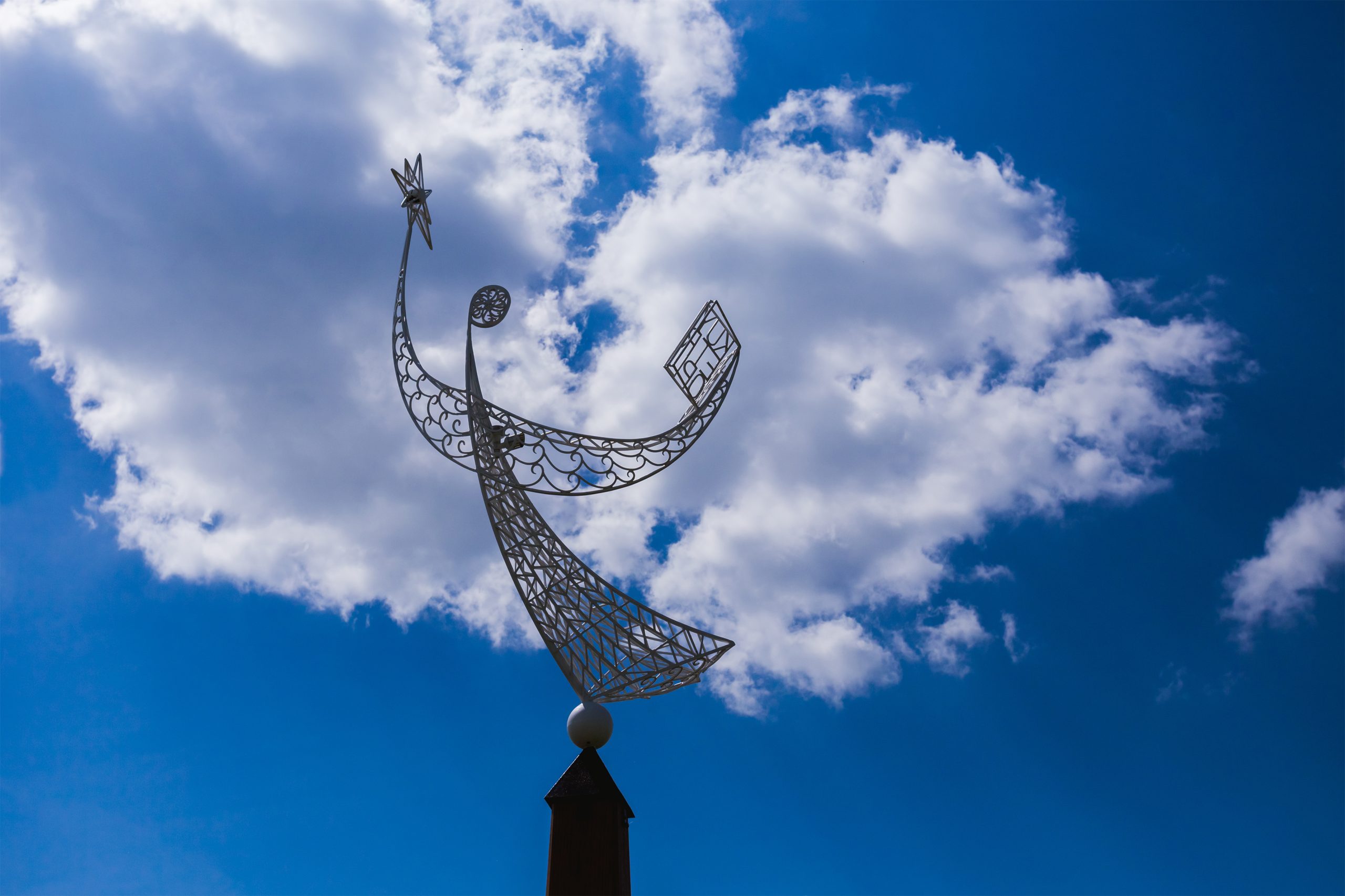
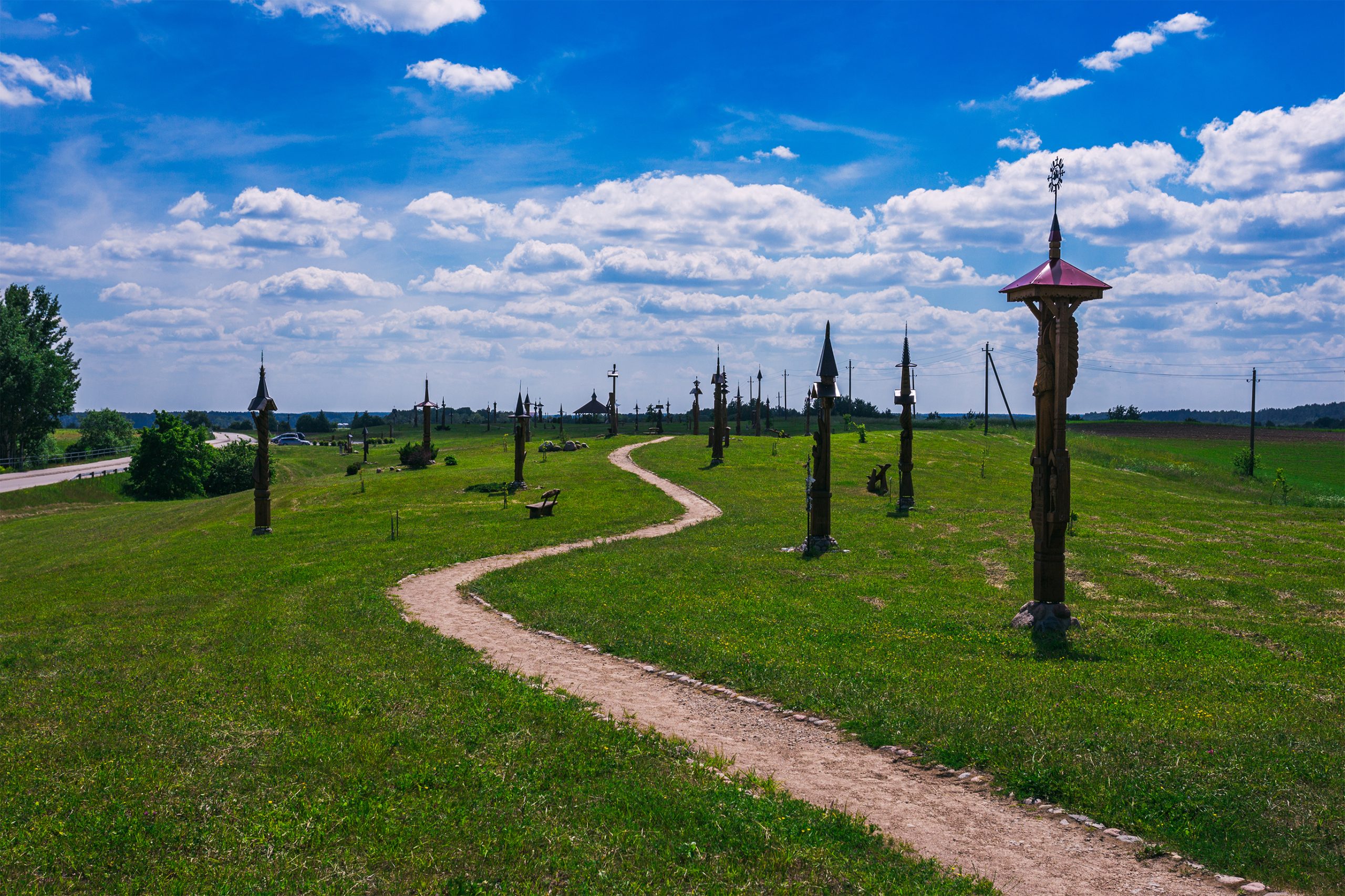
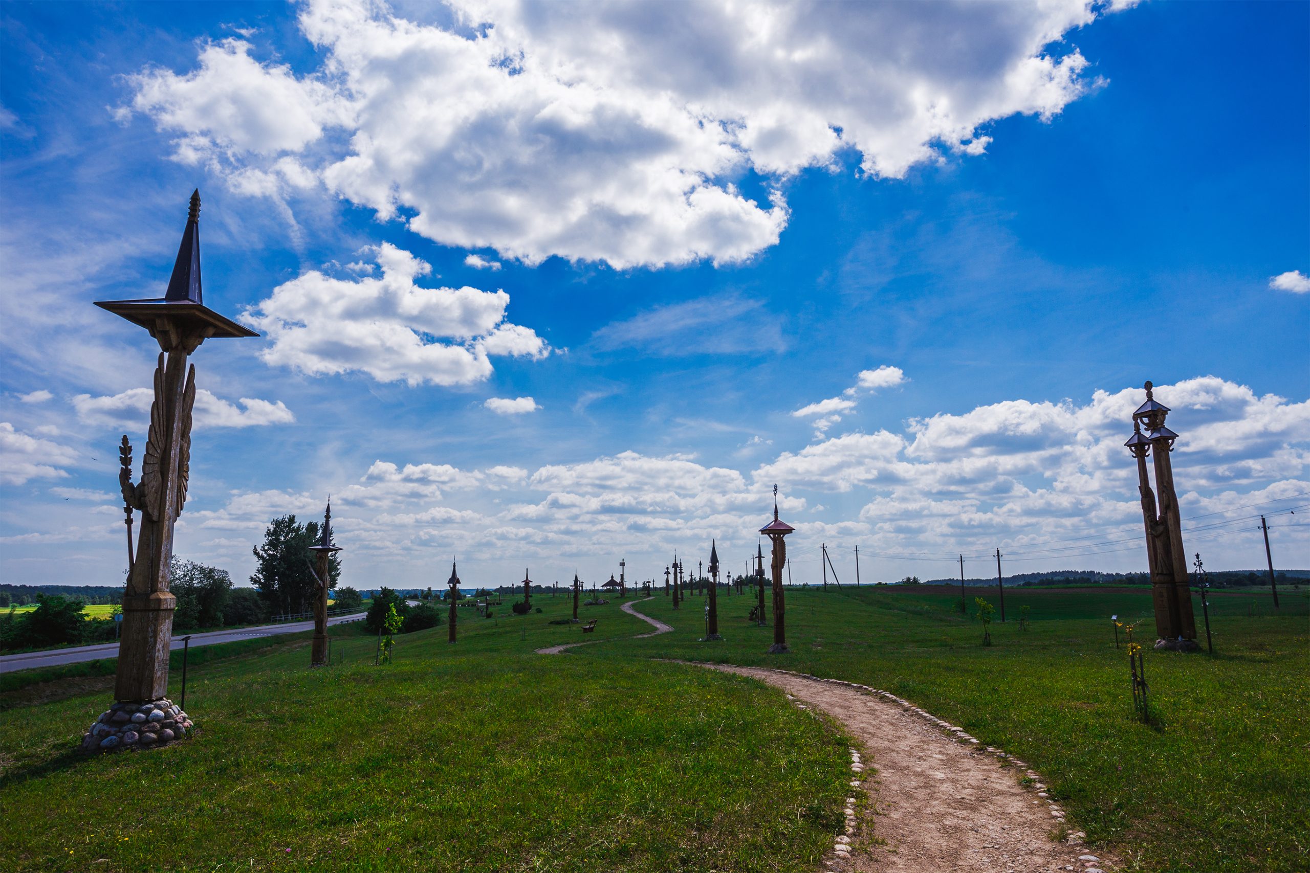
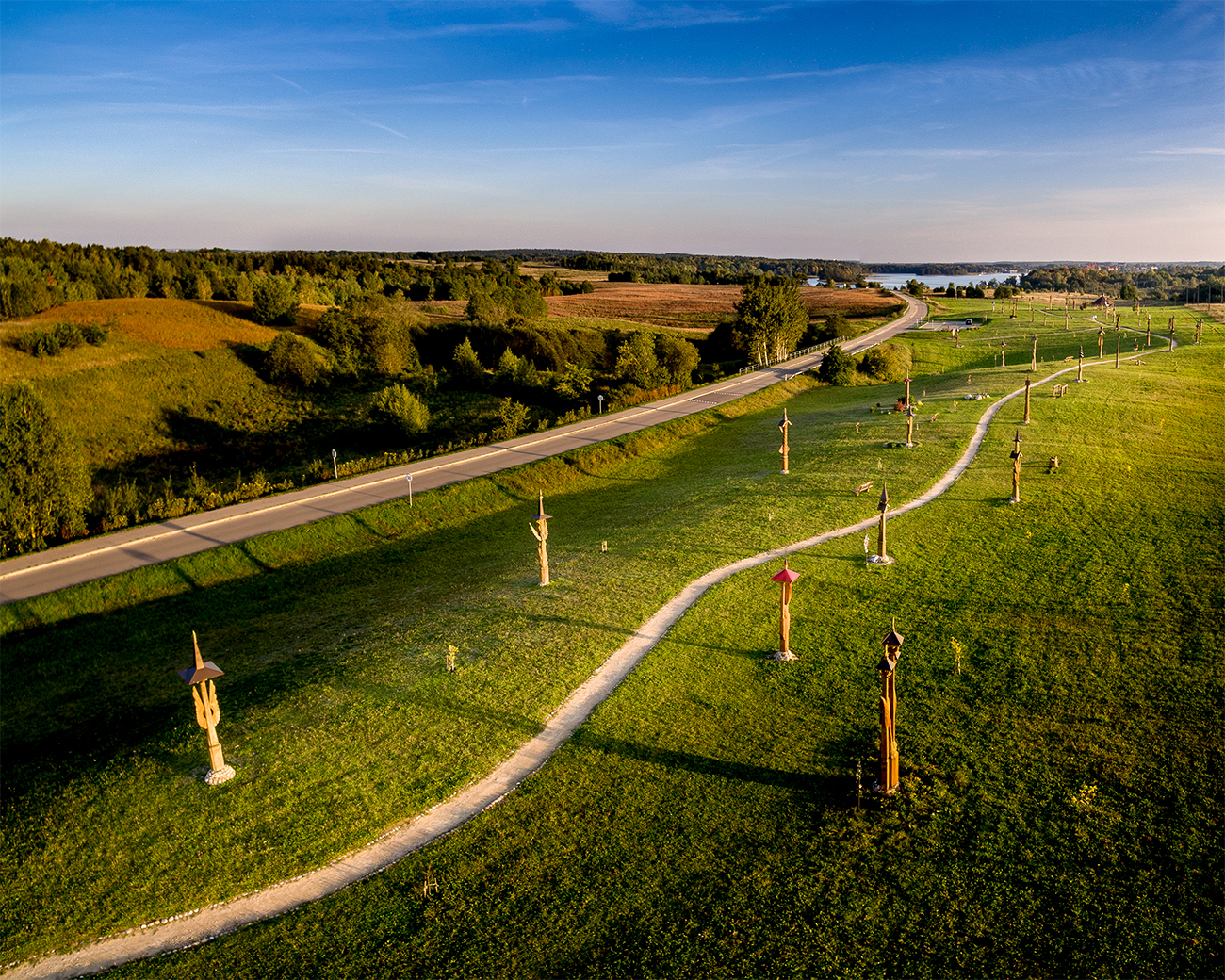
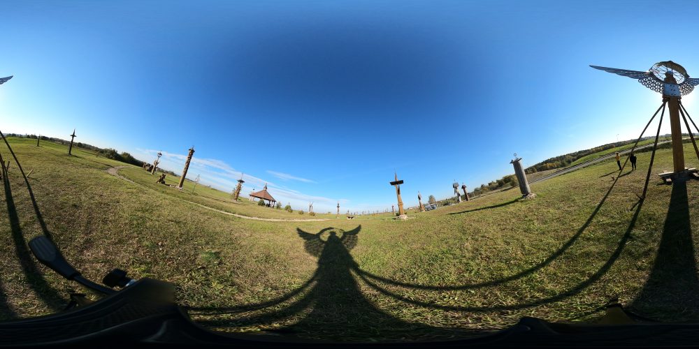
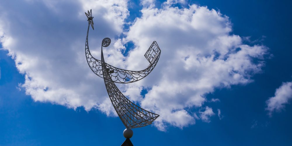
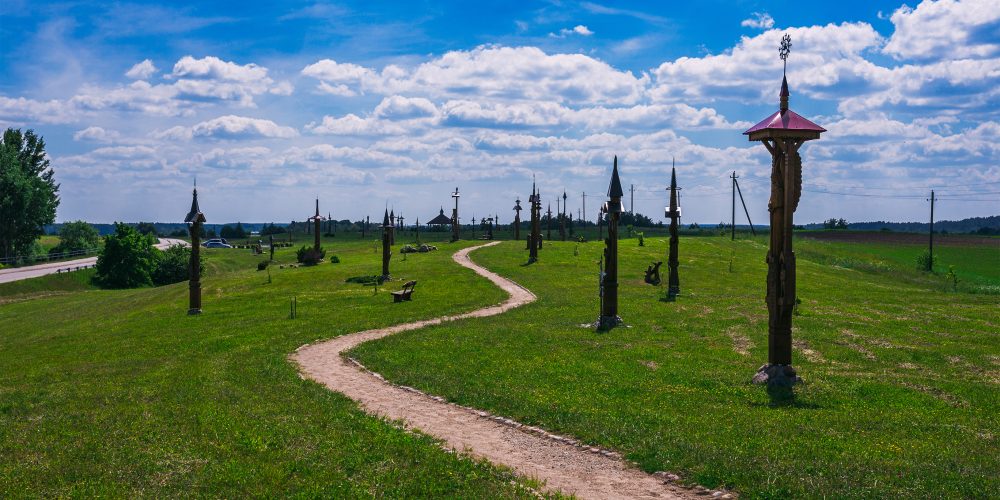
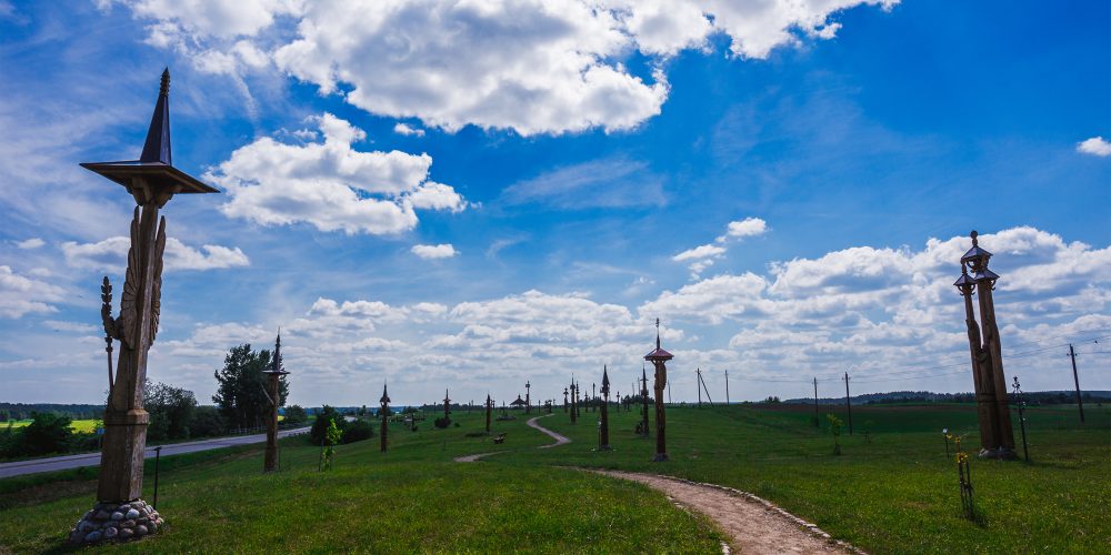
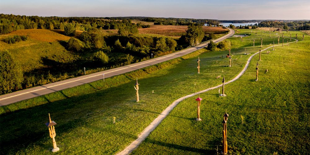
Address: Užtrakio str., Užutrakis village, Trakai.
Trakai region, with its many lakes, is famous for the abundance of its natural and historical heritage. This treasure is the location for Užutrakis Manor House with its luxurious palace, often called the white swan of Lake Galvė. The beautiful homestead nestled on the eastern shoreline of the lake is unique with its exclusive geographical locale and lovely history.
Written sources first mention Užutrakis peninsula in the 14th century when Tatar nobles called it their home. Peninsula territories, also called the island of Duke Algirdas, has belonged to different owners over the course of its history. The prosperity of Užutrakis Manor is associated with the Tyszkiewicz family. At the turn of the 19th and 20th centuries Count Józef Tyszkiewicz and his wife Jadwiga built a luxurious residence, a Manor House with a palace, decorated with impressive Louis XVI style interiors,and an impressive terrace crowned with open pavilions and a lovely mixed style park.
In the old days, counts used to arrive to the Manor by water – a rafter transported them by raft through the strait of Lakes Galvė and Skaistis. Land travels were also avoided by high ranking guests of Tyszkiewicz, who visited the Manor for frequent meetings, family get togethers and informal banquets. Events were filled with music, banquet tables were stacked with French cheeses made in the Manor, drinks produced in the distillery and even locally raised roasted pheasant was served in the middle of the table!
The people who worked at Užutrakis Manor House and homestead rarely travelled by water. Farm tasks were carried out using the old ‘Potato Road’ which led through the fields towards auxiliary buildings of Užutrakis Manor, but nowadays this road winds its way along the shorelines of Lake Galvė. Travellers along ‘the Potato Road’ are presented with an excellent opportunity to enjoy the marvellous scenery that includes the view to the lake dotted with islands and an exquisite jewel – Trakai Island Castle.
Today everyone who wishes to visit Užutrakis Manor will need to travel by the old ‘Potato Road’. However, finishing touches are being made to the construction of a pier, so visitors will soon be able to reach the peninsula by water as well! The renovation of the Manor House and ongoing maintenance is the responsibility of Trakai Historical National Park directorate. For the convenience of visitors several viewing platforms and wooden rest benches have been installed along ‘the Potato Road’.
The Manor Farm
Tyszkiewicz Manor complex in Užutrakis was supported by a very well-run farm, which was transferred to the eldest son by succession without the right to divide the estate. The farmlands alone comprised about 800 hectares and a part of them were allotted to gardening and a mixed-style park.
An interesting fact is that pheasants, which belong to the family of ground living birds, whose males are known for their deep colours, were raised near the Manor. A pheasant specialist from Austria was brought in for this purpose. The Tyszkiewicz family served their guests roasted and masterfully prepared pheasant on special occasions.
The farm area of Užutrakis Manor House consisted of 19 masonry and wooden buildings: horse stables, a grain barn, a forge, cattle sheds, a warehouse and others. Ten of the former buildings have survived to this day. One of the most important buildings was the distillery, since the distillery was one of the biggest sources of income for the Manor.
Servants and Workers in Užutrakis Manor House
Written sources inform that Užutrakis Manor House was served by about 60 servants and workers. As previously mentioned, to reach their ‘workplace’ they used the land road. One can guess that the road got its name because potatoes were delivered to the distillery.
The story tells us that the travels to the closest towns was long and expensive. Frequent ‘Potato Road’ usage was inconvenient and impractical, therefore families of Užutrakis personnel were forced to find ways to keep afloat. The women themselves fermented kvass, baked bread, did tailoring, knitted, made lard soap and so on.
The Manor lacked a doctor, however, so the servants and workers who got sick had to fend for themselves. Only on rare occasions, and with approval of the counts, was a doctor called in.
However, Countess Jadwiga established a school for the children of those poor servants. In her spare time, she took it upon herself to teach children to read and write, memorise short poems and songs. She also told stories about the region’s history.
Love for the French Style
There were stories that Countess Jadwiga used to say this phrase: ‘Love for everything that is French’. Count Józef freely spoke French, knew diplomatic protocol and was one of the very few in Lithuania who adhered to savoir vivre, or rules of politeness and good manners.
No wonder then that the exclusively beautiful Užutrakis Manor park was designed by a French man – Édouard François André. This world-renowned landscape designer created a unique water park that spans across the peninsula. Over 20 ponds of different sizes and shapes were dug and hundred-year-old oaks, pine trees and exotic plants brought in from abroad reflect in the water. Symmetrical (French) parterres with linden tree avenues, ornamental flower gardens, marble vases and sculptures were created in front of the palace.
Užutrakis was often visited by Russian diplomats, military and highest-ranking officials, because Count Tyszkiewicz earned his economical-military education in Saint Petersburg. He imitated Russian high society by bringing in a French chef and cheese maker. Lithuania for centuries was known for cheese making, but in Užutrakis they were made according to French recipes and traditions. It was believed that those cheeses, kept in a cold masonry building, were turned and stroked daily.
Užutrakis Manor House Today
Užutrakis palace brings you back to the turn of the 19th and 20th century like a time machine. While restoring two of the Manor halls, every effort was made to preserve the luxury typical of the Tyszkiewicz family era. Today, visitors can examine authentic furniture, sets of china, weapons, mirrors made of Venetian glass and other interesting artifacts related to the lives of the counts. Following the traditions of the Tyszkiewicz family the palace often organises a variety of temporary exhibits, therefore you can frequently encounter music and enthusiastic applause here.
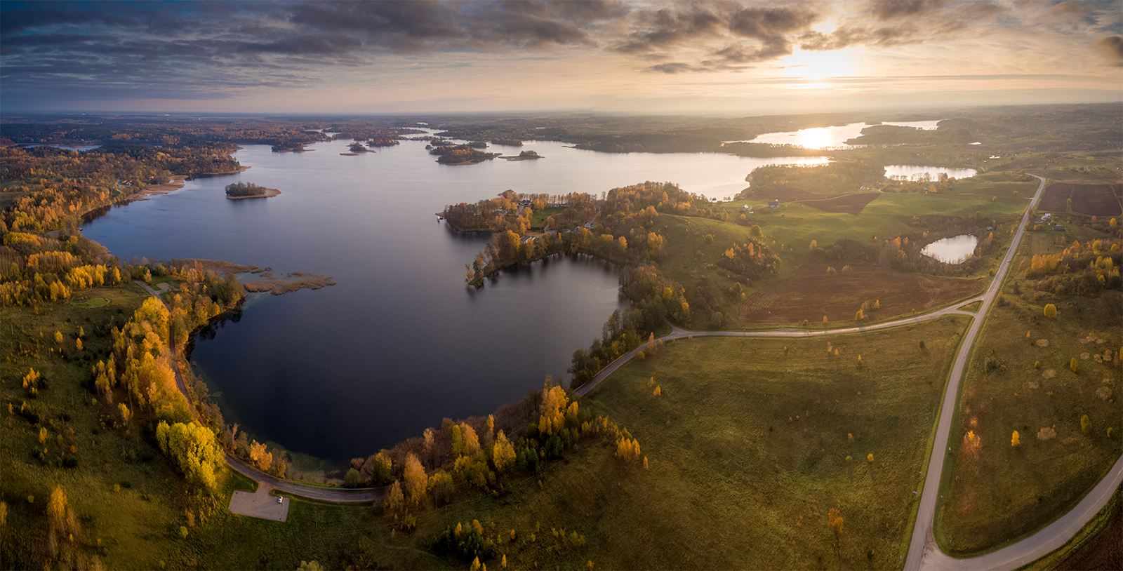
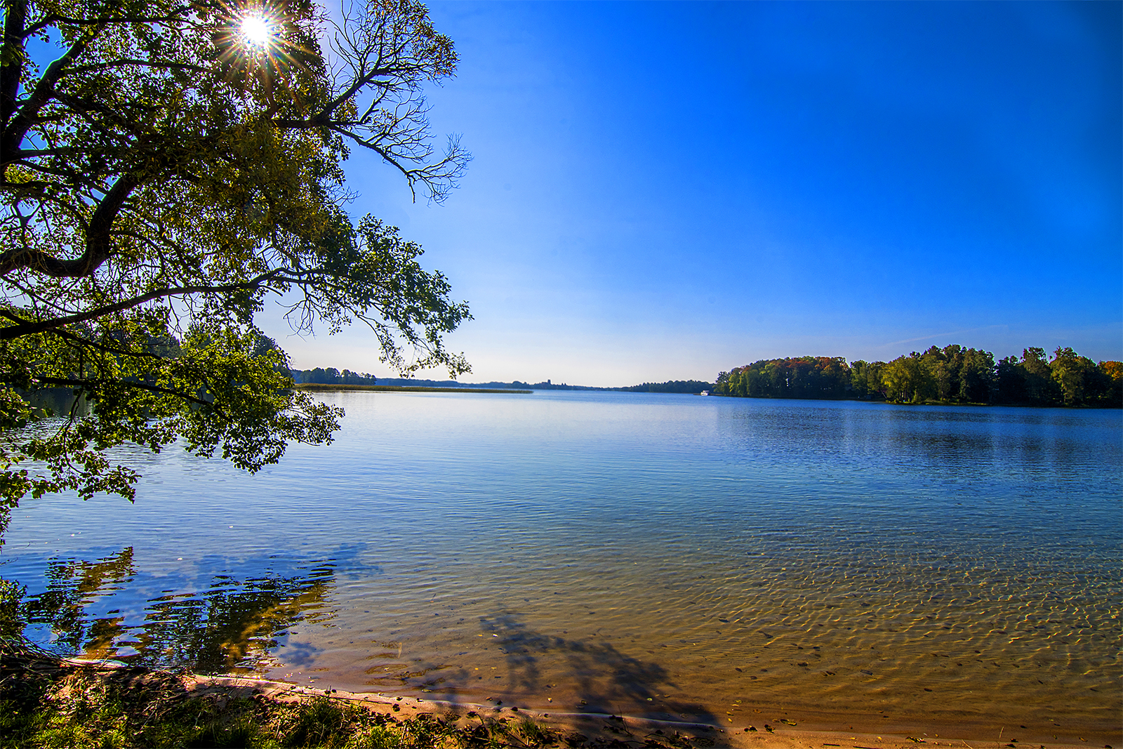
Address: Užtrakio str. 17, Trakai.
Užutrakis Manor House is one of the most prominent and best-preserved mansions in Lithuania. The restored manor and park ensemble on the shore of Lake Galvė will allow you to experience how the Lithuanian nobility lived in the 19th century.
Count Józef Tyszkiewicz and his wife Jadwiga founded the Užutrakis Manor Estate at the beginning of the 20th century. The Count was inspired by the unique landscape of Trakai, and the manor made the most of the area’s potential.
The Palace, decorated with impressive Louis XVI style interiors, was created by Polish architect Józef Huss. It was complete with a terrace, crowned with open pavilions, offering a fabulous view of Trakai Castle. The park was designed by Édouard FrançoisAndré, a famous French landscape architect. He created a mixed style park decorated with copies of antique sculptures and a large number of plants. The park still contains nearly 100 different kinds and forms of trees and shrubs, more than half of which were individually transported here to complete the park.
Today, the estate is accessible by road, but the Count’s family did not use it. It was only used for agricultural purposes and was known as ‘the Potato Road’. The nobles used to reach the peninsula by a ferry raft, crossing the isthmus between Lakes Galvė and Skaistis, and the rafter lived nearby. The Tyszkiewiczes hosted numerous receptions, family reunions or friendly parties, but even then, their guests did not use the road either. The events were characterised by loud music, the tables were laden with French cheeses produced on the estate and the drinks were from the local distillery. More often than not, there was a locally grown roast pheasant in the middle of the table!
The Užutrakis Manor House belonged to the Count Tyszkiewicz family before World War II. During the Soviet occupation, the manor was nationalised and turned into a sanatorium, later it served as a pioneer camp, and then it became a tourist base. The manor was severely damaged: the original design of the Manor was destroyed, and the park was completely abandoned.
Today, Užutrakis Manor House is coming back to life. The manor is being restored and the park is being rebuilt. Concerts and exhibitions are often held here, and the Užutrakis Manor ensemble is now one of the most visited places in the region.
History of Užutrakis Manor
The peninsula between Lake Galvė and Lake Skaistis was first mentioned in historical sources in the 14th century. In those days, it was called ‘Algirdas Island’ and belonged to the Tatar nobility. In the second half of the 19th century, the peninsula was acquired by Count Józef Tyszkiewicz (1835–1891).
The Manor Estate, which survived to the present day, was founded by his son, also called Józef (1868-1917), and his wife, Polish duchess Hedwig Światopełk-Czetwertyńska. The palace was built, and the park was created between 1896 and 1902.
During World War I, when the German army was approaching, Józef Tyszkiewicz and his family left the manor and moved to St. Petersburg. Before the beginning of World War II, the Manor was managed by the Count’s eldest son, Andrzej.
During the war, the German army occupied the Manor, and after the war it was nationalised by the Soviet government.
Park
French landscape architect Édouard André arrived at Užutrakis in 1898. Here he developed an 80-hectare mixed style park in his characteristic style. In front of the palace, he designed parterres of regular shape with trimmed lime alleys, ornamental flower gardens, marble vases and sculptures.
The architect skilfully exploited the contrasting landscape of the peninsula, highlighting its hills with compositions of artificial rocks, and strengthening the glow of the surrounding lakes with a complex system of ponds. More than 20 ponds were artificially dug, which interlinked with each other and the lakes, thus creating a unique park full of water reflections, where the boundaries between the land and water would disappear.
The Restored Manor
The manor of the estate was not only luxurious, but it also allowed everyone to admire the spectacular scenery. In the second half of the 20th century, the palace was abandoned, but today it is being gradually restored.
In 2008, the exterior, the first floor, the attic, the lobby and the staircases of the palace were refurbished. In 2010, the first restored chamber of the manor was opened to the public. It was a representative dining room decorated in the style of Louis XVI. At the same time, the original design of the entire ground floor was restored, as was the delicate wall moulding. In the same year, the restoration of the Tapestries Chamber was also completed.
Nature
A great number of local and imported plants can be found in Užutrakis Manor Park. They include 38 species of indigenous Lithuanian trees, 54 species of imported trees and shrubs, and 400 species and forms of herbaceous plants. Many of these plants were planted by Édouard André.
The Park is home to seven species of bats, a number of squirrels and roe deer. The ponds and their surrounding areas create a habitat for rare species of frogs, smooth newts, the great crested newts and otters. The old trees in the park are frequented by woodpeckers, black woodpeckers and owls. Areas surrounding the Park shelter the nests of goshawks and marsh harriers; the roof of the palace is cherished by mergansers, while the ponds provide food for herons and common terns.
Sculptures
From the day of its foundation, the estate was decorated with many sculptures which included copies of works by Antoine Coysevox, a famous 18thcentury French sculptor. They would usually depict ancient gods and goddesses. Almost all of the sculptures were destroyed after World War II, but today attempts are being made to restore them and return them to the Park.
The park also features a sculpture of the ancient goddess Diana, modelled after the mother of King Louis XV of France, Marie-Adélaïde de Savoie. This sculpture, as well as the sculptures of Flora and Hamadryad, are copies of original pieces on display in the Louvre. The works also include a statue of Bacchus, various busts and a sculpture of the Virgin Mary located on the lake’s shore. The latter was the longest surviving sculpture of the Park.
This sculpture could still be seen by visitors in 1964. Later, it was thrown into the lake. In 1975, the damaged sculpture was found in Varnikai Village cemetery and moved to the church of Trakai parish. Today, there is a copy of the sculpture of the Virgin Mary
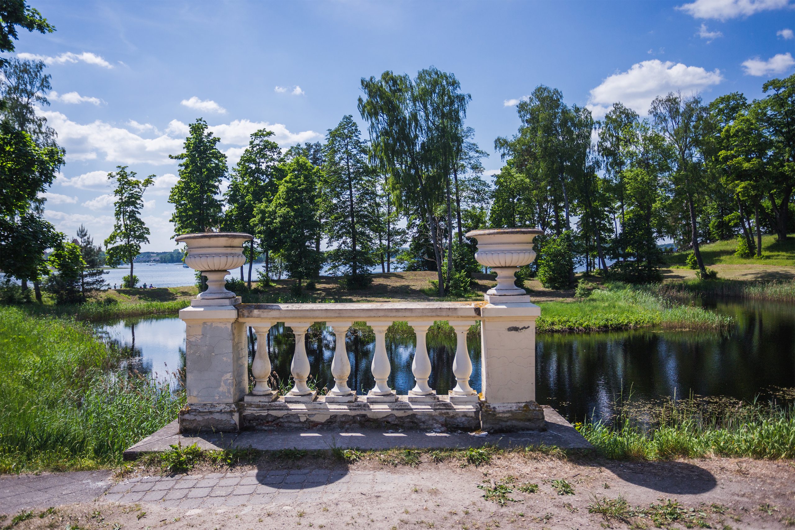
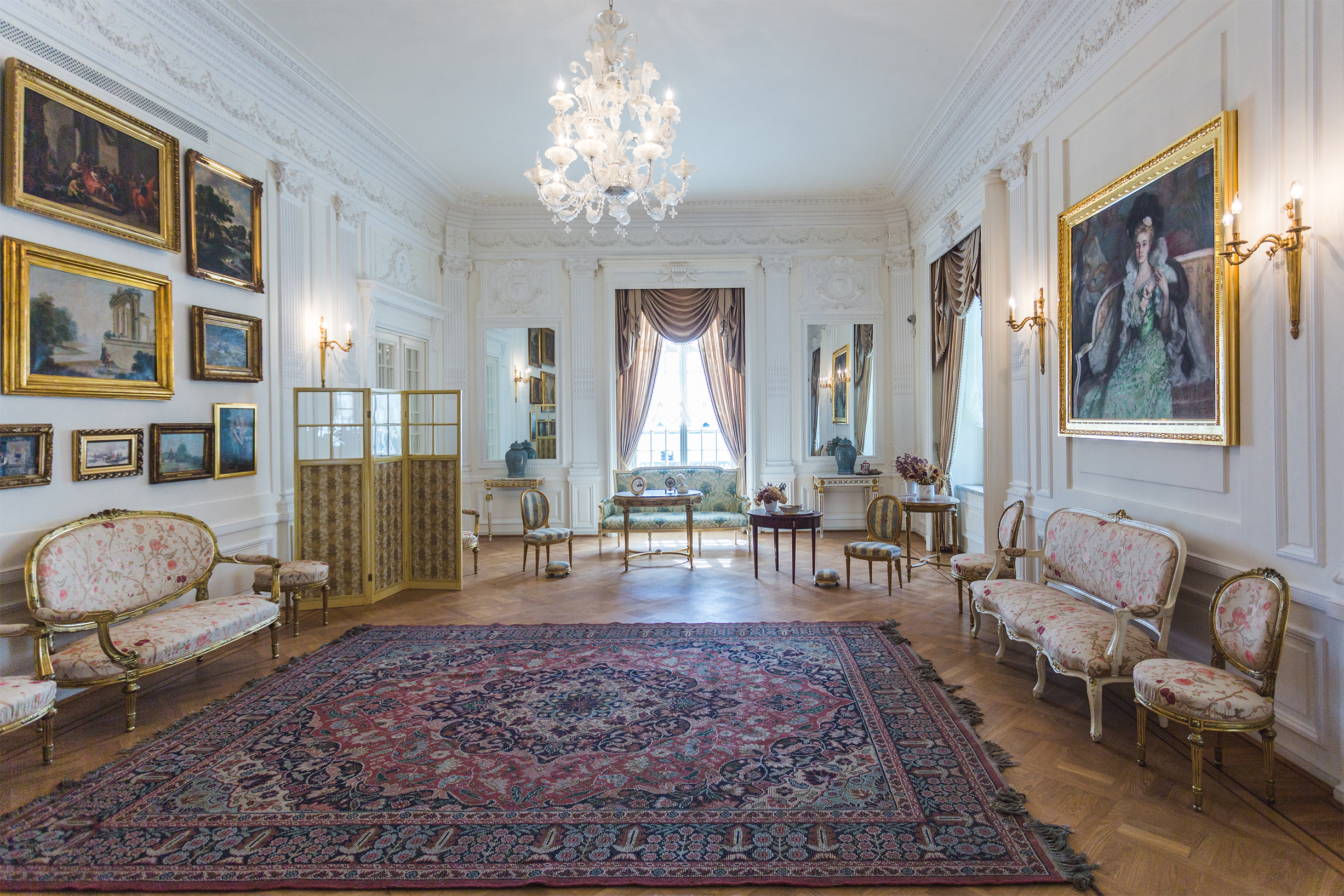
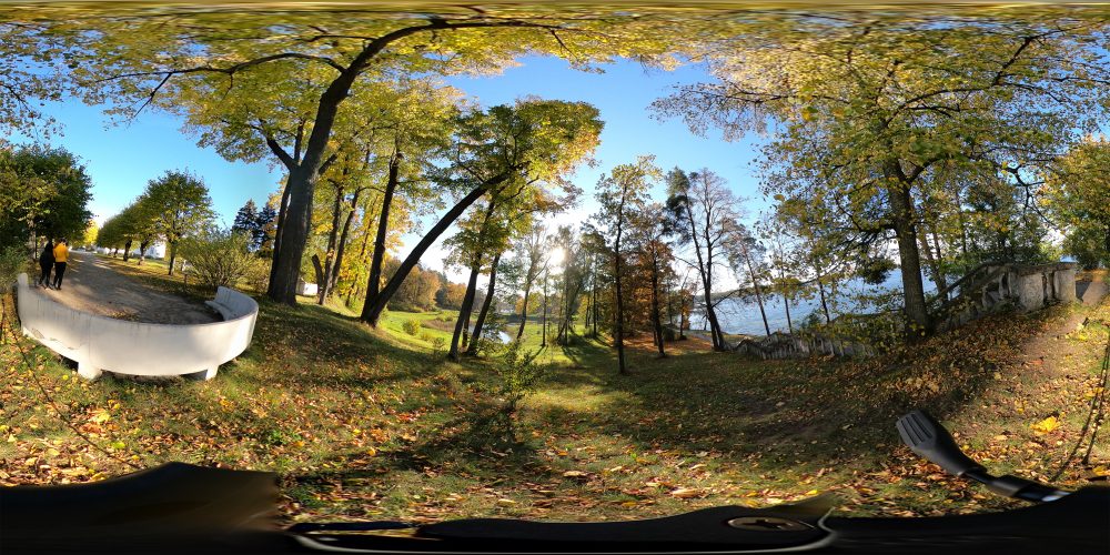
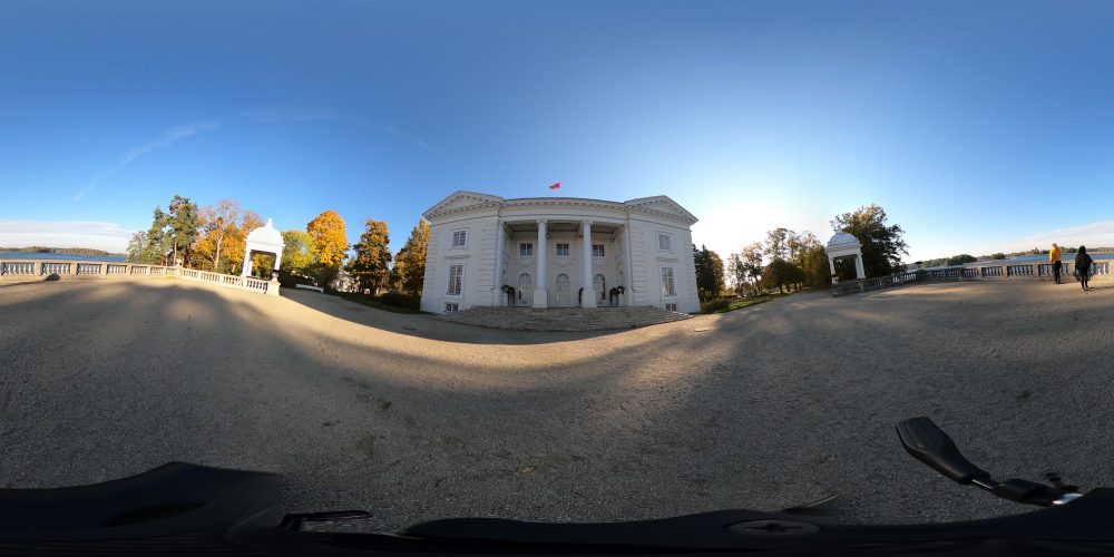
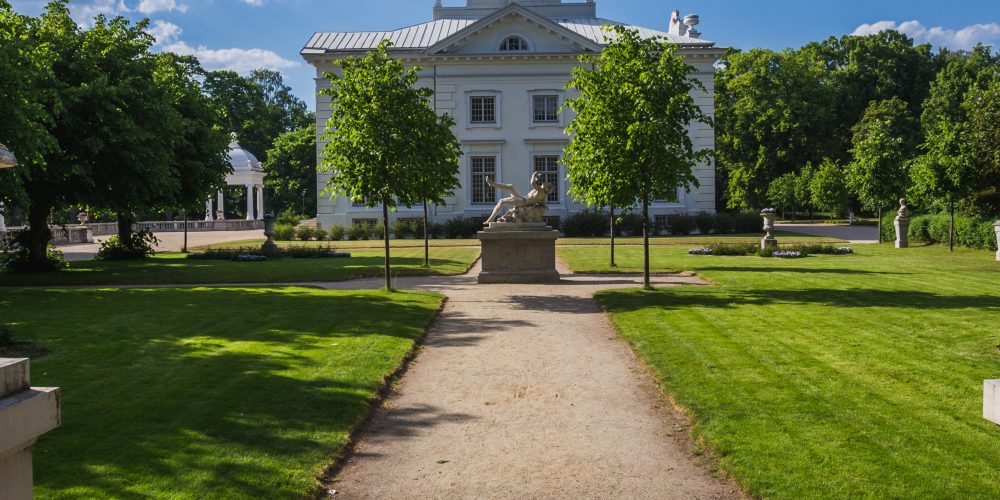
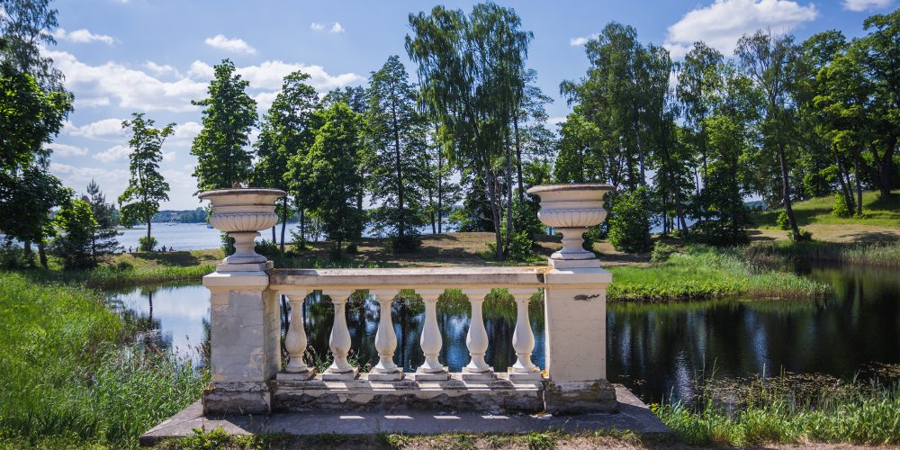
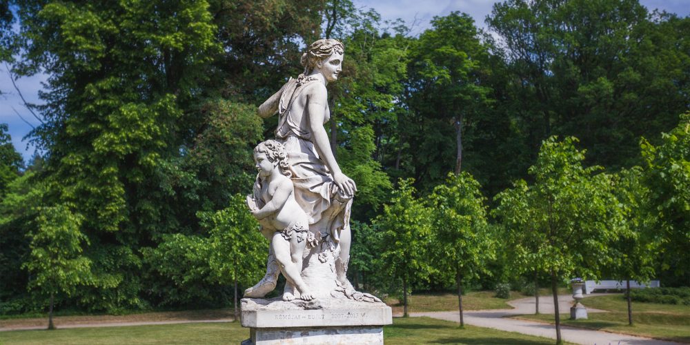
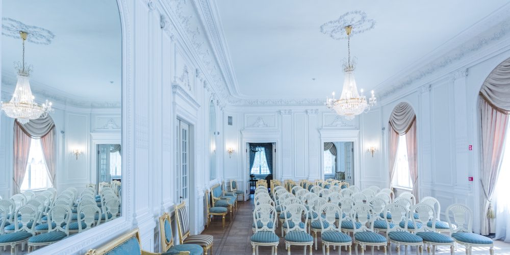
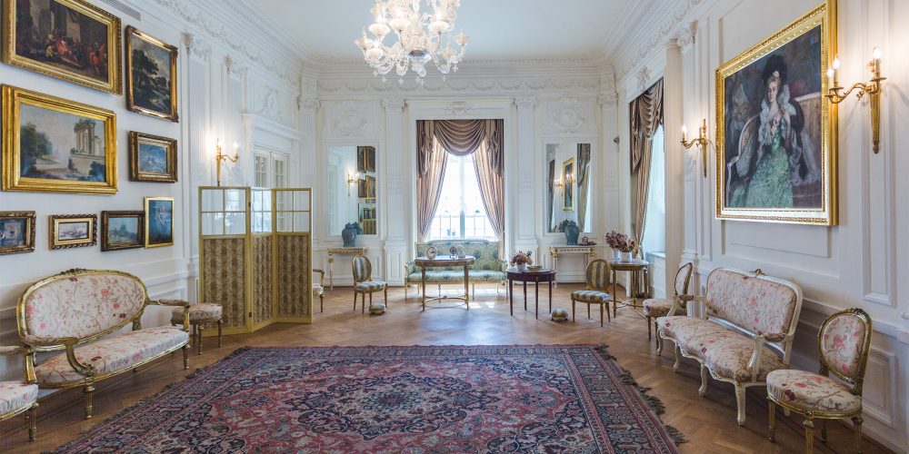
Address: Bažnyčios str. 8, Rykantai village, Trakai district.
Rykantai is one of the first locations of the Lithuanian Evangelical Reformed (Calvinists). Rykantai along with its wooden Calvinist church was mentioned by a well-known Italian Reformed Paulius Vergerijus (Paul Vergerius) who visited Lithuania in 1555. At the beginning of the 16th century, Tolvaiša family built a wooden church in Rykantai which at first belonged to Trakai parish, but later became a Calvinist church after Calvinist faith was adopted by Tolvaiša family who were one of the first ones to do so in Lithuania. It is believed that the first (wooden) Rykantai Church was also one of the first Evangelical Reformed churches in Lithuania.
A wooden Evangelical Reformed church was built until 1555. Ruler of Rykantai Mikalojus Talvošas built a brick Evangelical Reformed church in 1585. In the 17th century, Rykantai became the property of Oginskis family. During the war between Russia and the Republic of Both Nations, the church was demolished by the Moscow army in 1655. It was restored until 1688 by Marcijonas Oginskis.
The church stood empty and abandoned in 1696. Church services were held in Rykantai Manor. In 1688, Rykantai and its church were given away to the Dominicans of Trakai. They did not want to hold services in an Evangelical Reformed church, therefore a new wooden church was built in 1725. It rotted away in 1784. It is believed that at the end of the 18th century services were transferred to the brick church. In 1792, Rykantai became a branch of Vievis parish. Church property and its liturgical supplies were stolen during the war in 1812. In the middle of the 19th century, the church has deteriorated.
The current brick Rykantai Church of the Saint Trinity is one of the oldest churches in Trakai district.
The church has Gothic structures, Renaissance forms, a rectangular plan, no towers, and a hall style with a three-sided apse and a sacristy. The interior has three naves separated by pillars. The fence of the churchyard is masonry. Murals dating back to 1668 remained to this day.
From the outside, the church is similar to Žodiškės Church located near Neris River in Belarus. Its interior is similar to that of St. Nicholas Church in Vilnius.
Source: © daytrip.lt
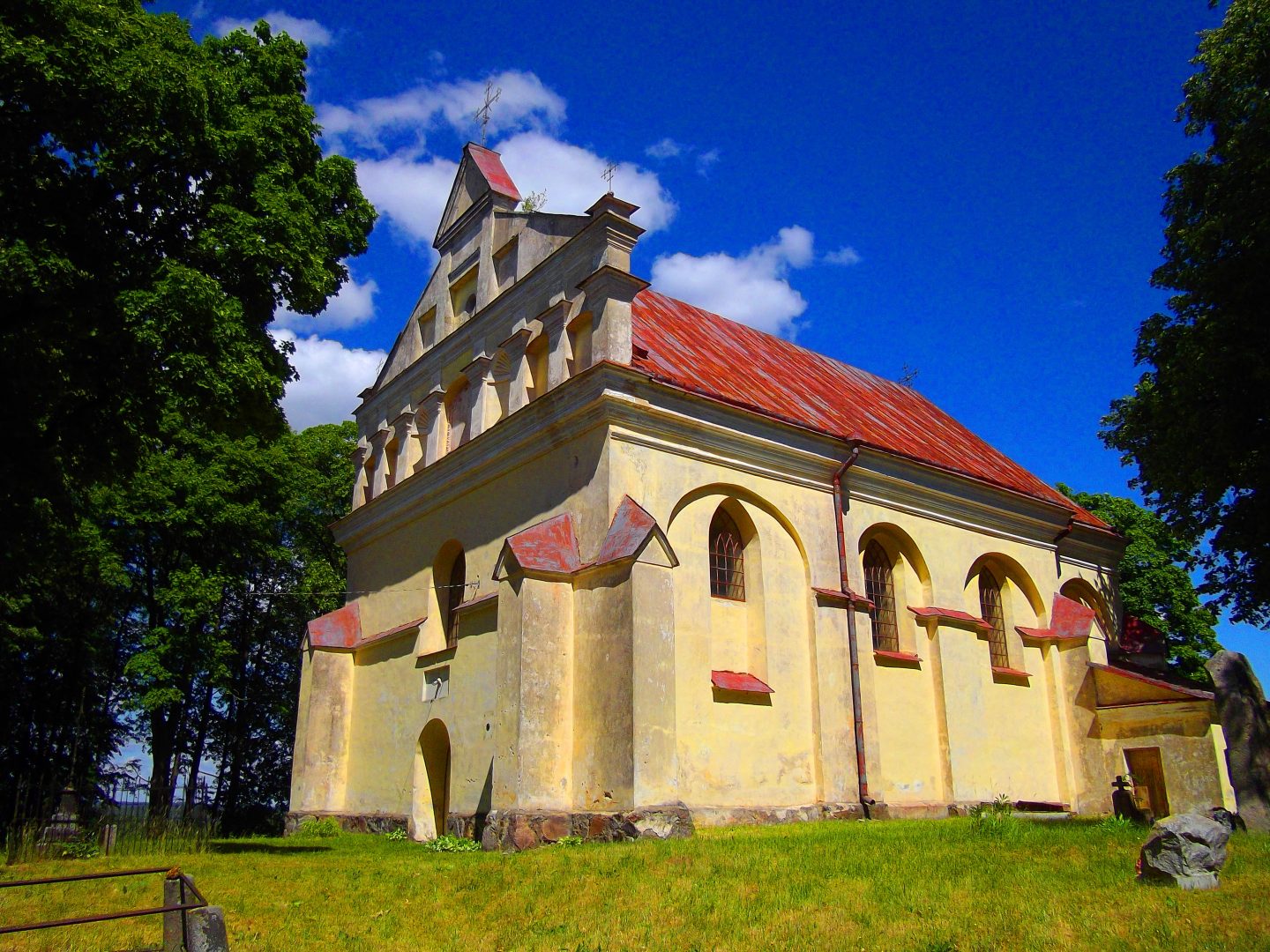
Address: Vosyliukai village, Trakai district.
GPS: 54.72001, 25.02878
To overhear sounds of freshwater spring trickling in an idyllic forest might be one of the greatest pleasures for us. That sound would lure us to get closer, to see the place, and to take a sip of cold rejuvenating water. The Saidžiai, or the Vosyliukai freshwater spring originates in the emerald green forest, in the district of Trakai, on the left bank of the Neris River. The vicinities are of breath-taking beauty there, the banks of the spring are covered with lush grass and moss, and the spring itself blends into the valley of the forest. The slope closer to the flowing water was reinforced with the help of supporting wall made of wood pickets. The location of the spring is marked by a memorial pole made of oak, to which a cobblestone path offers an easy access.
Source: © www.lietuvosgamta.lt
Photo: © www.lietuvosgamta.lt
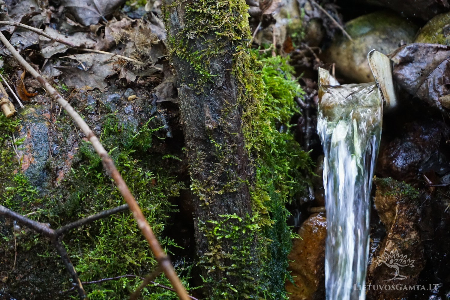
Address: Varnikai forest, Ilgelis swamp, Trakai eldership.
The winding 5-km long Tourism Path goes through the Varnikai Botanical-Zoological Reserve offering nature lovers an opportunity to enjoy spectacular views and the rich natural biodiversity found here.
The Varnikai Reserve is located in the southern part of Trakai Historical National Park. It is part of the Trakai Forest Enterprise in Lentvaris Forestry, and spreads across an area of 611 hectares, the majority of which (450 hectares) is covered with forests, while the remaining 207 hectares comprise the Ilgelis bog. In the northern part of the reserve, on the shores of Lake Skaistis, a 200-year-old oak tree forest grows proudly on top of a hill. Next to it, there is a naturally mixed forest with 100-year-old fir and pine trees. About 30–60 years ago, additional fir and pine trees were planted along its edges. Notably, the Varnikai Reserve contains a dedicated area of forest habitat, i.e. an area not affected by human activity, which includes rare or specialised species of plants and trees. In addition, several ‘Natura 2000’ protected sites have also been identified on the territory of the reserve.
Varnikai Ecotourism Path leads visitors through beautiful forests and a meadow that enriches the diversity of the habitats of the reserve opening up a spectacular view over the Ilgelis Bog and lakes. Trakai Forest Enterprise has made this trail visitor friendly and equipped it with gazebos and benches, three scenic viewpoints and ten rest stops located in the most beautiful and hard-to-reach places of the reserve. Visitors can rest and read the information on the local landscape, its features, the Varnikai Reserve and the activities of Trakai Forest Enterprise. Information is available in Lithuanian and English. One of the observation decks provides an opportunity to enjoy neighbouring, yet quite different ecosystems: ancient oak forest located at the top of the hill, mixed forest covering its sides, and a forested bog located at the foot of the hill.
The largest part of the path is a winding non-paved trail. However, a stretch of almost 1.5 km goes through hard-to-reach swamps! In order to ensure the safety of visitors and to provide a unique opportunity to take a stroll in this unique wild nature, a 1-metre wide boardwalk has been installed. Aspen trees were used to construct the boardwalk. This type of wood has long been known for its fantastic moisture resistant qualities.
The reserve can be easily reached by car, bike or on foot. Just follow the signs leading to the Varnikai Ecotourism Path. A car park, children’s’ playground and other guest amenities are located at the start of the route. Symbolically, the trail starts with wooden gates that tourists enter through.
Environmental Protection
The management of Trakai Historical National Park seeks to preserve the biodiversity of its territory and, at the same time, to create favourable conditions for its expansion. Varnikai Ecotourism Path aims at preserving the old Varnikai forest and bogs together with their unique flora and fauna. The path established by the Trakai Forest Enterprise helps manage the flow of human traffic and to protect nature from uncontrolled visitation.
Protected Biodiversity
The Varnikai Botanical-Zoological Reserve is the most studied part of the Trakai Historical National Park. More than 600 different higher plant species were identified here, of which as many as 16 are included in the Lithuanian Red Book.
An impressive 118 different species of moss can be found in the reserve. Four of them are protected throughout the territory of Lithuania. Certain types of mushrooms found here are included in the Red Book.
Scientists have noticed, however, that some types of lichens found here a hundred years ago can no longer be detected today. Actually, the majority of rare lichens indicate the forest’s special value as they point to the key types of forest habitat. This type of endangered vegetation is protected throughout Europe.
There is abundant wildlife in both the forests and swamps of the Varnikai Reserve. Mammals found here include foxes, marten, meles, hare, deer, roe deer and boar. It is no surprise to catch a glimpse of a common European viper on a bright sunny day.
Fifteen varieties of protected insects and beetles are also detected in the Varnikai Reserve. Some of them, including the calosoma inquisitor, the emperor dragonfly and others are listed in the Red Book. In addition, you could also spot some rare types of butterflies and moths. Common cranes and Eurasian hoopoes living in the reserve are protected throughout the territory of Lithuania. The reserve also has many different types of singing birds such as wood-larks, thrush nightingales, true thrushes and golden orioles. There are plenty of predator birds in the area including various types of owls, hawks and falcons.
The Ilgelis Bog
The Ilgelis Bog with its 1.5-kilometre-long wooden Ecotourism Path covers a territory of 207 ha in the southern part of the Varnikai Reserve. Four lakes of remnant origin lie within this territory and include the Baluošas, Bevardis, Piliškių and Ilgelis lakes. It is said that these lakes are the remains of a single large lake. Interestingly, all the Varnikai Reserve small lakes are closed: they are dependent on the surrounding bogs, where the water level is 1 metre higher than that of the Bernardinai (Luka) Lake. Thus, the excess water from the Ilgelis Bog flows into the lake.
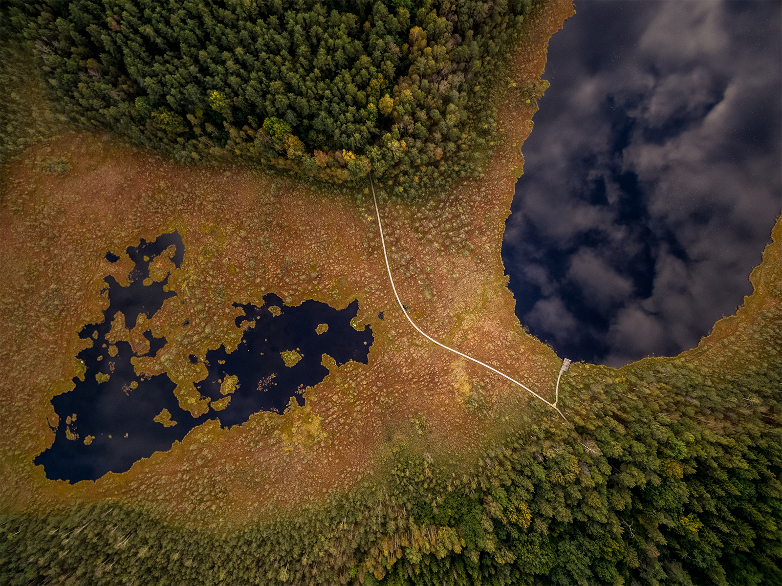
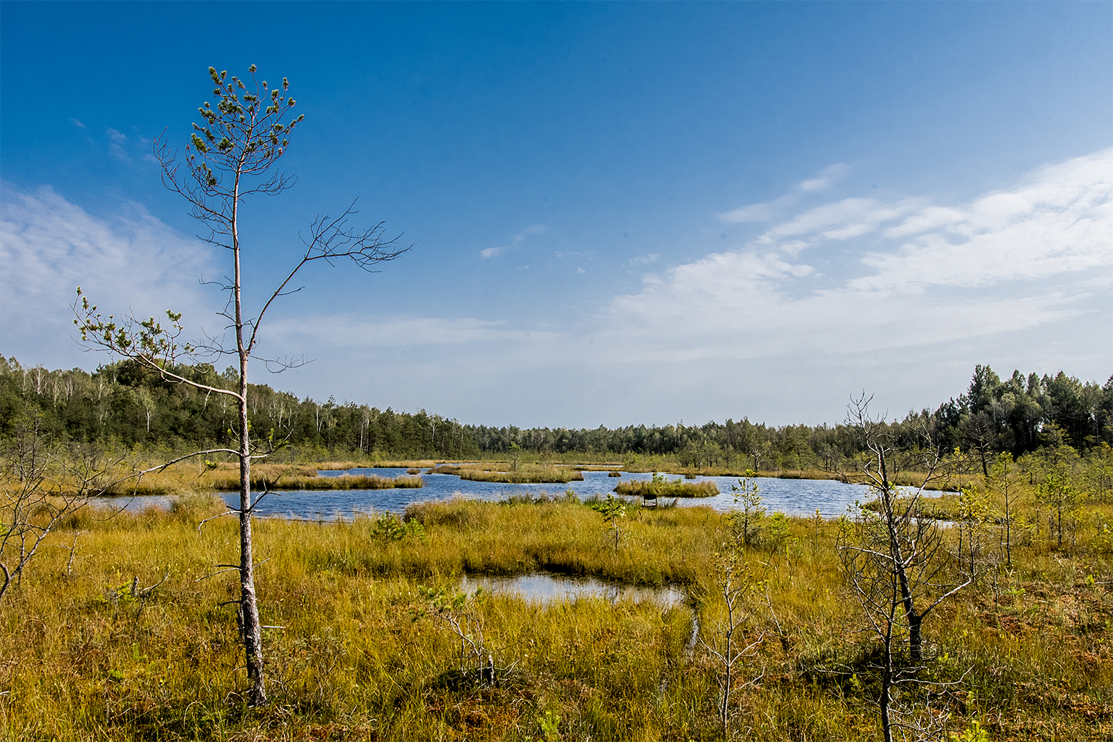
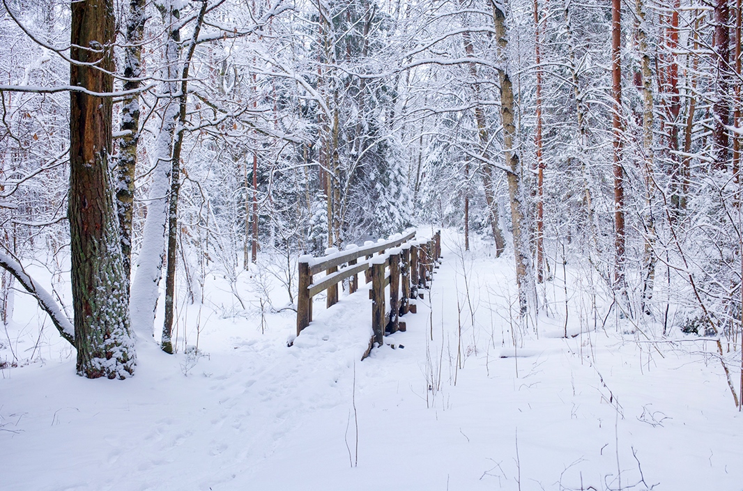
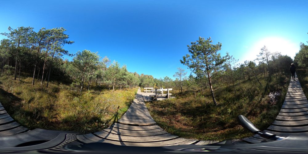
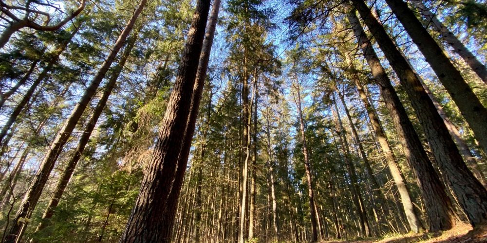

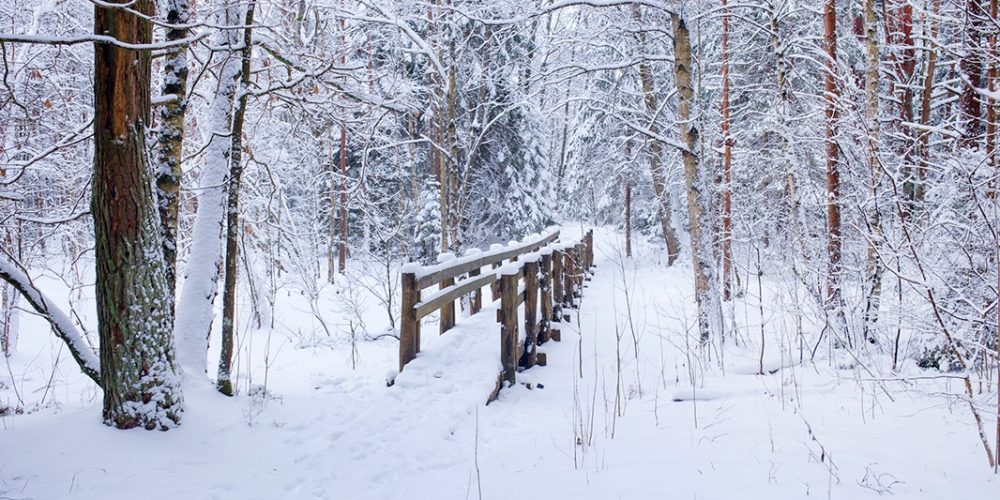
Address: Varnikai forest, Trakai district.
GPS: 54.649797, 24.959616
In Varnikai forest, next to the village Varnikai, in the place which borders Galvė and Skaistis Lakes, there is a dark spot of the Lithuanian history. In September, 1941 many Jews from Trakai and other neighbouring localities (Lentvaris, Onuškis, and Aukštadvaris) were brought to country houses, which served as a ghetto. After Trakai head of police Kazys Čaplikas had refused to obey the order of County Governor Mašinskas and commanded his subordinates to behave likewise, about 30 German soldiers and policemen from the Special Squad were sent from Vilnius. On September 30, 1941 they shot 1446 Jews in Varnikai forest. 366 men, 483 women and 597 children were killed. The tomb for the victims of this massacre is marked by two memorial boards with Lithuanian and Yiddish inscriptions and a wooden sculpture.
Source: © www.keturiossostines.lt
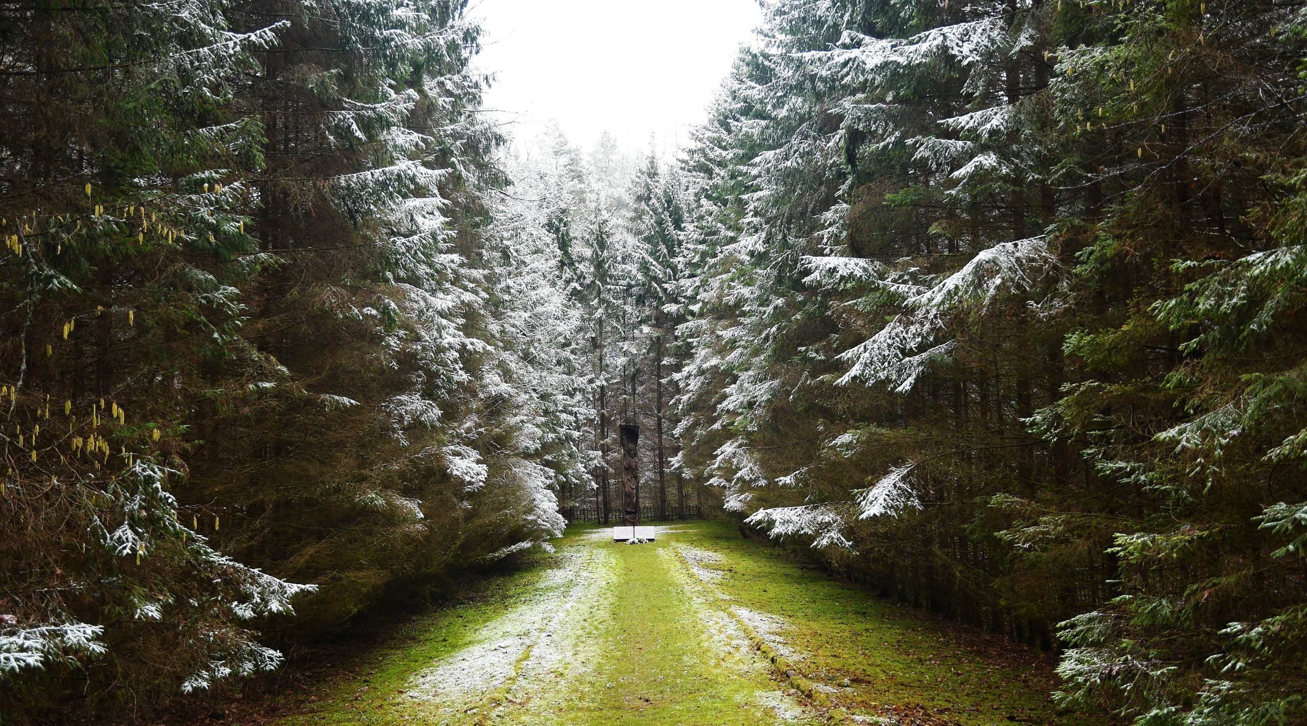

GPS: 54.649753, 24.947248
The mound is located in a beautiful place on a separate hill, about 130 meters to the north-east of Nerespinkos Lake and 170 meters to the south of Galvės Lake. While digging the mound, Archeologists found hand shaped ceramics with granite particles in the clay used. Such ceramics was most common in the first millennium BC and the first centuries AD. This allows to make a presumption that Varnikai mound was inhabited very long ago. Varnikai is a mound having a platform, which suggests that it could not be used as an important defensive castle. However, it was perfect to hide or reconnoiter. Unfortunately, there are no written sources which could reveal the significance and functions of the mound in the historical path of Trakai very close to an important trade route to Vilnius.
Source: © www.keturiossostines.lt
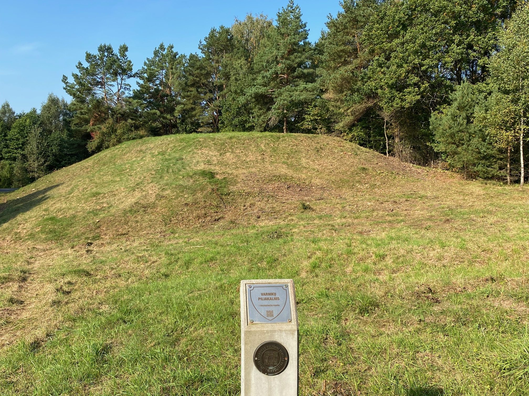
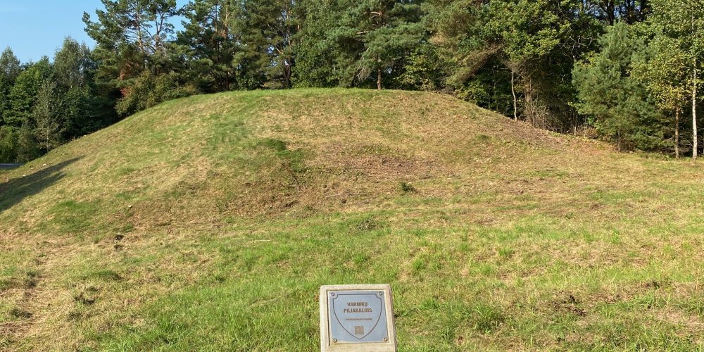
In 2017, aquifer exploration showed that groundwater from the Upper Silurian aquifer has a stable and unique low-mineralisation chemistry. There are no indications of local anthropogenic (microbial and chemical) pollution in the naturally pure water that is retrieved from the 205-meter-deep borehole. The water has a low concentration of naturally occurring total iron (0,12-0,14 mg/l).
A natural mineral water bivouette was constructed in 2023 next to the borehole, inviting visitors to drink the pure gift of the Varnikai forests, regain their strength, be in harmony with nature and find inner peace near the chapel of the Blessed Virgin Mary.
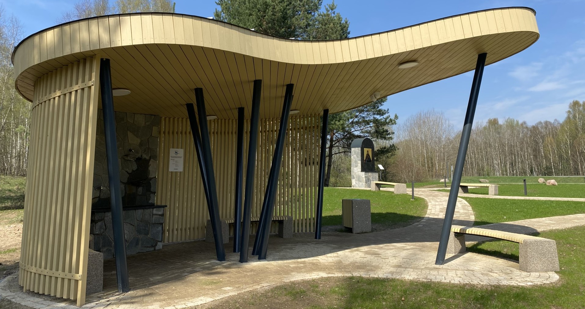
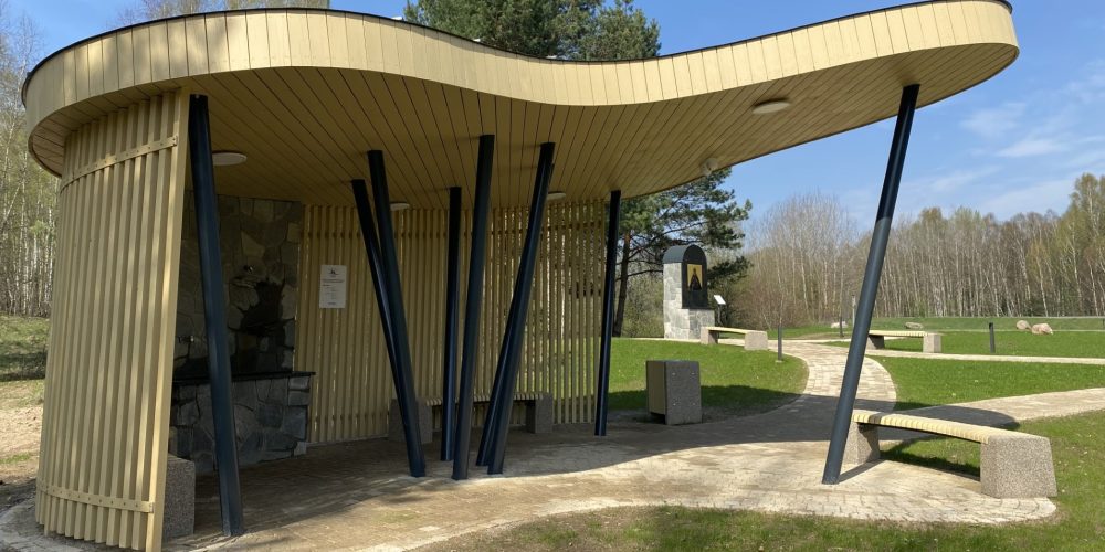
Address: Mokyklos str. 17, Lentvaris.
Lentvaris, located half way between Vilnius and Trakai, is famous for its unique natural beauty, a magnificent English-style castle-like manor standing on the peninsula of an artificial lake, and a Neo-Romanesque building of rare beauty, the massive red-brick church of the Annunciation of the Blessed Virgin Mary.
Count Tyszkiewicz, who owned the manor in the 19thcentury, started the construction of the church. It is claimed that Italian culture and art were very close to his heart. Therefore, it is not surprising that Lentvaris Church architecture was inspired by the 15thcentury Santa Maria delle Grazie (St. Mary the Gracious) Church in Milan and Leonardo da Vinci’s famous mural painting The Last Supper.
Count Tyszkiewicz believed that The Last Supperwas the key to understanding the life philosophy of this genius artist. Lentvaris Church of the Annunciation of the Blessed Virgin Mary is a testament of respect to Leonardo da Vinci.
The church’s décor deserves special attention. Its walls are covered with murals and decorated using a special sgraffito technique. Notably, the church’s decoration works took place in the midst of World War II, when all the required décor materials were of strategic importance and could only be used for military purposes. The archives of the Artists’ Union confirm that at the time each tube of paint was distributed according to a list.
Lentvaris Church of the Annunciation of the Blessed Virgin Mary belongs to Trakai Parish. Every day sacred masses are celebrated in the Lithuanian and Polish languages. In addition, on the first Monday of every month, a Requiem Mass is held in Latin.
Building of the Church
At the end of the 19thcentury, Count Tyszkiewicz and residents of Lentvaris County asked the authorities for a permit to build a church as local practicing Catholics had to travel to other churches located in settlements at least 10 km away. Unfortunately, at the time the requests were denied. Thus, it was not surprising that in 1905, when the permit was finally granted, Lentvaris residents built a wooden barrack in a record 10 days, in which to celebrate masses temporarily.
Construction of the real church was funded mainly by the Tyszkiewicz family, but donations were accepted in other ways as well. The Golden Book of Donations details the input of various private individuals and institutions. Additional funds were gathered through the sales of candles, commemorative church postcards, etc. Interestingly, the Catholic Society in the US organised special lotteries, sales and events aimed at collecting more funds for the church.
Lentvaris Church of the Annunciation of the Blessed Virgin Mary was designed in the Neo-Romanesque style, which was especially popular in Europe at the time. It was to be built on land donated by Countess Tyszkiewicz. As typical of Neo-Romanesque architecture, Lentvaris Church is characterised by its massiveness, half-circle arches and windows.
Design decisions inspired by the church in Milan can be easily explained. Trying to avoid the tsarist oppression, Count Tyszkiewicz spent a few years in this city of northern Italy, where he came to admire the church and its famous The Last Suppermural by Leonardo da Vinci painted in 1497. Count Tyszkiewicz thought of the Italian artist as a perfect personality and artist!
The red brick basilica-type church was consecrated in 1926. The name of the Annunciation of the Blessed Virgin Mary was selected for it, and during the consecration ceremony, the 17thcentury sculpture of the Crucifixion was placed at the main church altar. The gift came from Pope Pius XI, whom Count Tyszkiewicz had met in Vilnius a few years earlier, when he visited Lithuania as a nuncio and an apostolic visitor in 1920.
Church Décor
Lentvaris Church of the Annunciation of the Blessed Virgin Mary is one of the biggest and most impressive examples of monumental painting found in Lithuania at the beginning of the 20thcentury. Its murals and sgraffitodecorations reflect religious motives and cover the walls of the church almost entirely.
Sgraffitois a special painting technique where initially a few layers of different colours of paint are applied. The paining is engraved on the top layer, and then the plaster is scraped off to reveal lower layers of contrasting colours. This type of painting is a long-lasting work of art, reminiscent of antique vases and romantic or Byzantine mosaics.
The Sgraffitotechnique was intentionally chosen for the design of the Lentvaris Church décor. As mentioned above, the inspiration came from the Santa Maria delle Grazie Church in Milan famous for its impressive interior décor. Besides, it perfectly matched the prominent and magnificent architecture of the Church of the Annunciation of the Blessed Virgin Mary. Notably, the sgraffito technique was used in only one other place in Lithuania, i. e. Perloja Church located close to Varėna.
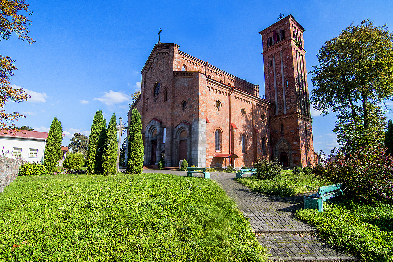
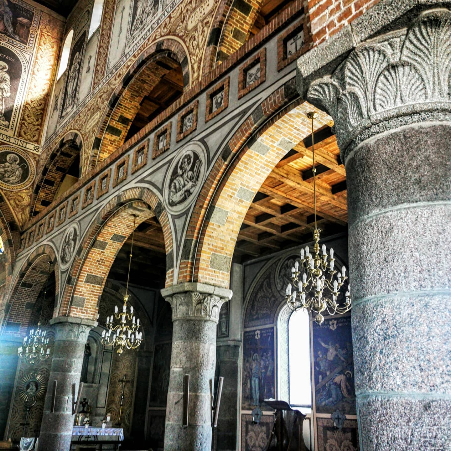
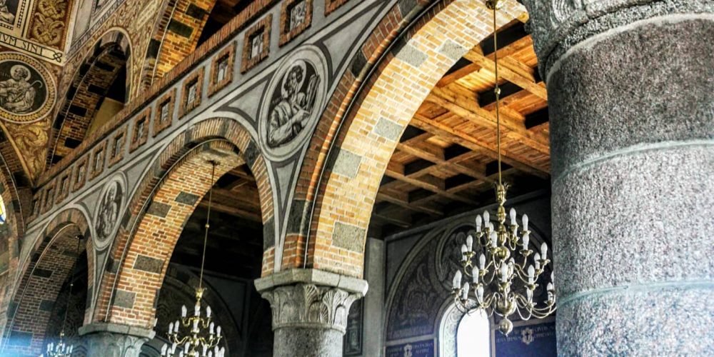
Juozapas Tiškevičius acquired the Lentvaris manor in the middle of the 19th century, starting its most impressive stage of development. Not even a decade has passed when the manor estate typical of the neo-Gothic of the Romanticism era was built, surrounded by a park designed by Édouard André, and the economic potential was supplemented by the newly built wire and nail factory. Vladislovas Tiškevičius, having inherited the manor, decided to reconstruct the main building of the manor – a Belgian architect de Waegh was invited for this purpose in 1899, and turned the former two-storey palace, of asymmetrical design and complex volume, typical of Romanticism, into the two-three-storey building with symmetrical composition closer to the historicism era, where the neo-Gothic architecture form, more typical of the manors of the north-west Europe, would be emphasised. The main highlight of the palace – a five-storey tower – was turned into a graceful six-storey tower. Just like to the majority of manors, the sorrowful period for the Lentvaris ensemble came after the Soviet nationalisation – the integrity of the complex was destroyed, the palace itself was transferred for the needs of the kolhoz, and since 1957 – transferred to the administration of a carpet factory. By adding a third storey, the original silhouette of the palace was disfigured and the roof lucarnes were destroyed. The inside of the palace was severely affected, the expressive first floor of the palace has also went through many changes. Currently the building is abandoned.
The palace consists of a rectangular volume with a high roof with attached volumes facing sideways, forming avant-corps in both wide façades, which are greater by the number of floors, but having lower roofs; at the junction of the south-west volumes, a tower is rising. The historical trends, of the second half of the 19th century, used in the Benelux and Great Britain, are clearly reflected in the architecture of the palace. The distinguished light-coloured angular rustics, window architraves, cornices and some other elements are not typical in the non-plastered palace façade in the Lithuanian architecture. Though neo-Gothic forms are used throughout the building, which may be observed at the central avant-corps of the front façade and in the decorative elements used in it, however some of them are interpreted quite freely and are rather more typical of the phenomena of the Romanticism era. The expressed spire of the tower, the impression of vigour of which is enhanced by the surrounding bay window helmets and the compositions of arcatures and pointed arch niches located in top section of the tower. Bas-reliefs depicting the coat of arms of Tiškevičiai and Lubomirski families are still hanging above the central entrance, and the moulding ornamentation of the architraves still remains in the niche of the pointed arch portal. At the back façade, the central avant-corps acquires a five side form, and the two smaller three side and square design avant-corps attached to the sides of the façades of the palace, adding variety to the configuration of the volume of the palace. Other buildings from the Historicism era remained in the palace’s ensemble, such as the later built “Riviera” café, where the impact of the brick style can already be felt. One of the most interesting buildings is the water tower of a bulky form, the construction date of which is unknown, but it is believed that it appeared in the middle of the 19th century. The building is of utilitarian architecture, divided into three sections by cornices. Deep semi-circular arches, where the window and doors niches are incorporated, continue through the two lower segments. Yet, the top section, decorated with arcature of Gothic forms and pinnacles combines with the old and the post-reconstruction architectural elements of the palace. From one side, the rounded extension of the stairway of almost the same height leans on the building. The tower building is interesting not only in its architectural configuration, but also as the part of the history of the engineering heritage.
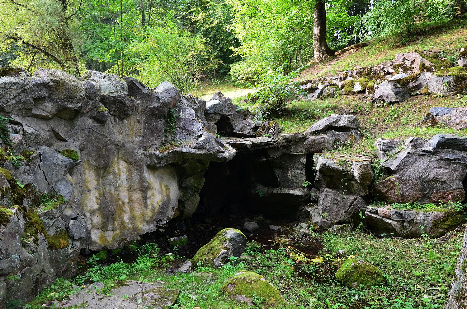

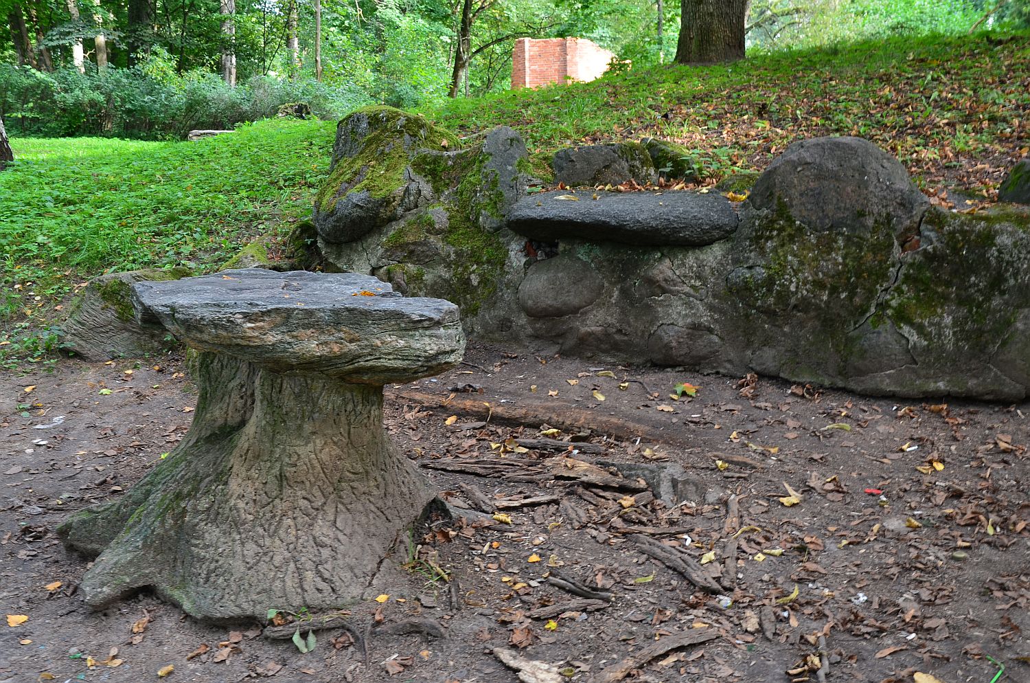
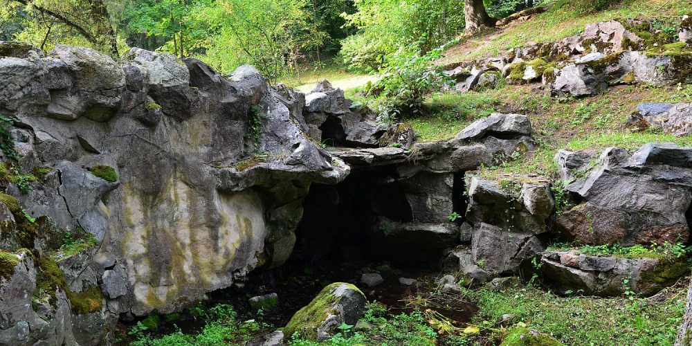
Address: Žukiškės village, Trakai district.
Žukiškės chapel can be clearly seen while driving on the road from Trakai towards Rūdiškės, in the shade of the forest behind Žukiškės village. It is a Baublys tree monument of approximately 100 years old (created in the early twentieth century), the younger brother of the famous Baublys trees of Dionizas Poška located in Bijotai
The monument is an oak with a height of 2.2 m, diameter of 1.3 m, and a niche carved in its trunk. It is covered with a low shingle roof with a wooden cross attached to the top. The niche of the chapel is covered with glass. The chapel used to have sculptures, but now there is a small picture of a saint, candles and artificial flowers brought by the people of Žukiškės and other surrounding villages. This oak chapel is a perfect fusion of paganism and Christianity. The oak has long been a sacred tree for Lithuanians. Baublys trees were more common in Samogitia and were rarely found in Eastern Lithuania. This chapel is one of only a few surviving Baublys trees in this region.
Trakai District Municipality Administration received the consent of Trakai History Museum to preserve this object of cultural importance, and the consent of Vilnius branch of the Cultural Heritage Department to relocate it. A copy of the chapel was made by member of the Lithuanian Painters’ Association, sculptor Mindaugas Šnipas.
Source: © www.keturiossostines.lt
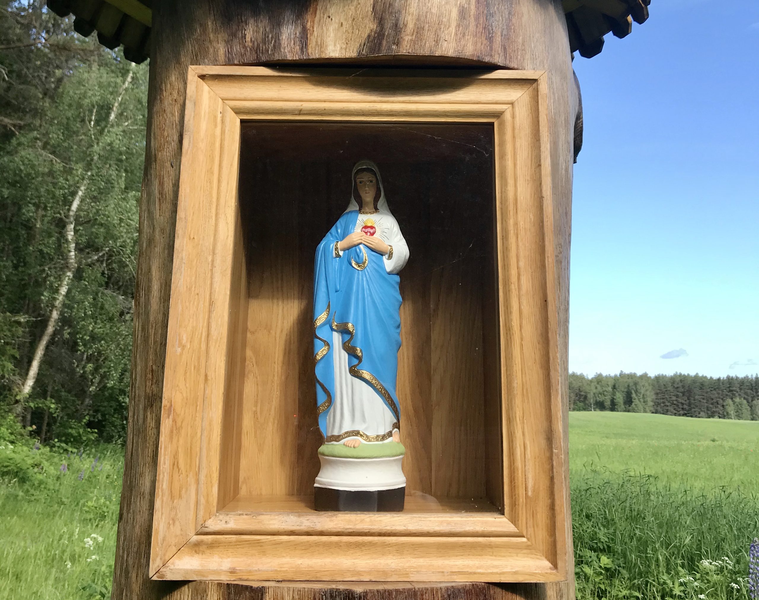
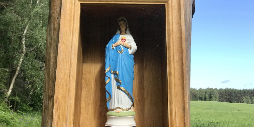
Address: Bažnyčios str. 1, Rūdiškės, Trakai district.
The village of Rūdiškės has been mentioned since 1774, and, after the construction of the Warsaw-Petersburg railway, it began to rapidly grow since 1864. In ancient times, this was an extremely swampy place. It is believed that bog iron ore was melted in the vicinity of the settlement, which is why it was named Rūdiškės (‘rūda’ means ore in Lithuanian).
In 1908, the government allowed the construction of the Church of the Holy Heart of Jesus, a branch of Trakai Parish. In the first half of the 20th century, the Holy Heart of Jesus became the most popular subject in Lithuanian ecclesiastical art. Piety was inspired by the visions of St. Margaret Mary Alacoque: in 1674, the nun saw a flaming wounded heart of Christ with a cross at the top, surrounded by a crown of thorns symbolizing the suffering caused by the sins of men. Paintings of Jesus and devotion to the Holy Heart have spread based on the image drawn by the saint, particularly after the beatification of Margaret Mary Alacoque in the 19th century and her canonization in 1920.
Priest A. Žemaitis, appointed to Rūdiškės in 1909, installed an altar in a residential house and began to hold services there. The parish was founded in 1910 and has grown significantly over the century. The first records of the parish show that there were four hundred parishioners in it. Today this number has increased to four thousand.
Priest J. Jurkevičius and his parishioners built the present brick church in 1925–1932. In 1980, it was repaired. The church is historic, has neo-Romanesque and neo-Gothic features, a Latin cross plan, a single tower, and an interior of three naves. The churchyard is bricked.
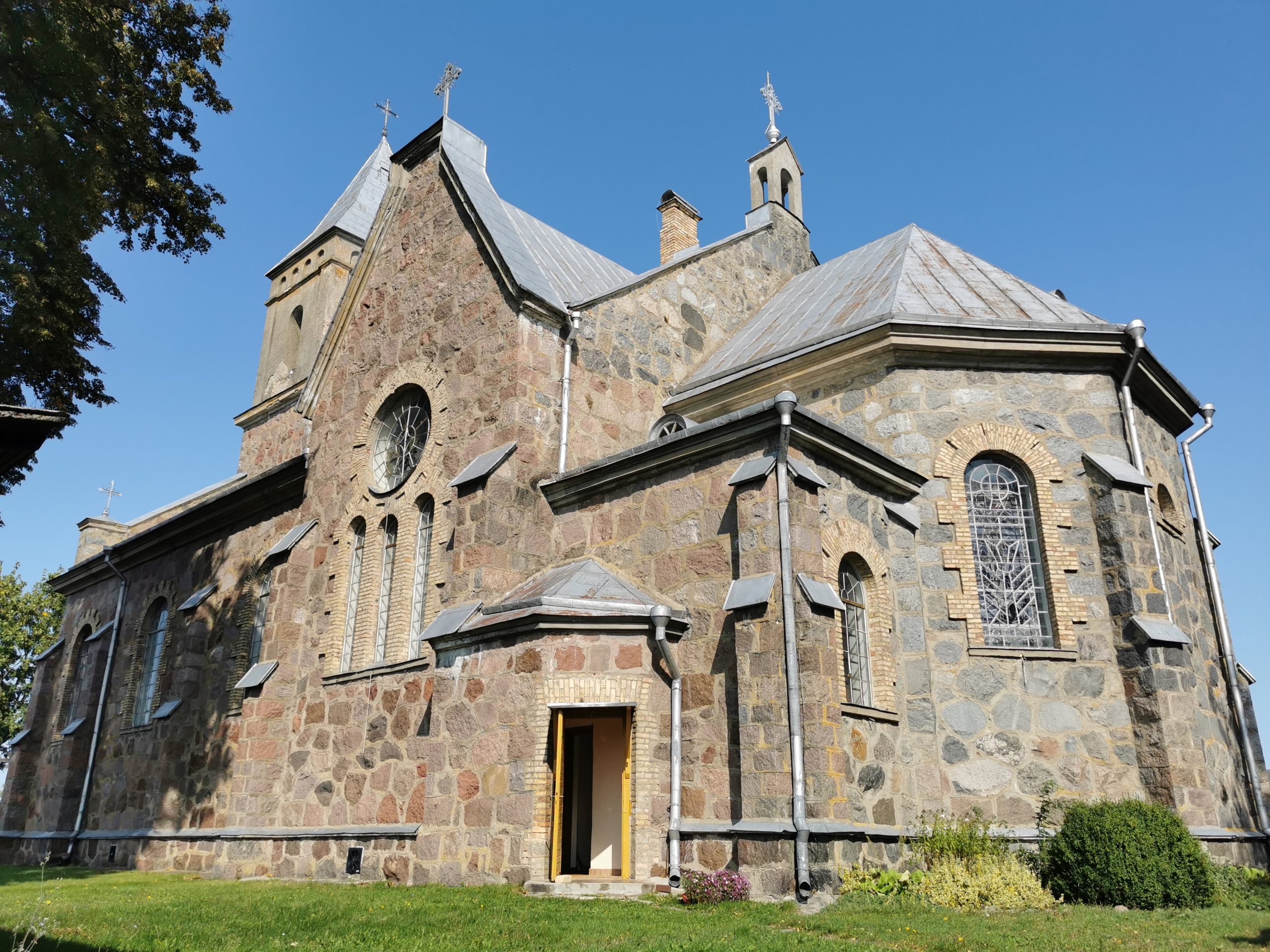
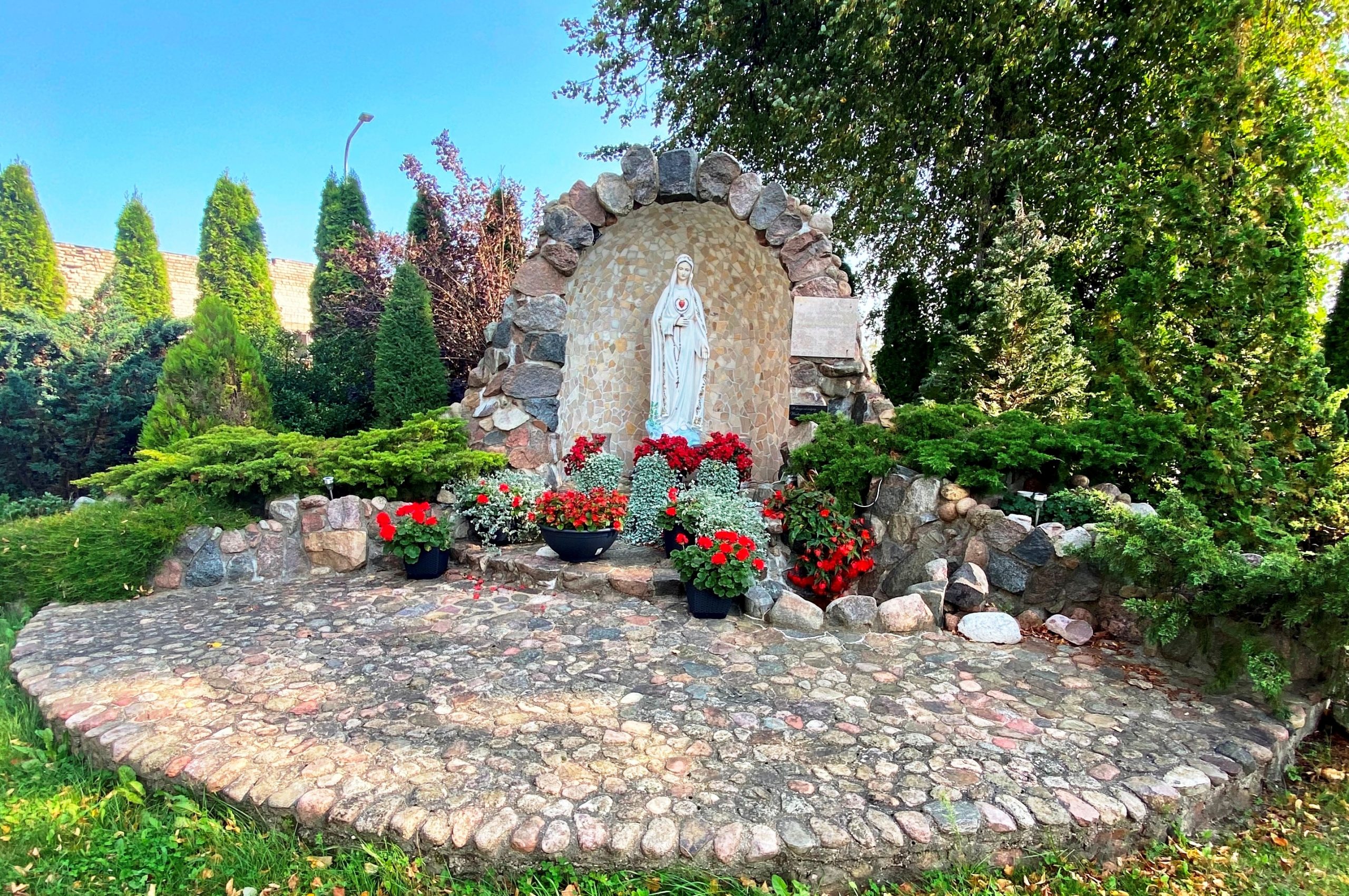

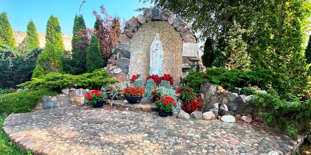
Address: Piliakalnio str., Žuklijai village, Trakai district.
GPS: 54.509861, 24.682523
Žuklijai Mound is located on the eastern outskirts of Žuklijai village, on the hill of the left bank of Nemunas. The mound is built on a separate hill located on the northern shore of Vilkokšnis lake. A cape formed on the hill was used to build the mound. The oval site of the mound is around 35 m long, 30 m wide and covers an area of around 600 m². The site and the slopes situated at a height of 5-7 m were significantly damaged when the land here was ploughed. No cultural layer was found. The mound is around 35 m high from the sides of Nemunas river and the ravines. The slope is not as steep when descending into the Nemunas valley, while the slopes of ravines are steep and fall at a 60° angle. The slopes are overgrown with trees.
Only the western end of the mound remains to this day. The rest of it was destroyed by turning the mound into a cultivated field. According to local Maksvytis, large charcoal was found during the excavations of the mound. From the south side, there is a small dent next to the mound which is the remains of a former canal.
The southern foot of the mound holds the remains of its ancient settlement. There is a small hemispherical hill with gentle slopes around 100 m to the west of the mound. It is also considered to be a mound by the locals. Legend says that both mounds were formed with the hats of soldiers who built the larger mound before leaving to war, and the smaller mound after returning home. The mound dates back to the middle of the 1st millennium– beginning of the 2nd millennium.
Sourse: © www.daytrip.lt
Photo: Gytis Juodėnas / Lietuva360
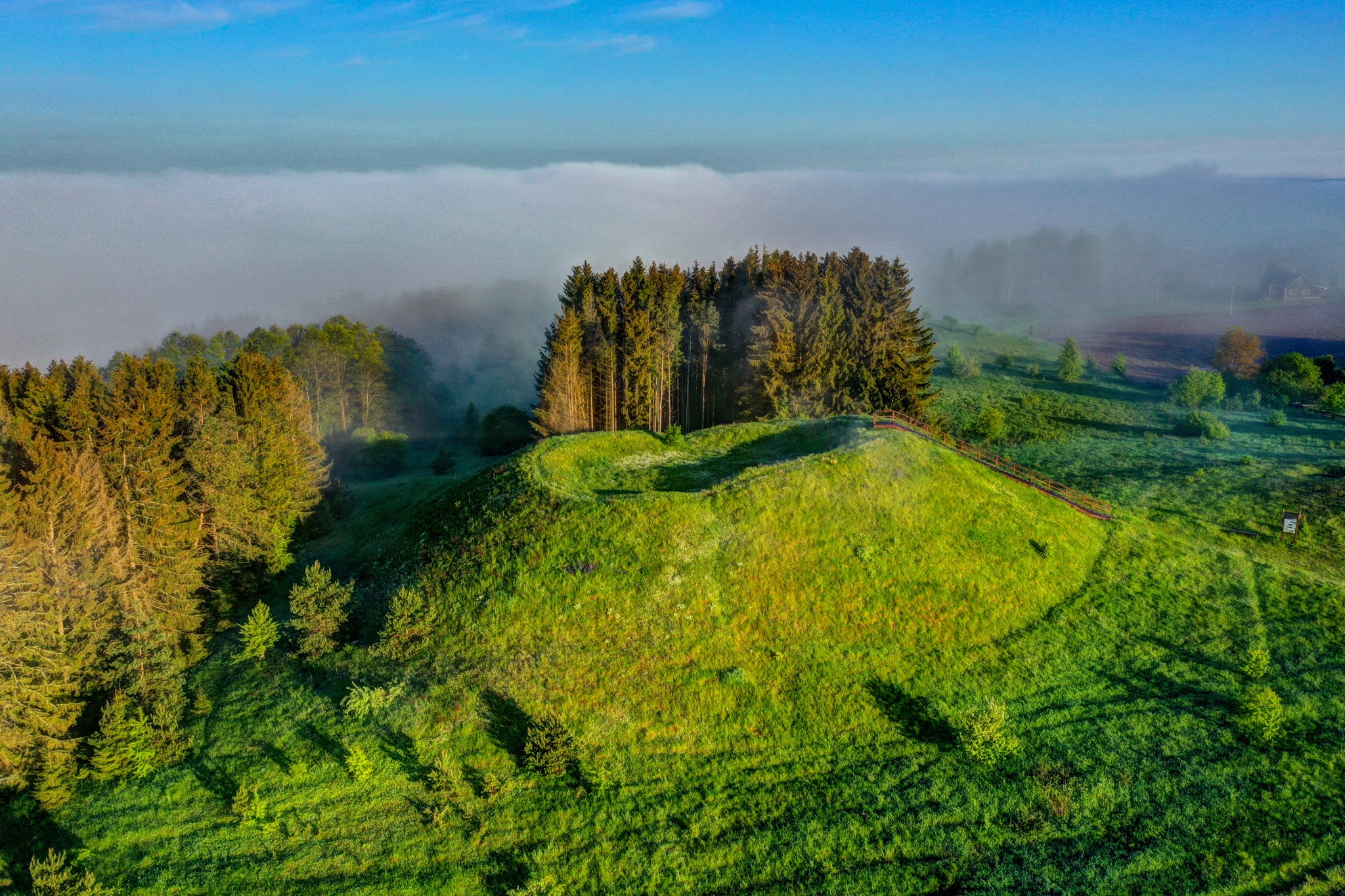

Address: Gojaus str. 5, Gojus village, Rūdiškės eldery, Trakai district.
Gojus village with its community of 30 people can be found by the northern side of Ropėjai forests in Rūdiškės eldership in Trakai district. The name of this lovely village, nestled next to Lake Meduvis, means small forest or a grove. Not only is the village lovely but the surrounding area, known as Ilgutis Botanical Reserve, is also lovely as well.
The construction of the heart of Gojus village – Blessed Virgin Mary Chapel of Patient Health (or Mother of God Chapel of Patient Health) began in 1936. Chapel relics signify a special meaning and are revered as religious objects and create an exclusive atmosphere. The most important is the Mother of God Patient Health picture, famous because of the miraculous powers attributed to it, a monstrance made of bullets, and a 200-page manuscript of Gojus village and chapel history.
Today the chapel, situated not far from the Vilnius-Druskininkai road, belongs to the parish of Paluknio St. John the Baptist. Masses are celebrated here on Sundays. People say that in the area surrounding Gojus chapel one can feel a special vibration of the soul and the breath of God’s grace, which incites us to believe in God’s mercy and care. Upon entering the chapel the faithful encounter the statue of Mary the Immaculate Conception.
In addition to Gojus chapel, there is the children’s foster home founded by the monastery of Saint John’s congregation. One can visit an original clay house along with the first and only operating Japanese kiln in Lithuania – anagama. Anagama pottery workshops are organised here during the summer, when the kiln is fired up and participants work using an ancient technique.
History
The history of Gojus village began in 1865, when the owner of Apatiškiai manor, Russian General Reklickis decided to sell his forests, a total of about 100 hectares. The forests were sold separately while most of the lands were bought by the Andžejevskiai brothers and other families. That was how the village community started to develop.
In 1881 the second son Aleksandras was born into the family of one of the Andžejevskiai brothers. It was his idea several decades later to build a chapel in the village. When he was 19-years old, Aleksandras lost his parents. Soon after he left for Senieji Trakai, where he began learning the basics of the faith. Later he arrived at Bronifratai (Brothers Hospitallers of Saint John of God) monastery in Cracow. Aleksandras Andžejevskis, who later became a monk and received the name of Vlodimiežas, for a long time lived in Prague, Vienna, and Rome. Although often out of country, he regularly visited his homeland.
In 1936, in his father’s native Gojus village Vlodimiežas began construction of the Josephine-style chapel that he had designed. The construction of a small chapel 2-metres wide and 3-metres long and high took one year to complete. However, soon after a project to expand the chapel commenced. In 1939, the foundation of the chapel was consecrated and a plaque commemorating this is inlaid in the wall of the main altar of the chapel.
At the time Gojus chapel had a choir, young people were taught the basics of the faith and educational activities took place here. Children planted 22 linden trees around the chapel and promised to care for them. The trees grow here to this day.
A Miraculous Picture
Pilgrims come to Gojus Blessed Virgin Mary Chapel of Patient Health not only to pray, but also to examine relics that are kept here. One of the chapel’s treasures is the Mother of God Patient Health picture. It is a copy of a 1936 image that was painted by Romualdas Varachovskis and is kept in Vilnius Bonifratrai Holy Cross monastery (now Mary Immaculate Sisters of the Poor monastery). In Lithuania there are total of 30 pictures that are declared holy!
The Mother of God Patient Healthpicture attracts visitors because of its miraculous powers and God’s graces. The first vote (latin word votummeans a wish, gift, promise) was attached to it three years after it was brought to the chapel – this was how a woman gave thanks for the miraculous cure that was confirmed by a special Church commission. Beginning the same year, 1940, and on the last Sunday of August ever since Gojus chapel hosts an annual Mother of God Patient Health celebration.
The Relics
Gojus chapel has an exclusive reliquary – a monstrance, made of bullets taken from the bodies of Austrian Prussian, and Russian soldiers! The monstrance is one of the most important and magnificent liturgical vessels used in the Catholic church where the Holy Sacrament is respectfully kept during Masses and processions. This church vessel is usually made of precious metals, thus honouring the body of Christ.
This is the story of the famous monstrance. During WW I Fr Vlodimiežas (real name Aleksandras Andžejevskis) was working in Bonifratrai monastery hospital, which was then a war hospital. Injured soldiers from Austrian, Prussian, French, and Russian regiments were being brought in. The clergyman began collecting bullets taken out during treatment. Later a special 36-centimetre high monstrance was made of 88 bullets.
A 200-page manuscript ‘Mother of God Patient Health Chapel Chronicle is kept in the chapel of Gojus village. It details the genesis of the village, circumstances concerning the building of the chapel, and has valuable information about liturgical utensils and so on.
One of the more interesting chapel relics is the 17th-century clock. It has his father’s words written on it: ‘Any of these hours could be your last’.
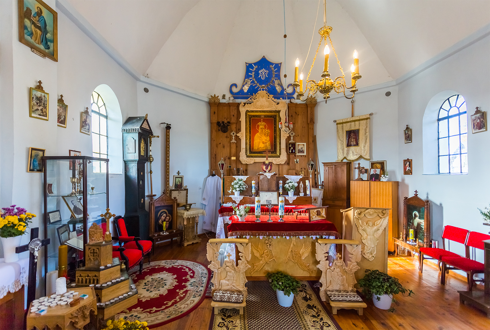
Address: Vytautava village, Rūdiškės eldership, Trakai district.
GPS: 54.545733179337454, 24.71476972103119
The history of church’s emergence and town’s title is closely related to national revival movements and ideas disseminated through them that took place in the inter-war period. In the Independent Lithuania, attempts were made to implement a strong cult of Vytautas the Great. Apparently, the reason for this was a wish to unite the nation, give it the opportunity to feel historical magnificence of the state, and contribute to consolidation of the authoritarian regime of Antanas Smetona. In 1930, the year of commemoration of the 500-year anniversary of death of Vytautas the Great, the Grand Duke of the Grand Duchy of Lithuania, in order to give meaning to his memory at national level, in all cities and towns of this country, through erecting the monuments, naming streets, squares, official enterprises or even settlements after Vytautas.
Thus, in this historical context, in the first half of the 30-ies of the 20th century, the settlement was named Vytautava to honour the Grand Duke of Lithuania. The professor of Kaunas University Zigmas Žemaitis (1884-1969), an airman and physicist, took care about construction of the church. He gave the land plot of his farmstead as a present to the church. The building of the church was built of logs taken from the stackyard of Z. Žemaitis’ manor.
A wooden building of the church, built in 1936, is of folk style, has a compact long-drawn rectangular plan, without an apse, and reminding of an ordinary residential house. In the main facade – a small four-walled tower of belfry with a small pyramid hip roof and a portico, propped on two wooden poles, marking the main entrance. The walls are built of logs and horizontally planked, the windows and doors are rectangle-shaped. The roof is double pitch, tin-plated. The tower is adorned with a cross of laconic forms.
The internal space is divided by rows of pilasters of a square base into three naves, while the central nave is higher than the side ones. The internal walls of the church are planked horizontally, there are some pictorial elements on the ceilings and walls. The interior is minimalistic, without exaggerated decoration.
The “Blessed Virgin Mary” in the High Altar of Neo-Baroque forms of Blessed Virgin Mary also is quite a symbolic and tendentious sign in the buildings of the 30-ties having ideological meaning: after Poland seized Vilnius region, attempts were made to make the symbols and memory of the historical capital of Lithuania more meaningful in the conscience of the Lithuanian people. Among such signs were architectural forms characteristic of Vilnius, visualizations of historical fragments or copies of famous artworks from Vilnius.

Address: Mokyklos str. 2A, Onuškis, Trakai district.
There are two ways to reach Onuškis, which is located 30 km from the town of Trakai: by going in the direction of Rudiskes-Dusmenys-Alytus or towards Aukstadvaris.
A big cathedral adds a touch of sophistication to the town. The Onuškis St. Apostle Philip and Jacob Church, first mentioned in 1526, with late classicism and romantism features, mirrors the Vilnius Cathedral. The church has a rectangular plan, with a 6 dorenian column portico. The inside has three naves. Cilindrical arcs are supported by 4 pairs of columns. The churchyard is surrounded by a fence made out of stone and small brick posts. There is a wooden bell tower inside. It is believed that at the end of the XVI century it belonged to Evangelical reformats, because the owner of the Onuskis folwark gave it back to the Catholics in 1611. In 1655 the church burned down. It was rebuilt after 1674. For a long time it stood untouched. With the efforts of landlord K.Setkevičius, a majestic brick and stone church was built in the same place between 1823-1829.
Another unique object in Onuškis – the historic stone-paved Kipras Petrauskas square. Ever since the old times, it hosted celebrations and markets, there were taverns, tearooms and shops in the surrounding houses. The markets would begin early on Sunday in the central town square.
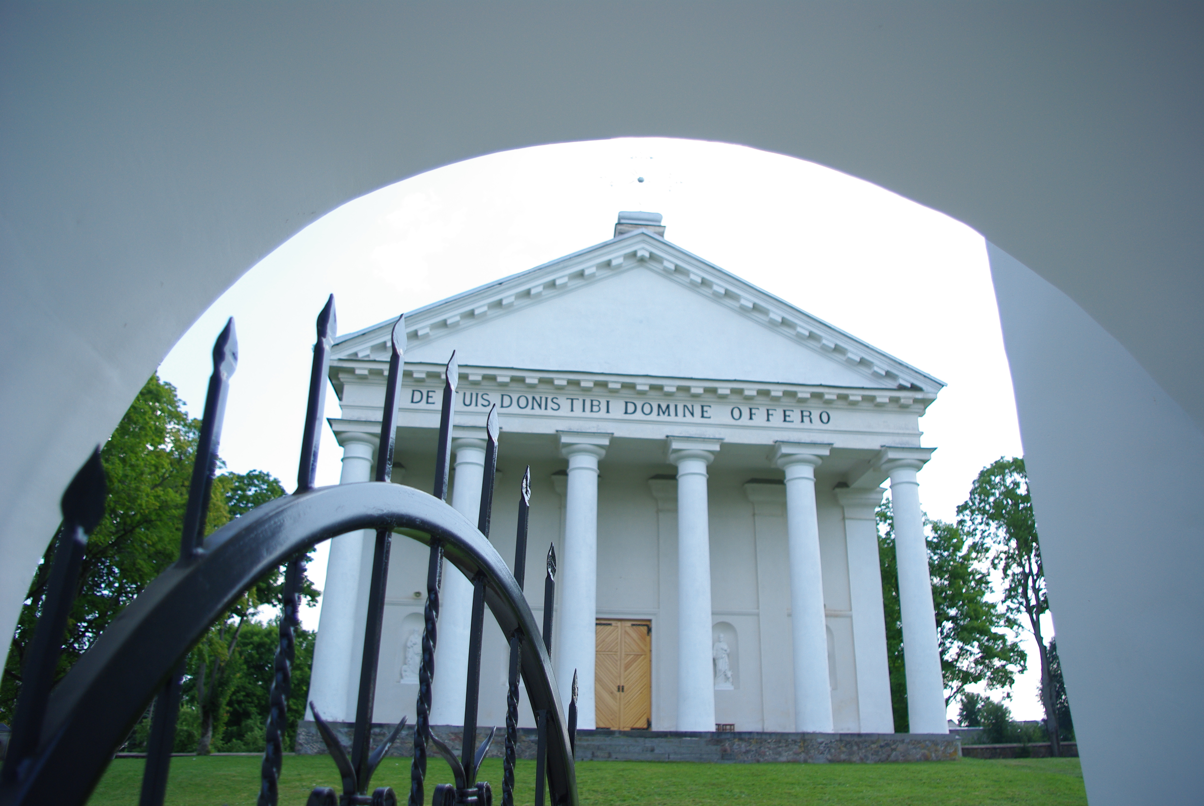
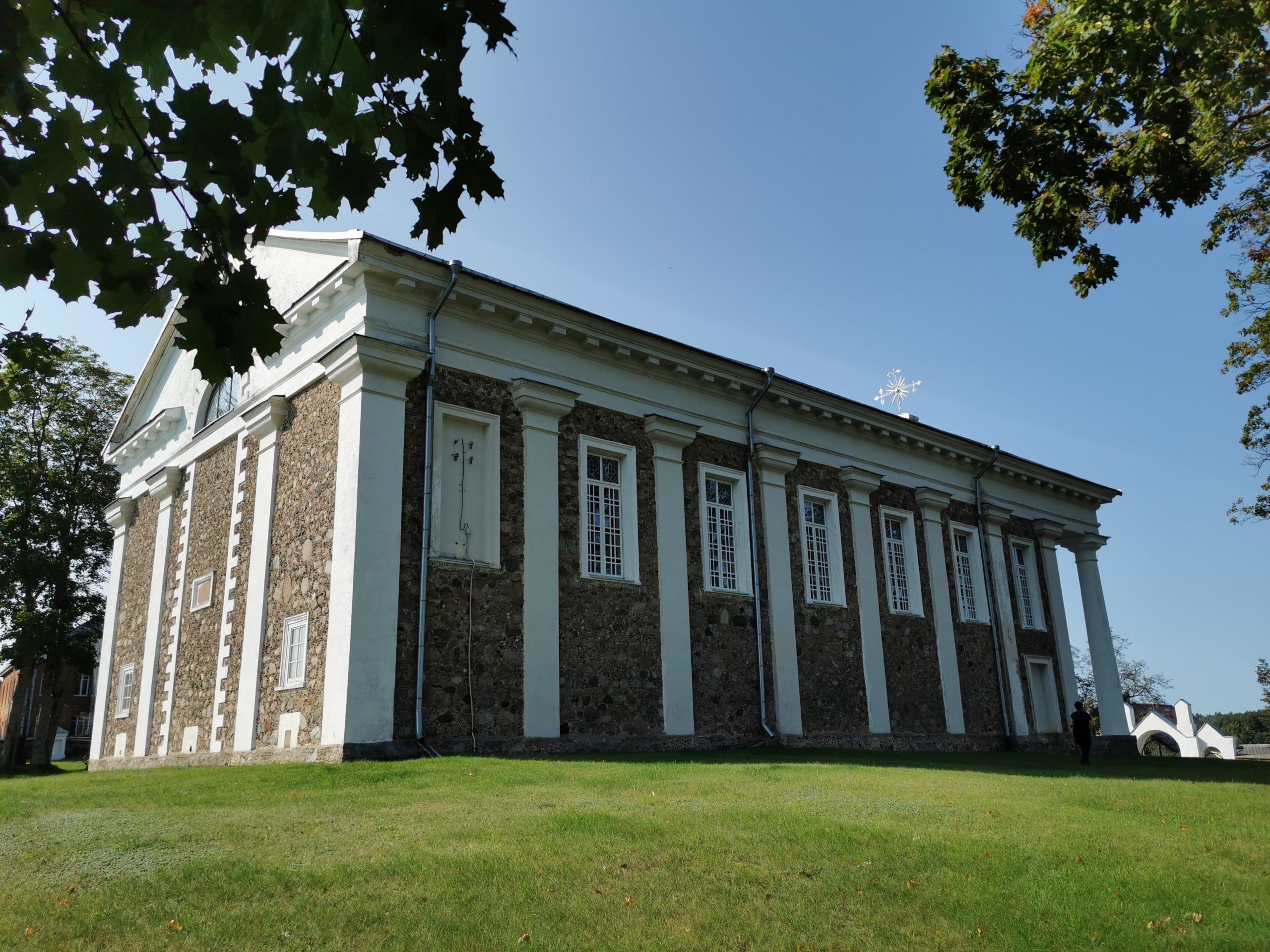
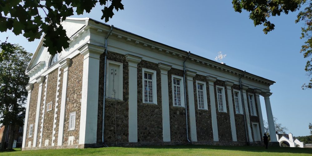
Address: Dusmenų str. 9, Dusmenys, Trakai district.
Back in the 16th century, Vilnius Diocese records of church visitations mentioned the Church of Dusmenys, but the Catholic church was closed as the Reformation spread. In 1667, the Chancellor of the Grand Duchy of Lithuania, Kristupas Zigmantas Pacas donated Dusmenys Manor to Pažaislis Camaldolese Monastery. In 1820, the Camaldolese monks built the present wooden church in the middle of the old cemetery. The church had two turrets and four altars. In 1883-1885, the churchyard was fenced with a brick fence covered with wood shingles, and a belfry was built. In 1904, the pastor of Dusmenys, the book smuggler Stanislavas Šlamas initiated the invitation of the organist Jonas Petrauskas, the father of the famous Mikas and Cypriot Petrauskas. Together with his sons and other musicians, Jonas Petrauskas created Dusmenys Church Orchestra. In 1937, Mikas Petrauskas was buried in the churchyard next to his parents. The remains of Stanislavas Smolinskas (1889-1975), the longtime pastor and dean of the church, were also buried in the churchyard. In 1965-1967, the church was renovated thanks to the priest Marijonas Petkevičius.
The church of the Apostles St. Simon and St. Judas Thaddaeus in Dusmenys is Classicist in style, and includes folk architecture features. The single volume church of a square layout ends with a three-wall apse. The roof is semi-gambrel, covered with sheet steel, and includes a turret located next to a trapezoidal pediment. A small two-section octagonal turret is topped with a small dome and an ornamented cross. A bulbous pedestal with a cross is located at the apse. The main facade includes a protruding portico. It is supported by four posts placed on pedestals. A small roof separates the portico from the pediment. The center of the pediment includes a square window. The church windows arched and edged, only the main facade has a square two-part window with edging. The stumpy silhouette of the church is further enhanced by horizontal cladding.
The interior of the church is decorated with three wooden altars. The 18th century pictures “St. Romualdo” and “The Most Holy Virgin Mary with a Baby” are associated with the Camaldolese are on the main altar. The picture of the church guardians, the Apostles Simon and Judas Thaddaeus are in the presbytery.
The church belfry is square, of two sections. The upper section is smaller, separated from the lower one by a small roof. The belfry is covered by a pyramidal sheet steel roof with a massive cross. The windows of the upper section are arched like the church windows, and edged. The belfry is boarded horizontally. A wide two-leaf door leads to it.
The churchyard fence is made of stonework and includes a massive arched gate. The gate is covered with a gable roof, and its pediment includes a niche with the image of the Most Holy Virgin Mary.
Source: © www.sakralilietuva.lt

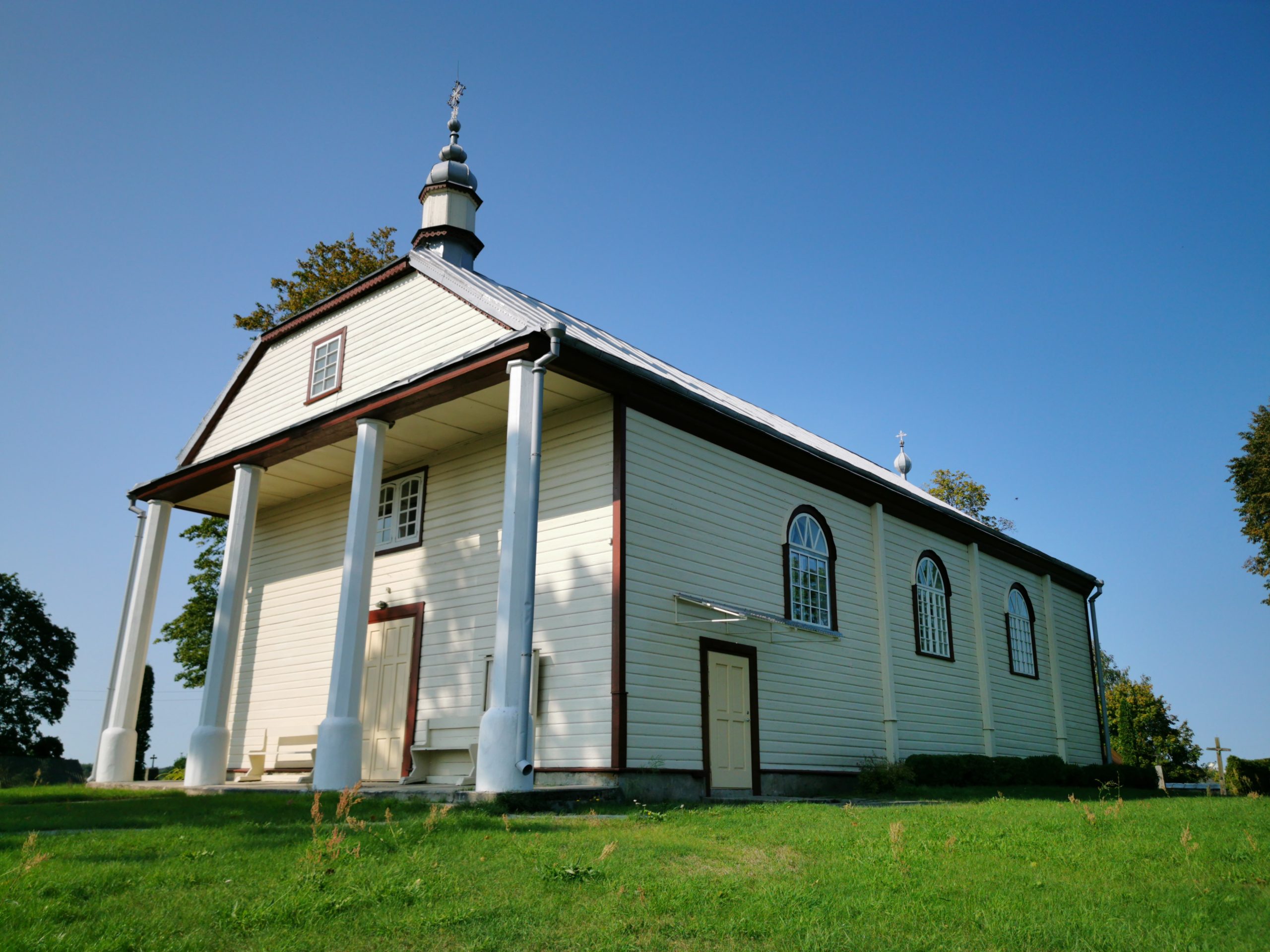
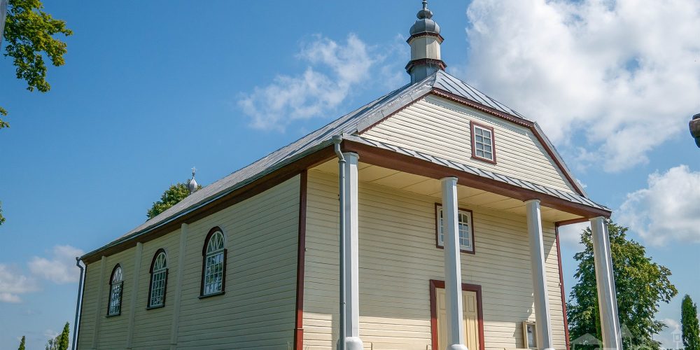
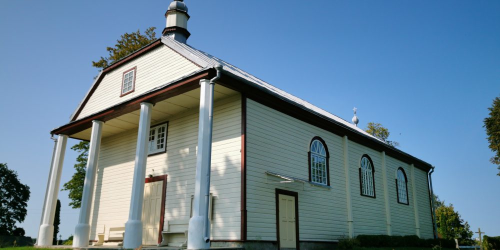
Address: Bažnyčios str. 14, Paluknys, Trakai district.
Paluknys is an old village located on the banks of the Lukna stream, from which the name of the village is believed to have originated.
A chapel was built here in 1794. In 1829, Jonas Volfgangas, the owner of Paluknys manor and a professor at Vilnius University, built a new wooden chapel. In 1904, with the permission of the authorities, Mykolas Sadovskis donated the Paluknys family chapel, other buildings and 2 tenths of land to the Vilnius diocese. In 1905, a temporary church was moved here from the Old Trakai. The chapel was repaired and enlarged in 1906.
The parish was founded in 1921, and Paluknys chapel became a church. In 1926, towers were added to the church. However, the church burned down on 25 August 1941. Kazimieras Packevičius (1884–1941), who was the pastor of the church since 1915, died during the fire. A temporary church was built in 1943. In 1981 it was reconstructed: extended, widened, with an addition of a tower. The church has a rectangular layout, basilica style, an entrance hall and a single tower. Inside of the church there are 3 naves separated by pillars, and three altars.
The Church of St. John the Baptist, which has an elongated rectangular layout and three naves, stands in the middle of Paluknys, next to the abandoned Volfgangas family cemetery. The cemetery contains state-protected art monuments: two 18th century chasubles and a wooden sculpture Pensive Christ. Pensive Christ dates back to the second half of the 17th century and is known as the oldest sculpture of this iconographic type in Lithuania. The professional skills of its author suggest that the figure of the Pensive Christ could have been carved by a master associated with the environment of the Vilnius Bernardine Monastery. The Bernardines of Vilnius owned a chapel in the town of Paluknys and the sculpture may have been transferred from this particular chapel to the present church.
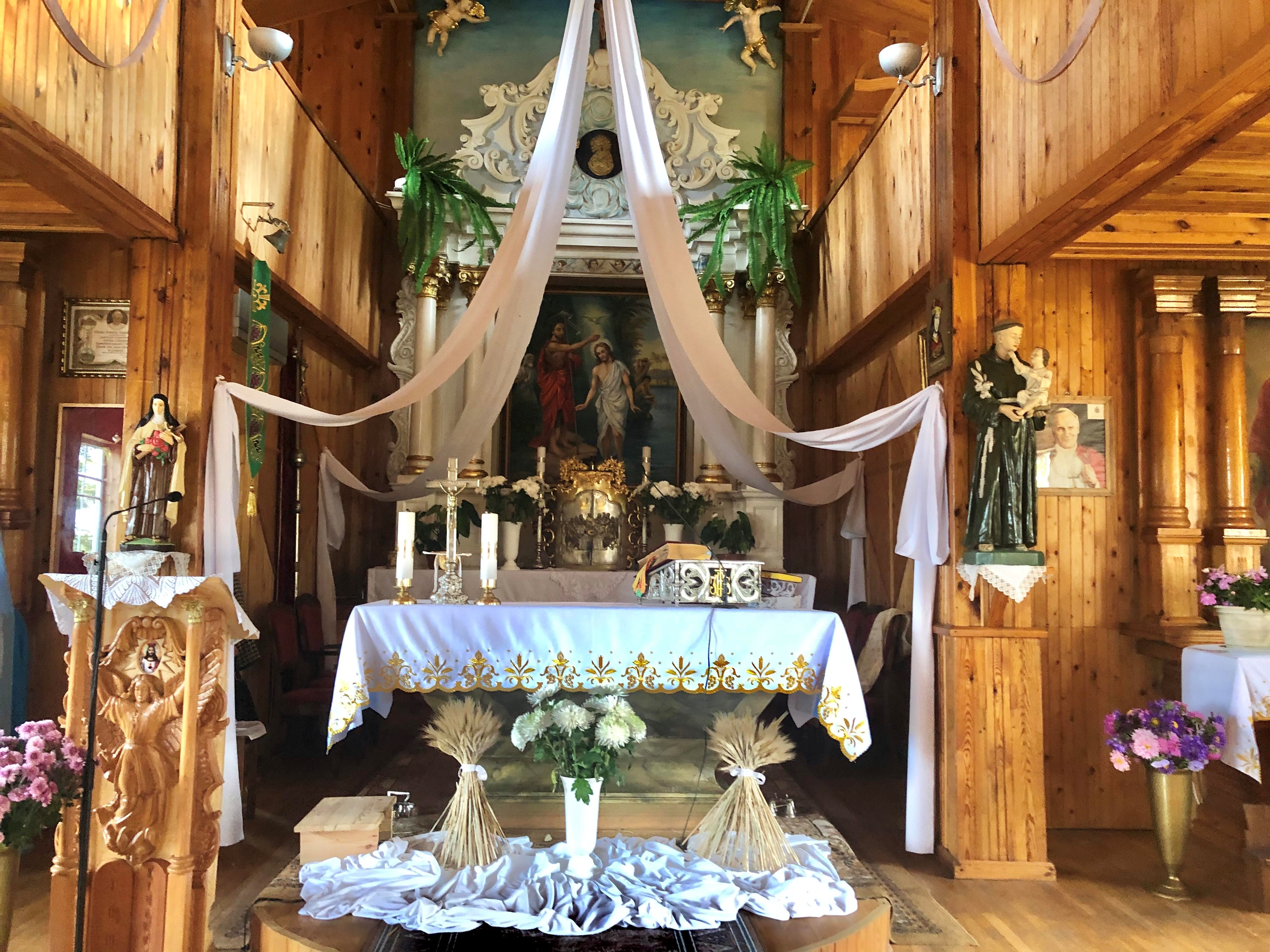
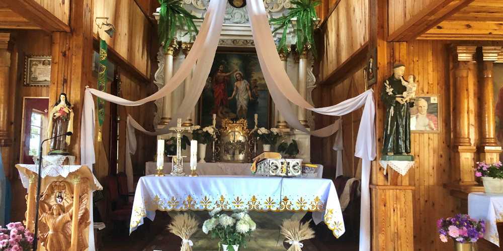
Address: Spindžius forest, 700 m from a highway No. A 16 Vilnius–Prienai–Marijampolė, Strėva, Trakai district.
GPS: 54.584429, 24.693048
The Sinkhole of Strėva is also known as a failure or a doline and is referred to as a sister of the Devil’s Pit. This mysterious place has inspired a number of legends and stories. Ancient Lithuanian mythology says that it was the place where the devils’ tavern sank into the ground!
The Sinkhole of Strėva is located in the Spindžius Nature Reserve by Strėva Village on the territory of Aukštadvaris Regional Park. The spectacular abundance and diversity of flora and fauna gives the reserve a special status not just within Lithuania. The Reserve is also listed as an EU protected Natura 2000 site. Trakai Forest Enterprise is responsible for the regular maintenance of this area so that this beautiful forest territory of state importance is attractive to the public.
Scientists claim that the Strėva Sinkhole is a doline of thermokarst origin and was formed about 18,000 years ago. When glaciers were retreating, various deposits and sediments blocked a piece of ice that had fallen off; this then melted and opened up a ravine in the ground. The estimated length of the ravine is about 150 metres while the width is 100 metres. A giant spruce trail leads visitors to a 20-metre-deep hole. There is a scenic viewpoint close to the ravine and a pedestrian ecotourism trail circling around it offers visitors an opportunity to have a closer look at this natural phenomenon from all sides. Interestingly, a lot of poisonous plants are found in the area!
Notably, the Spindžius Nature Reserve is the proud home to one of Lithuania’s ancient forests. Very old trees adorn this territory including tall pine trees, oaks and other types of long-living trees. Different varieties of trees have stood here for four generations. A part of the ancient forest’s territory is dedicated to an untouched forest not affected by human activity, where there is a high probability of finding various endangered or rare vegetation species. Some plants that grow there are protected not only in Lithuania but also in the European Union.
Treasure House of Legends
According to one of the most famous legends, the tavern that once stood on the site of the Strėva Sinkhole was a place for the devils to feast. Once, devils decided to throw a wedding on a day of fasting. With the sounds of the first roosters crowing at dawn, the tavern went down into the ground with the devils still raving in it. Locals say that even still strange and mysterious sounds can be heard near the ravine. Today, at the bottom of the Strėva Sinkhole a roof ridge of a wooden house still sticks out of the ground reminding everyone of the legend.
According to another legend, an old tavern once stood here; one of its regulars was the father of a very large family. Once his wife found him there and tried to take him home. When the man refused, his wife became furious. It turned out she was a witch! She decided to punish her husband and the owner of the tavern. She went out on to the road and cast a curse. The tavern immediately sank deep into the ground with everyone still in it.
People also say that a high hill with a beautiful big crystal palace on top of it once stood here. Devils lived in harmony in the fabulous palace, and each knew exactly what his duties were. They would all agree on what wicked tricks to pull or whom to get fighting with each other. One day they could no longer share the power and started arguing. All of them forgot their duties, thus creating havoc. The sight of quarrelling devils angered the God Perkūnas (Thunder), so he threw thunders that shattered the castle and sent all the devils deep down into the ground. People say that if you listen carefully you can still hear the devils shouting and arguing down below.
Strėva is Sravati
There are various places and objects linked to its name in the vicinity of the Strėva Sinkhole. The word Strėvais closely related to the Sanskrit word sravatimeaning ‘flowing or flooding’. In addition, the Strėva or Mūro Strėvininkų Village and the Strėva Hill Fort should also be mentioned, while the Strėva River embodies the Sanskrit word sravati. Indeed, the mouth of the Strėva River holds uniquely beautiful natural riches with an abundance of lakes and streams.
The Strėva is a marshy river with rather dense vegetation around it, linking together about 20 lakes. Powered by the spring water, the Strėva flows eastwards, i.e. against the rising sun. In Lithuanian folklore, this phenomenon symbolises the river’s sacrality. From ancient times, the Strėva was considered a sacred and special river. Locals have always spoken highly of the clear stream waters flowing into the river.
The Green Path
The Green Path goes along the winding banks of the Strėva River circling around Spindžius Forest. The trail takes tourists to the Strėva Sinkhole as well as to many other places. It also helps people to avoid getting lost in this somewhat eerie and mysterious environment…
The Hill of Streams holds one of the surprises along the Green Path. It is a rather rare natural phenomenon that is valuable not only from a natural, but also from a cultural point of view. A range of ice-free streams come flowing down from all directions and feed the Strėva River. On the way, they help the formation of swamps and morasses much loved by beavers.
In ancient Lithuanian folklore tradition, ice-free streams were always regarded as sacred places, and their water was believed to have healing powers. It is said that sick locals would bring this water to their houses, while herdsmen used it to wash their tired feet.
The Orchid Kingdom deserves special attention.A plantation of Lithuanian orchids reigns on a small hill! The hill is home to a collection of especially vulnerable variegated orchids including the Lady’s-slipper orchid, which is protected on the territory of both Lithuania and the EU.
According to Lithuanian folklore, in ancient times women tried to grow these flowers in their home gardens, but all to no avail. Therefore, locals consider these plants as whimsical or even mysterious. Orchids, sometimes called ‘the forest beauties’, were considered magical plants. They were widely used in folk medicine and fortune telling.
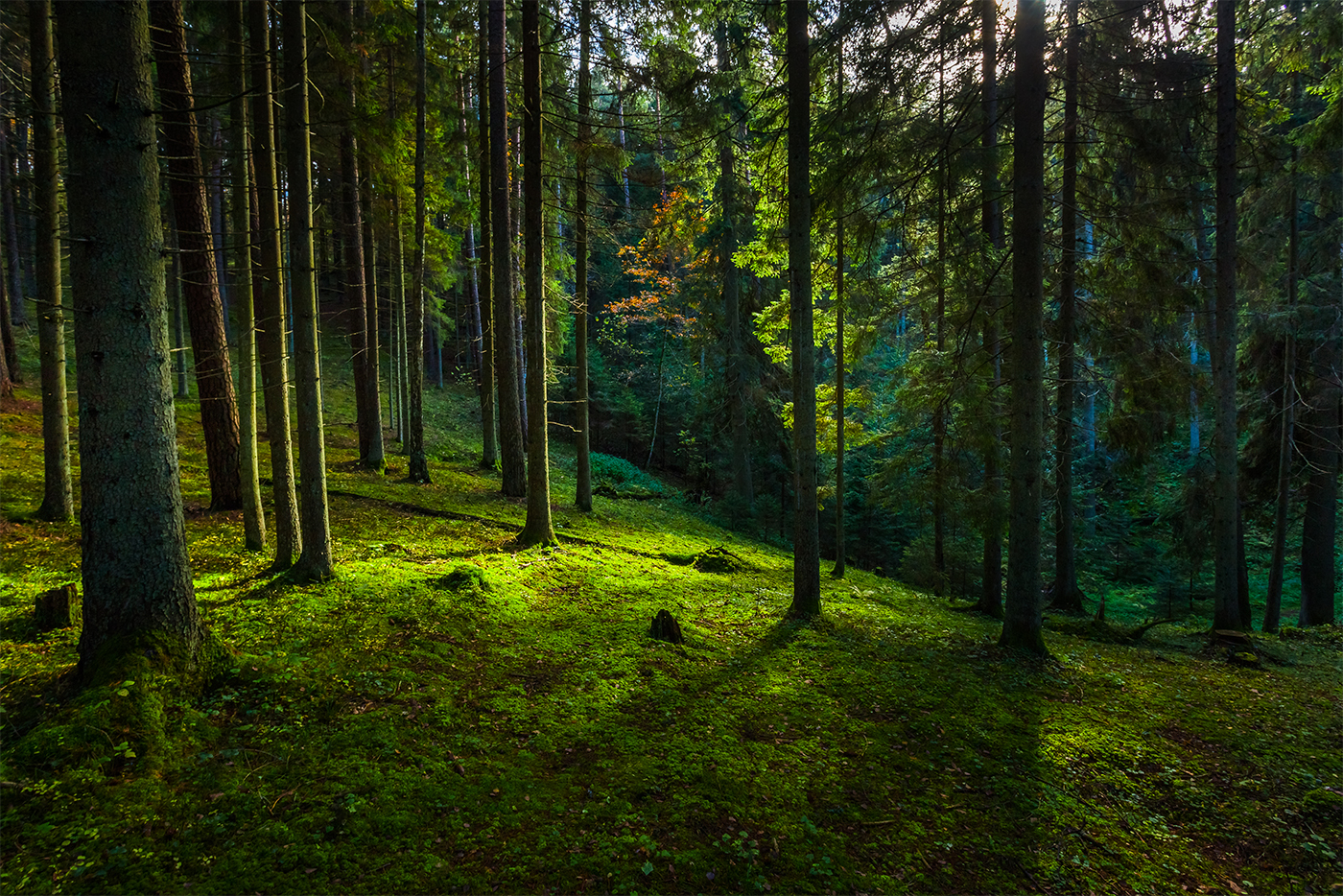
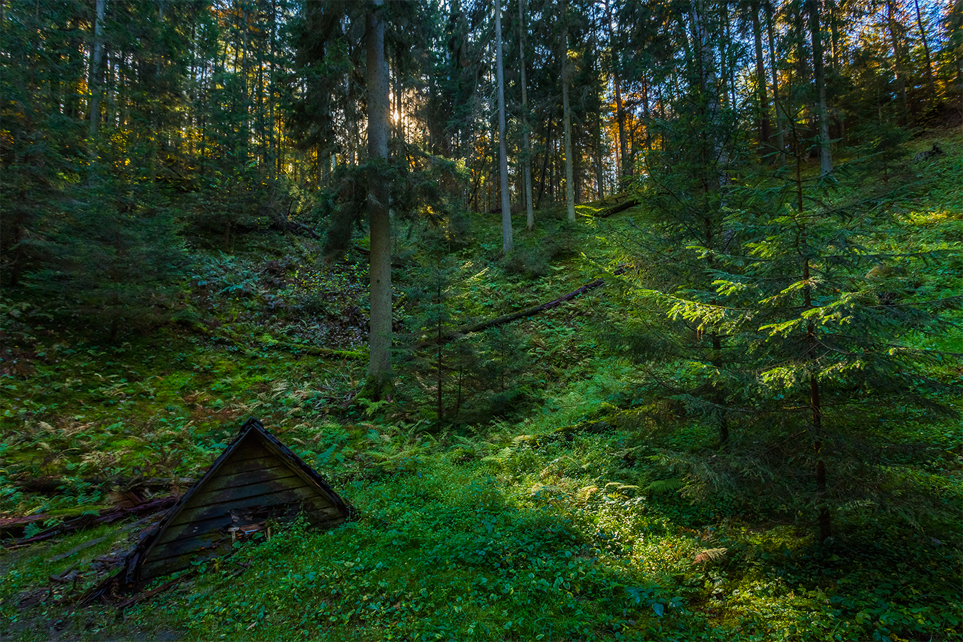
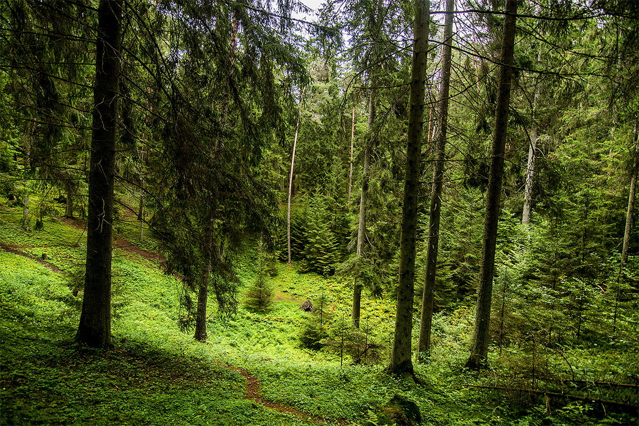
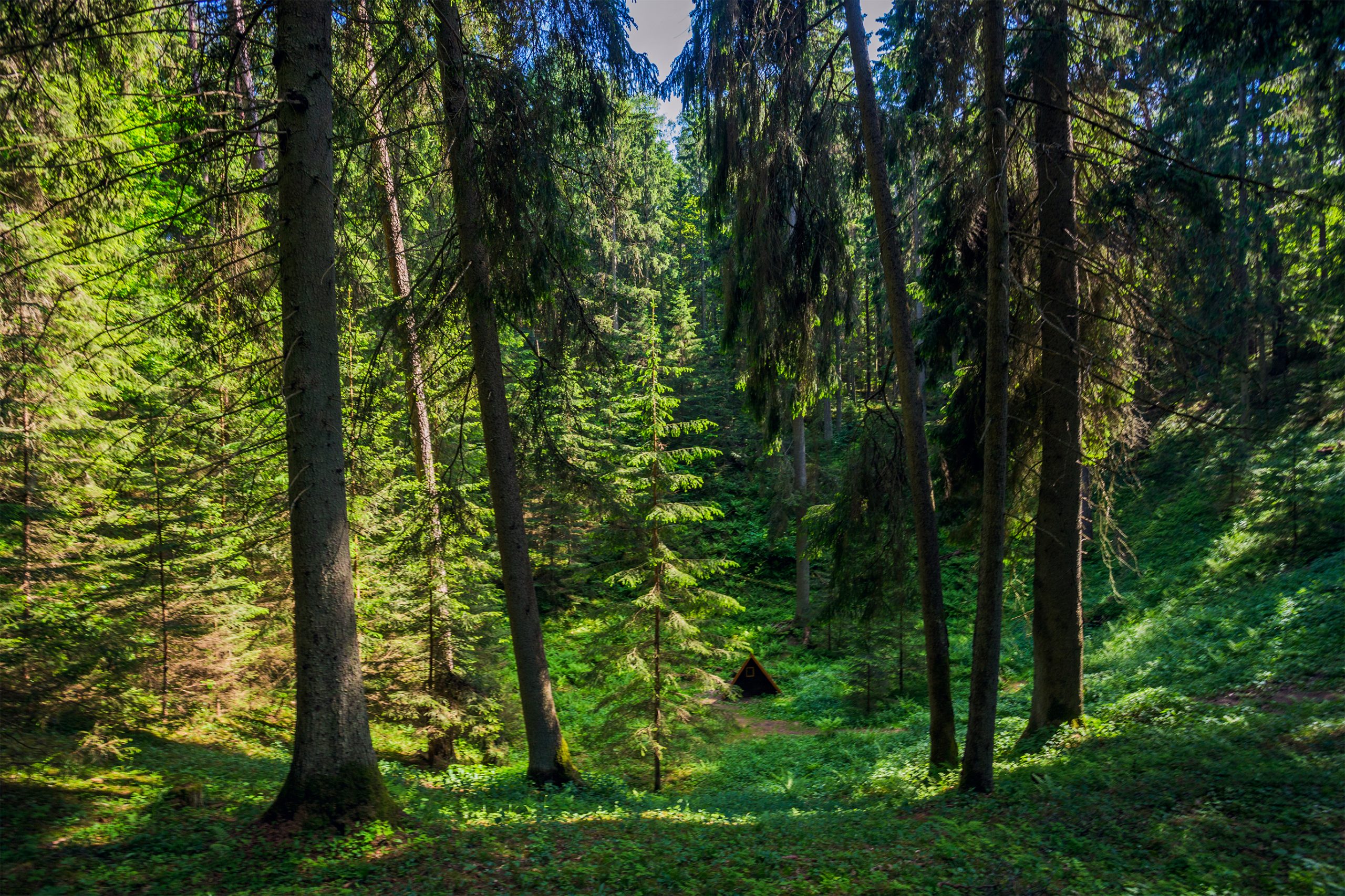
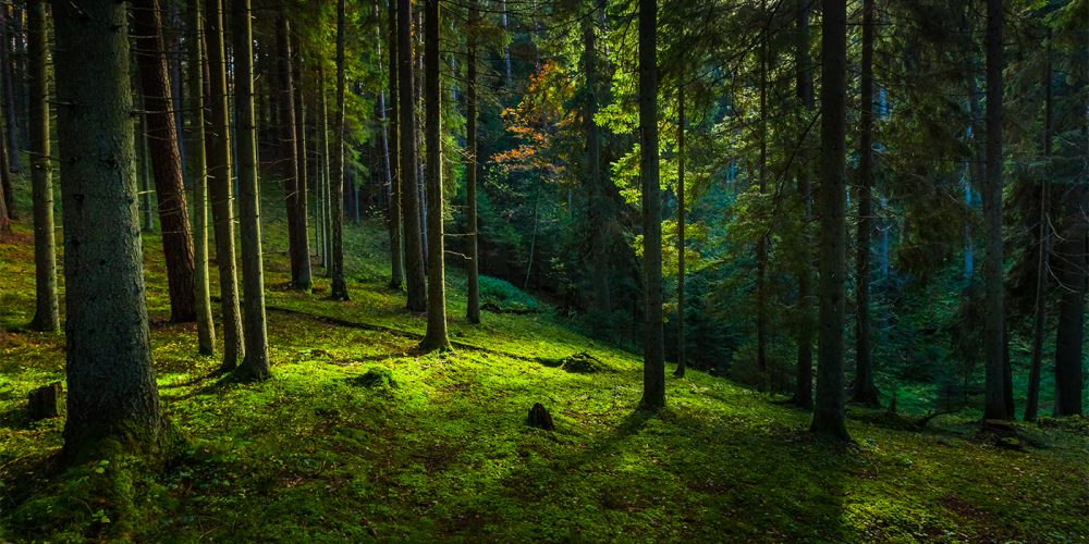
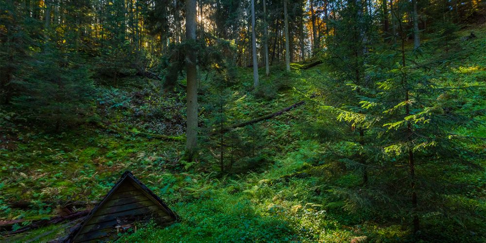

Address: Babrauninkai forest, near Lake Verniejus 3,3 km from a highway No. A 16 Vilnius–Prienai–Marijampolė (go through Nikronys village along Tilto and Ąžuolų streets), Aukštadvaris eldership, Trakai district.
GPS: 54.554434, 24.596046
Sunk into the ground, the Stone of Nikronys is sometimes called the ‘Great Stone’ and can be found in Aukštadvaris Regional Park. The stone represents a natural geological monument and is located in the Babrauninkai Forest, between lakes Sienis and Vernėjas. Trakai Forest Enterprise is responsible for taking care of the stone as well as the surrounding areas so that they are visitor friendly.
The Stone of Nikronys is a massive boulder of glacial origin on which up to 40 people can stand at any one time. The size of the stone is indeed impressive with its length reaching 6.3 m, width – 3 m, and height – 2.2 m. This irregularly shaped grey granite-coloured stone could be between 14,000 and 16,000 years old. Geological studies show that the so-called Scandinavian stones represent a unique feature of Aukštadvaris Regional Park. It is believed that just like many other giant stones located on the territory of Lithuania, the Stone of Nikronys originated somewhere in Scandinavia millions of years ago. Over the course of the last ice age, these boulders were rolled down to Lithuania.
Interestingly, various signs, letters and symbols are clearly visible on the Stone of Nikronys. For example, quite sizeable (about 35 cm tall) letters ‘MOPT’ are inscribed on one side in a 2-m horizontal strip. Above the letters, an arrow or a pointing sign can also be seen. On the other side of the stone one can see an even-sided cross which is about 30 cm long. Written sources indicate that two crosses were inscribed here in the past. Another drawing on the stone resembles a coat of arms...
Because of its puzzling signs, the stone of Nikronys is surrounded by mystery and associated with Lithuanian history and ancient Baltic mythology. The enigmatic boulder has long attracted famous archaeologists, historians and experts of different fields. It is not surprising that a lot of stories have been created about this unique site of natural heritage.
Mysterious Signs
The first written source mentioning the Stone of Nikronys is the book by Petras Tarasenka Footprints in the Stonepublished in 1958. He gave a detailed description of the appearance of the stone and the signs inscribed in it. The letters ‘MOPT’, an arrow, a pointing sign, a cross and a coat of arms – all inspire different stories, speculations and discussions.
According to locals, in about 1904-1905, the Stone of Nikronys marked the border between the state forest and the land of a noble lord. The landlord inscribed the ‘MOPT’ letters and the sign on the stone pointing towards his land. Local residents testify that the mysterious ‘MOPT’ letters are the initials of the Polish phrase ‘Moje pieniadze tutaj’, which means ‘My money is here’. In fact, it is believed that a hidden treasure lies underneath the stone. This is clearly evidenced by the remains of the attempted diggings left by treasure hunters.
On the other hand, it is argued that the Stone of Nikronys could not have been a sign separating the lands, because it lies right in the middle of the former Odyniec family-owned lands. It is also known that noble families used to carve their initials and coats of arms in the stones, thus marking their property or honouring the memory of the deceased. Helena, the daughter of Vladislav Odyniec, the last owner of the estate, has indicated that the letters ‘MO’ stand for Michal Odyniec. Documents secured in the Aukštadvaris and Onuškis churches testify to the fact that he was a Trakai-based court official, a judge in charge of the land trials. Therefore, ‘MOPT’ might stand for ‘Michal Odyniec Podkomorzy Trocki’ (Mychal Odyniec, Trakai judge). In addition, the daughter of Vladislav Odyniec has confirmed that the Odyniec family coat of arms contained the image of a wild boar just like the one on the stone.
The residents of Aukštadvaris and other districts around Trakai have preserved the memory of the noble Odyniec family until the present day. Local people regarded the family members as noble dukes, although the Odyniec descendants have not used this title since the 17thcentury. Vladislav Odyniec, the owner of Nikronys Mill, was one of the people behind the establishment of Aukštadvaris parish and the initiator of the construction of a local church.
Treasures Do Not Open the Doors to Heaven...
Many legends talk about the treasures hidden underneath the Stone of Nikronys. It is said that the direction of the place where the treasures are located is indicated by the pointing sign and the ‘MOPT’ letters detail the distance to it. The remains of the treasure hunters' attempts indicate their countless efforts to find it...
A popular story suggests that Vladislav Odyniec hid his money in the ground underneath the stone and... then forgot its exact location. Allegedly, he spent much time looking for it, but all in vain. In despair, or possibly under the influence of strong spirits, he jumped under a train.
Some legends even link the treasures to Napoleon. In 1812, Napoleon was resting in Babrauninkai Forest when he decided to hide his golden coins and tableware. So, he ordered the soldiers to bury his precious possessions in the ground and put a massive stone on top of it! Another story suggests that the news of hidden treasure reached Napoleon's soldiers. They started digging and... discovered the treasure! However, that was not money, but lots of books.
Today, no matter what the legends say, we know one thing for a fact. Recently, a local tractor-driver, who was working next to a neighbouring old cemetery, uncovered a pot of money. Today, everyone can take a closer look at it in the Trakai Castle Museum.
Alka – a Sacred Place of the Balts
In ancient times, the stone of Nikronys was worshipped and considered a holy object. Perhaps, it used to be a sacrificial stone attributed to the pre-Christian religion? Maybe a long time ago ancient priests used to light a sacred fire here? The crosses carved in the stone are often regarded as symbolic signs of the Sun.
Another interesting fact is that at the top of the stone there is a man-made 26-cm deep hole, holding at least a single drop of water at all times. It is believed that this water is sacred and has healing properties. Of old, people would come here from afar eager to put this water on their eyes. After the snowfall, people would drink this water and take it to their homes. Believers not only used to wash their eyes here; they would leave some money for the priest to celebrate Mass.
Old men say that sometimes lights wander here at night, but they are visible only to those who are truly kind. Some claim that the site of the stone is a haunted place...
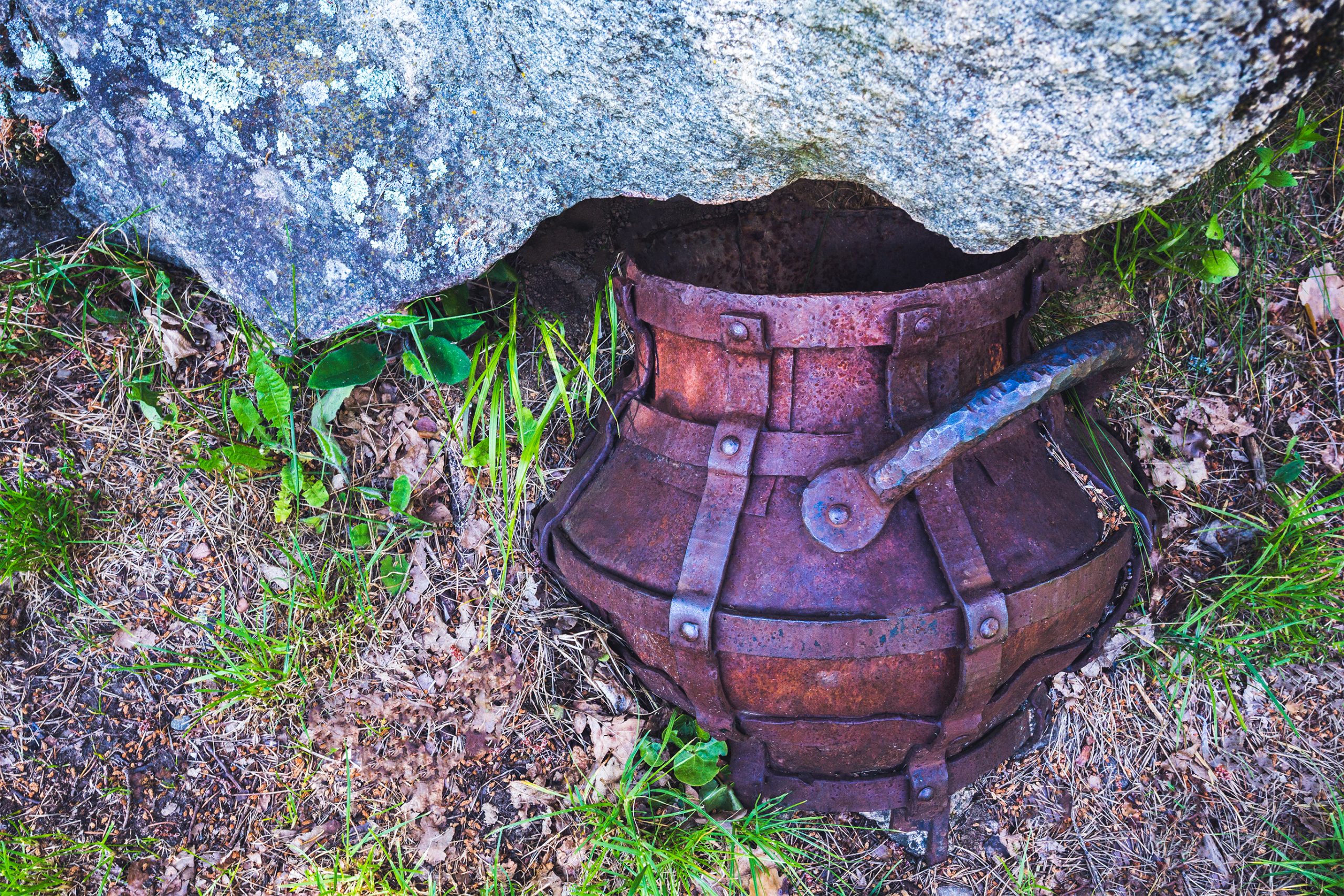
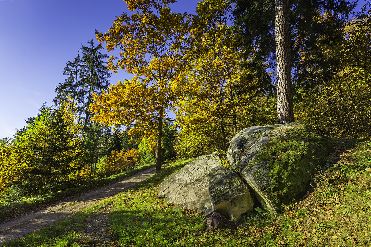
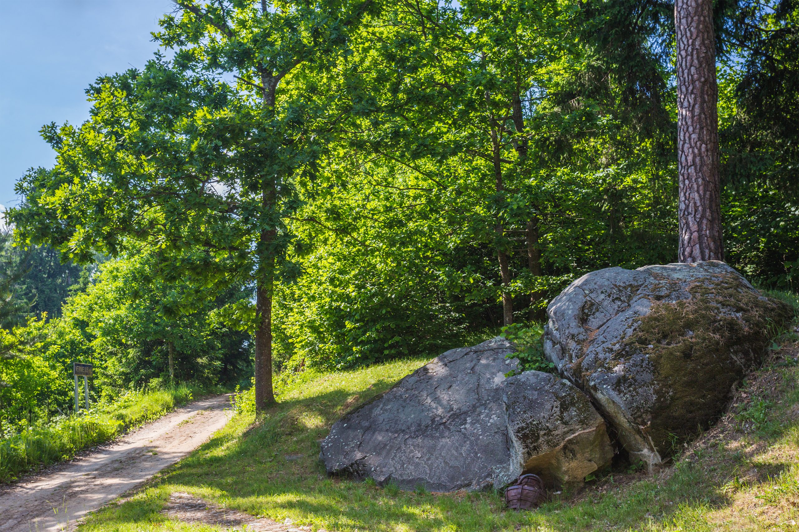
Address: Vilniaus str. 53, Aukštadvaris.
The Dominican-owned masonry church of Aukštadvaris Parish was closed after the uprising in 1832, and the services were held in a small cemetery chapel. Later the chapel was also handed over to the Orthodox Church, and in 1881 it burned down. At the beginning of the 20th century Aukštadvaris inhabitants decided to reestablish their parish and build a church. Bronislovas Malevskis, the owner of the manor there, donated a land plot for the construction of the church, and a wooden church designed by the architect Antanas Filipovičius-Dubovikas was approved in 1907. Initially, a temporary chapel was built and the church parish was restored. The newly established parish had substantial Polish population, so the services were held in Polish. The new church was built in 1910-1913. World War I, which began shortly, caused great damage to the newly built church: in 1914, the Russian army stationed there took three church bells away. The church also suffered during the World War II: on 24 June 1941, Nazi Germany soldiers destroyed the roof of the church by firing at Aukštadvaris.
The church building is Historicist with neo-Gothic features. The building layout is symmetrical, with two graceful towers on either side of the main facade and two two-storey sacristies. The two-section towers end with four symmetrical small pediments with sun motifs and a pointed four-sided roof with a cross on a round pedestal. The same sun motif is echoed in the other pediments of the building. On the main facade pediment, the sun motif is further accentuated by a circular, decoratively segmented central skylight. The window and tower openings in the building are arched, decorated with dripstones.
The interior space is divided into three naves. The church has four altars. The great altar is decorated with the painting The Transfiguration of Christ by the professional artist Stanislovas Gobiata. The same author used a similar composition to decorate the processional altar. The other three smaller altars of Historicist style were brought from the old Dominican church of St. Dominic.
The church interior is richly decorated with paintings. The transept’s right wing includes the painting St. Francis of Assisi on the wall that was painted in the second half of the 19th century by the painter from Kaunas M. Bučinskas. The same artist painted the Stations of the Cross. The paintings St. George and St. Stanislaus on the side walls of the church were painted in 1913 by Juozapas Balzukevičius. Two paintings of the famous Lithuanian artist Vladimiras Didžiokas are kept in the church and the sacristy.
Some of the wealth of the old Dominican church is also stored in the church: a reliquary of St. Cross of the 18th century, a chasuble embroidered in plant patterns, a brass chandelier of the second half of 19th century. Instead of the bells that disappeared during the war, the church belfry now has a bell of 108.5 kg recast in Poland in 1882, and a small bell made in 1808.
Sourse: © www.sakralilietuva.lt
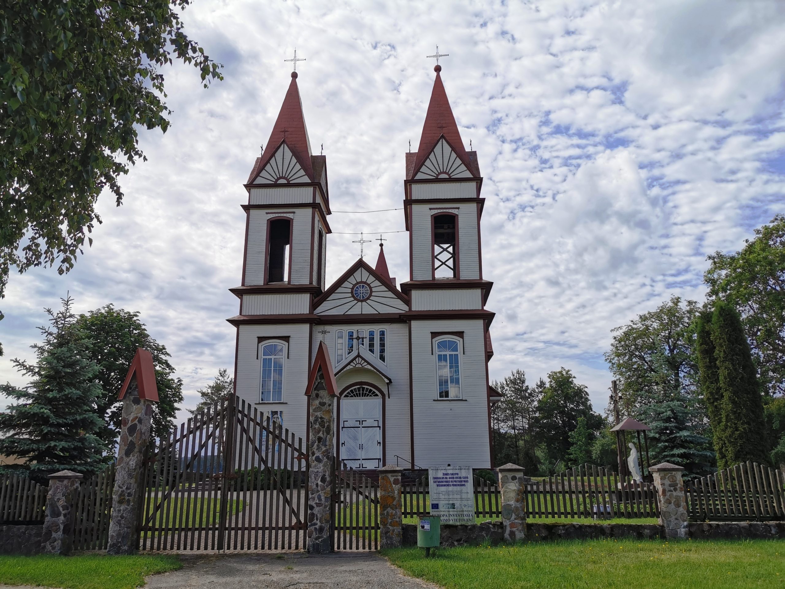
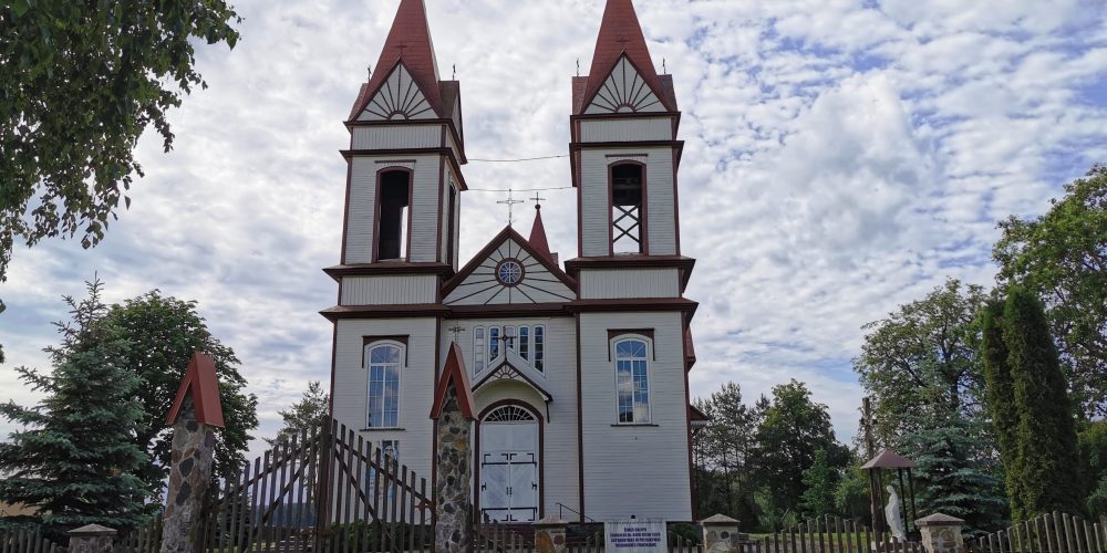
Address: V. Mongirdo str., Aukštadvaris, Trakai district.
The Mound Aukštadvaris, also known as the Mound Pilaitė, is standing framed in the picturesque place of the Stream Verknė and Lake Pilaitė. The castle was standing on the Aukštadvaris Mound and was extremely important. Written sources state that the Teutonic Order demolished and burnt down the Navinpilis Castle on 14 February 1381. In January 1382, it is mentioned as fully functional. In 1957 to 1960, archaeological excavations were carried out during which almost 1,800 findings were found and historical facts were evidenced. The mound dates back to the 2nd century AD - 17th century. During the 15-17th centuries, a manor owned by the Grand Duchy of Lithuania was already standing on the mound. In the 16th century, King Žygimantas Augustas donated it to the nobleman Ivan Liacki, who moved from Moscow trying to escape the oprichnina persecution.
Source: © www.keturiossostines.lt
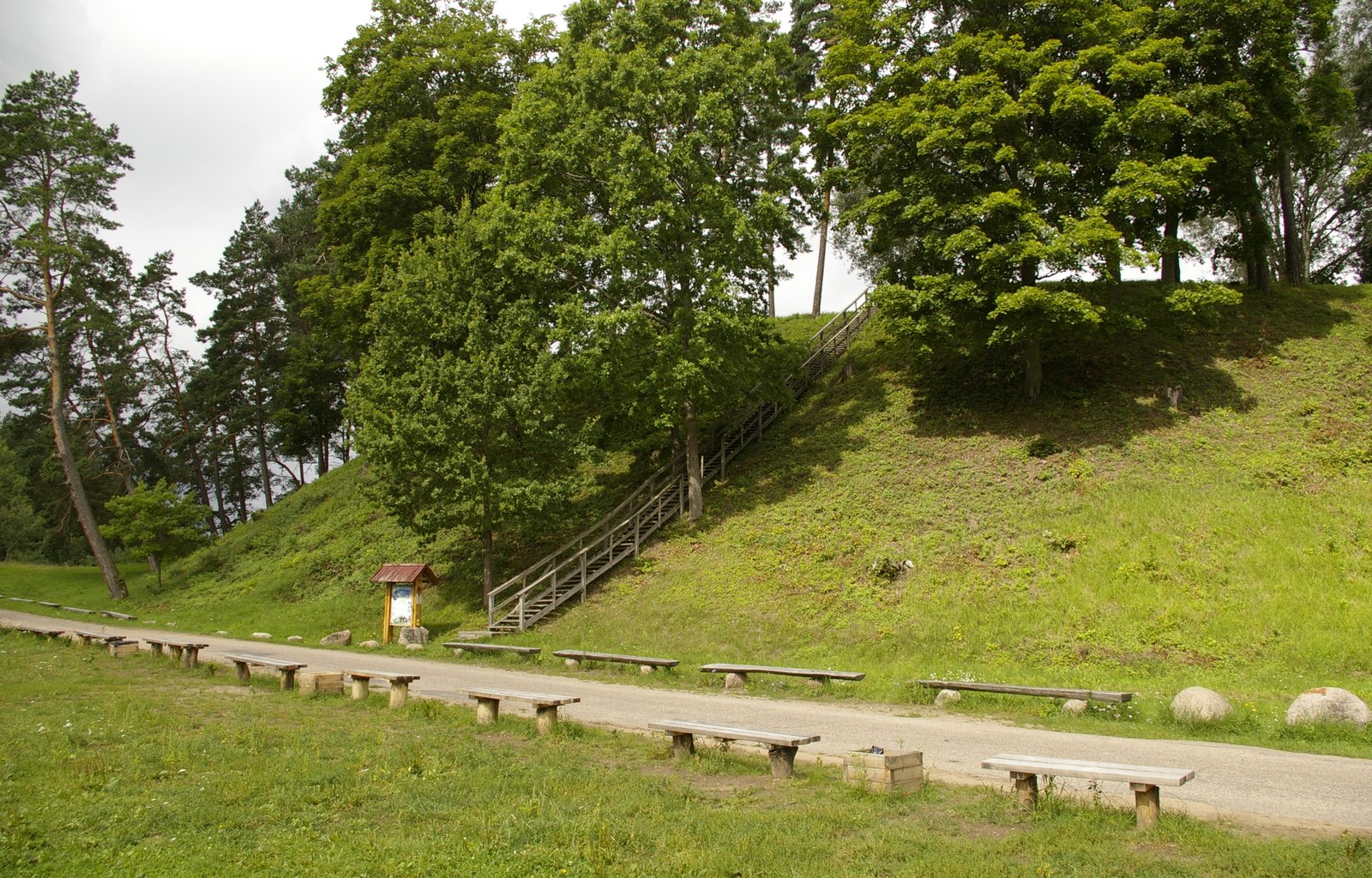
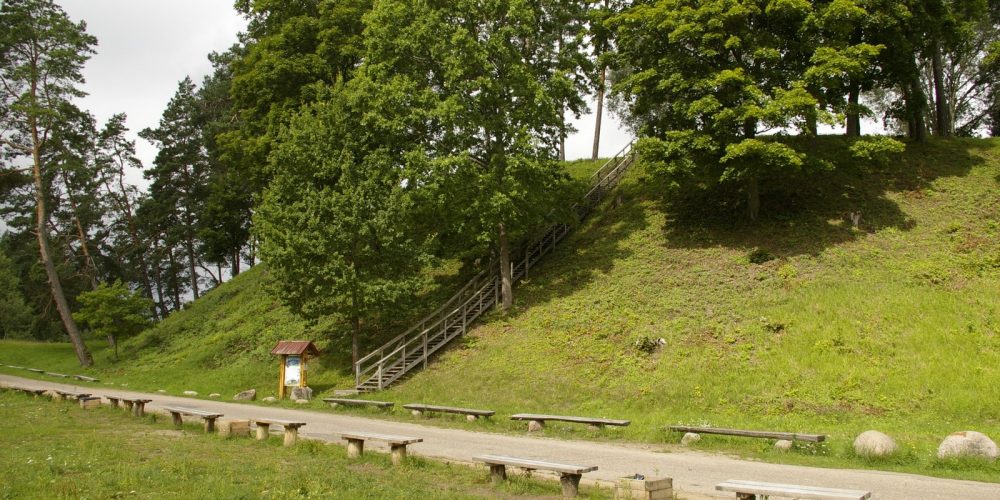
Address: Mergiškių kalvos forest, 3 km from regional road No. 221 Vievis–Aukštadvaris, Aukštadvaris eldership, Trakai district.
GPS: 54.611636, 24.515195
The Devil’s Pit is the ‘queen’ of the Lithuanian pits, surrounded by legends and myths. It has been proclaimed a geological natural monument of the Republic of Lithuania and is among the Top 100 of Europe’s most-visited natural monuments. The Devil’s Pit is a special mythological sacral place.
It hides deep in the forests of Mergiškiai Landscape Reserve at Aukštadvaris Regional Park. Aukštadvaris Region is known for its old and distinctive history and culture. The first people settled there as early as the 3rdand 2ndcentury BC. In addition to important archaeological monuments, wooden castles, hill forts, kurgans and ancient settlements, this territory has a uniquely beautiful relief. It is the highest part of the Dzūkai Highlands, rich in hills, valleys, pits, ridges and lakes. Four kilometres from the Devil’s Pit is the highest point in the vicinity – Gedanonys Hill. The place where the Verknė and Strėva rivers originate is a unique natural treasure. This visitor-friendly territory is of state significance, and the Trakai Forestry Enterprise is responsible for its maintenance.
There are many deep pits in Lithuania. The Devil’s Pit is the deepest: it is funnel-shaped and is about 40 metres deep. The regular circular upper pit diameter is 200 metres. The peat layer at the bottom of the Pit is about 10 metres tall bringing the total depth of the Pit to about 50 metres. It is believed that in ancient times the Pit was even deeper.
The Trail of Secrets of the Devil’s Pit goes down to where a viscous swamp of 60 metres in diameter lies stagnant. In summer, it is tempting to wade in it, but people are advised to refrain from doing so as the swamp is very viscous and dangerous. It is believed that this swamp is connected with neighbouring deep Škilietai lakes through underground tunnels. Legend has it that local livestock fell into the Pit tempted by the devil and were later found floating in one of the nearby lakes. Another legend tells a story of a giant’s skeleton that lies in the vicinity: the Devil’s Pit is his mouth, Škilietai lakes are the eyes and the nose is the Pamiškė Hill Fort.
Tree anomalies are found in the area of the swamp and the loamy ridges surrounding it. The desire to explain this strange natural phenomenon attracts a lot of scientists. They claim that deviations of the energy field can be recorded around the Devil’s Pit. In any case, it is a place distinct for the collision of strong geological biofields. People tend to experience strange sensations having visited the Devil’s Pit and especially after going down to its very bottom.
The Origins of the Devil’s Pit
The Devil’s Pit is a truly mysterious place. Even its origins are a mystery to be solved. Speculations, reasonings and legends have been passed on from generation to generation. A single scientific explanation is yet to be developed; however, there are a number of important hypotheses. One of them says that thousands of years ago, there was a glacier covered with rocks at this place. As it gradually melted, this impressive cavity was forming in the process. Another one states that a melting glacier formed a strong waterfall. Over time, the force of the falling water might have formed this deep pit. It is also believed that the hollow opened up when the underground stream brought fine sand and sediment to a small Škilietai lake.
Or, perhaps the Pit is the result of a fallen meteorite? The hypothesis of the meteorite crater is further supported by the relatively small and regular diameter of the Pit and various splintered boulders found on the steep slopes of the Pit and around it. Similarities can be found when data taken from other meteorite-formed crater pits are compared. Scientists are still looking for more evidence and are in no rush to confirm this theory.
According to Stories and Legends…
A long time ago, a beautiful church stood on a high hill at the place where the Devil’s Pit is today. Once a villager was passing by when he saw a local priest walking with a young girl. He became really angry about such inappropriate behaviour and shouted: ‘You deserve to fall deep into the ground!’ Together with the priest and the girl, the church fell deep down into the ground. It is said that on the days when there is water in the Pit, those with good eyesight can spot the church towers, while honest men would hear the church bells ringing.
*
Once there was a man who wanted to marry girl he liked. Unfortunately, he was married already, so he could not marry her in the church. He ignored the prohibition, threatened the priest with a sword and made him solemnise their marriage. As soon as the groom started saying his wedding vows the church suddenly collapsed into the ground taking the couple with it. The ringing of the church bell could be heardfor the next three days.
*
One day, God saw a priest kissing a local matron. He became so angry that he pounded his fist on the place so hard that the church with the hill went straight down into the ground.
*
Devils have their midnight feast here. People say that they could hear the devils screaming and raving. Those who pass by at night can see devils, so no one dares to go close to the Pit in the dark. That is the reason why this horrifying place was named the damned Devil’s Pit.
The Devil’s Fingers
In Lithuanian mythology, the Devil is often seen as a real creature, sometimes related to the world of the dead and sometimes to the giant behind the creation of nature. It is not surprising that in our country more than 400 natural objects bear his name. According to the belief of the ancient Balts and other Indo-Europeans, the devil’s finger is a magical stone. Our people relate the stone with the god called Perkūnas, (Eng. Thunder). The stones of yellow, brown, blue, grey or black colour are also called thunder-bullets in the region. People believed that God Thunder was throwing the stones at the Devil during a storm, and if he missed the ‘bullet’ went deep into the ground to emerge on the surface a few years later.
Lithuanian folklore suggests that the devil’s finger could be worn as an amulet against devils, witches and other evil spirits. The house that has a thunder-bullet inside will never be struck by lightning. This stone is also used in folk medicine to be placed on the sore area or to be taken as a drink with ground thunder-stone powder in it.
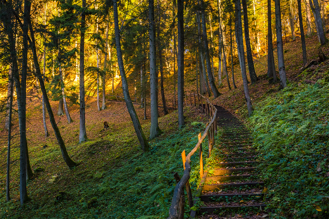
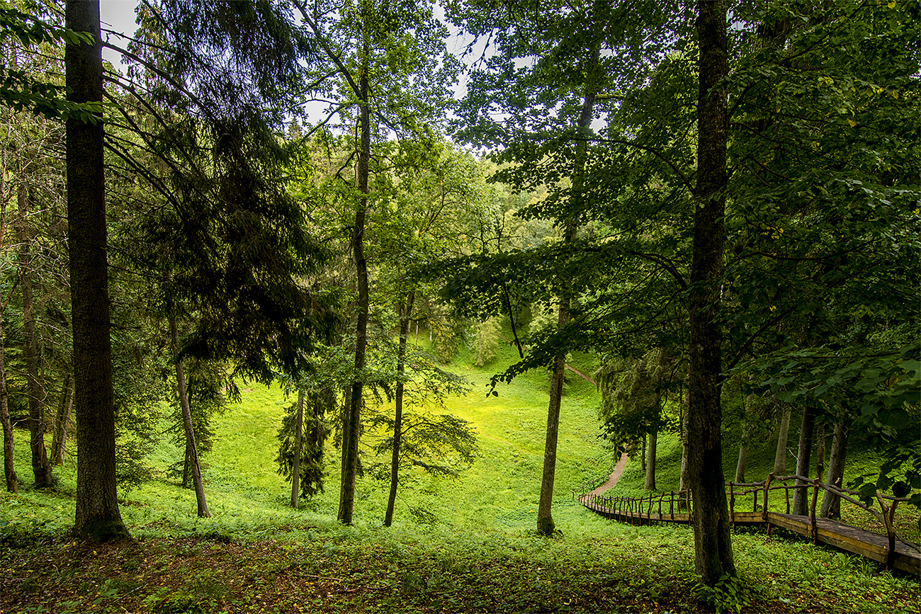
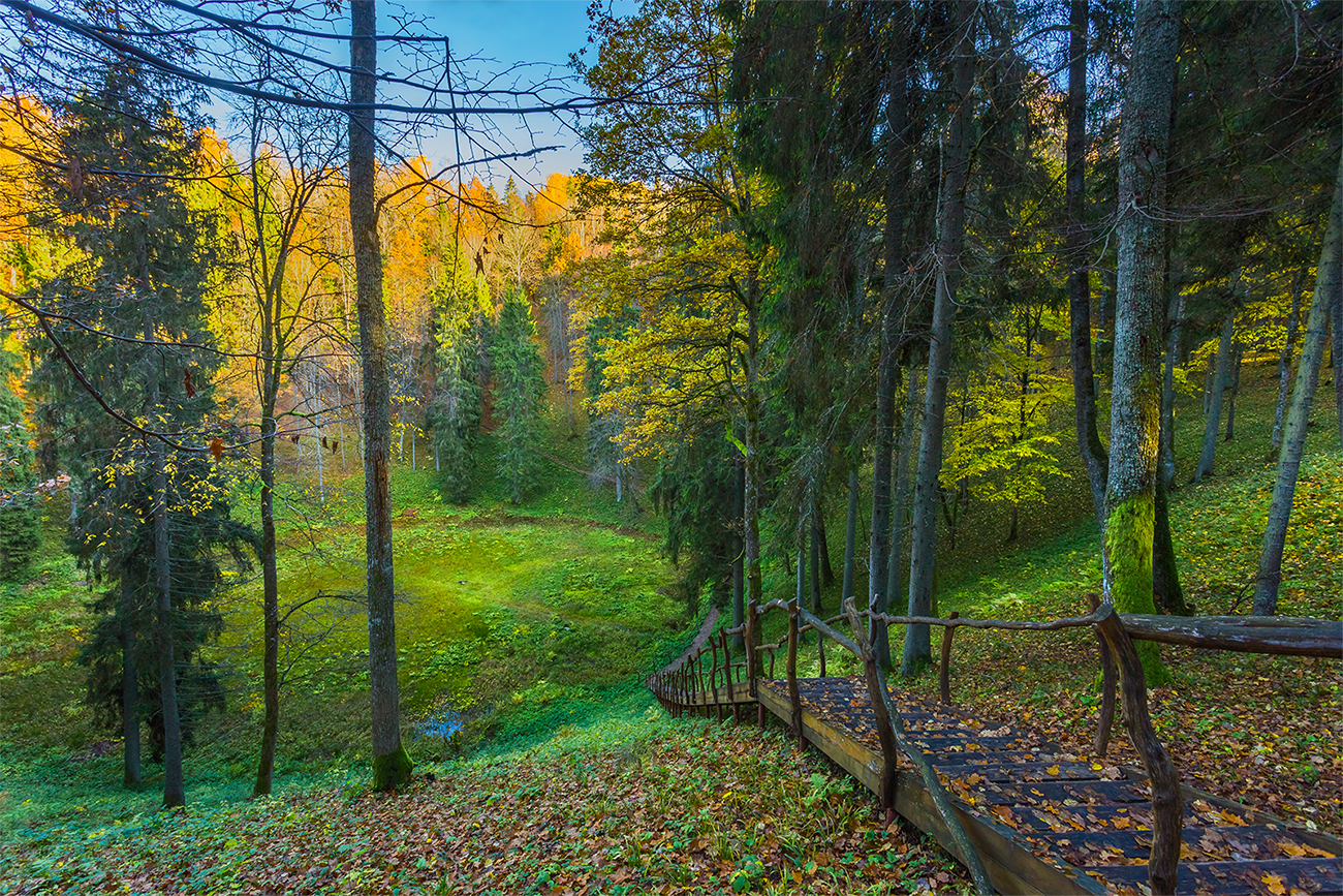
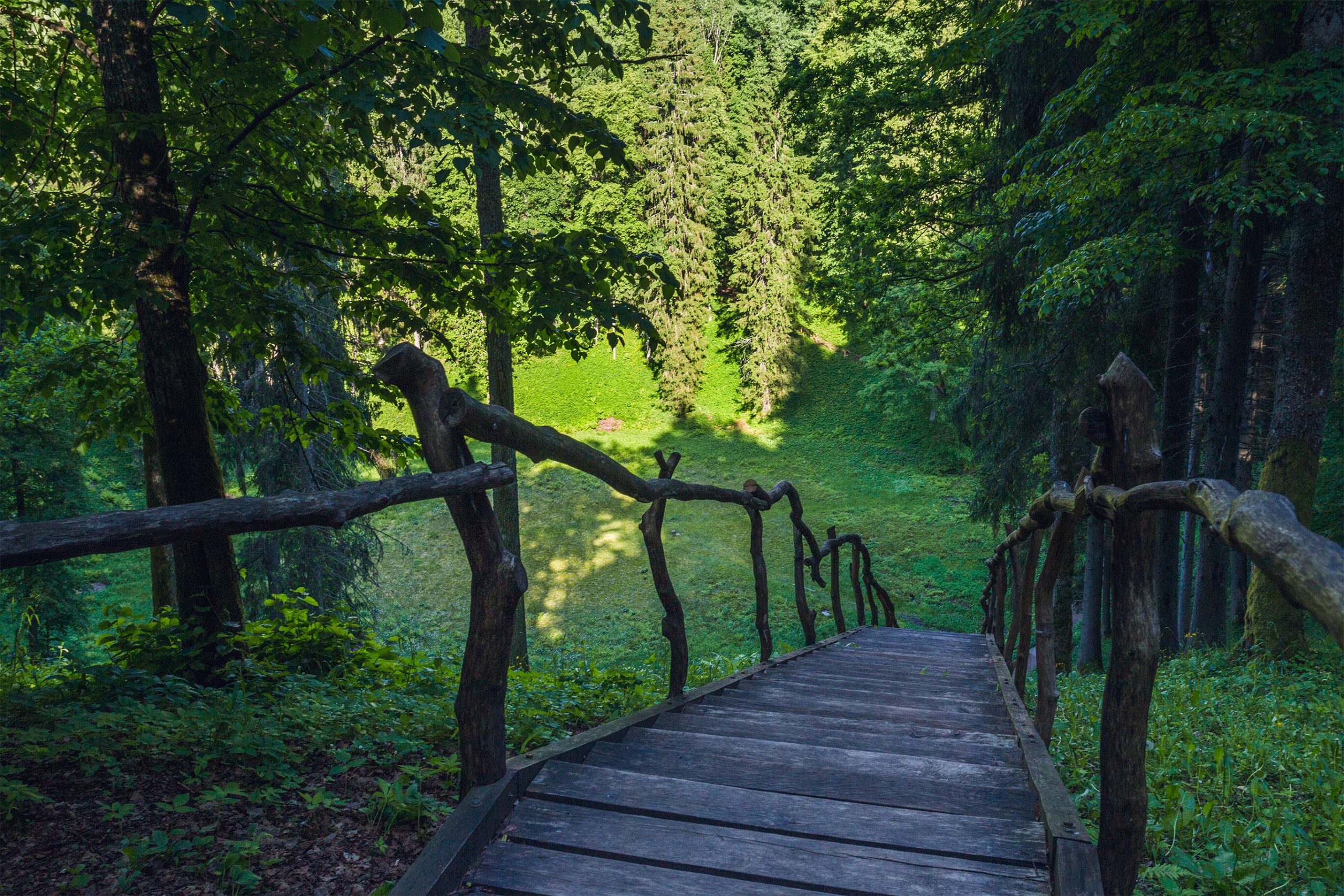
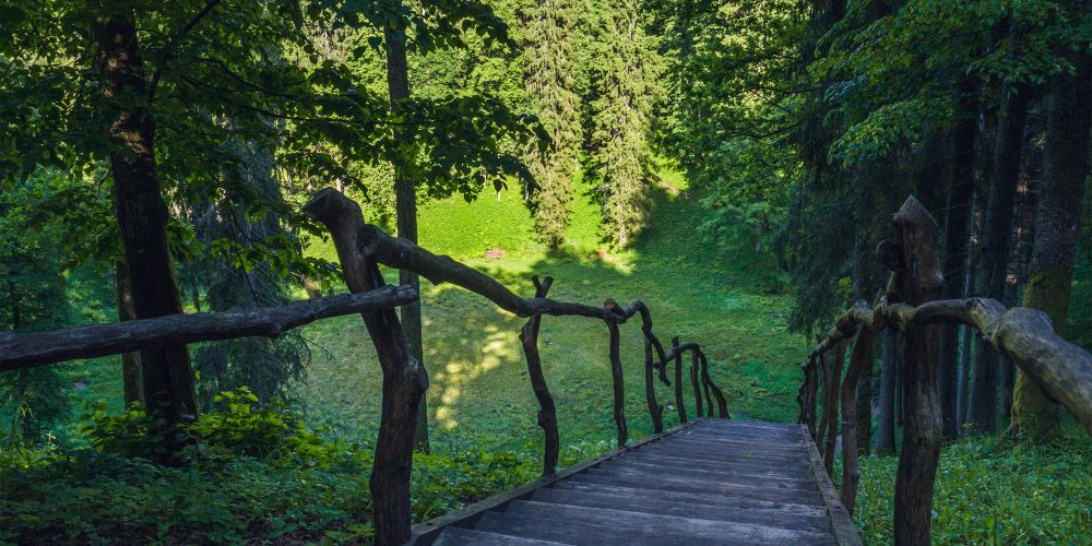
GPS: 54.575768, 24.527663
The spring is located on the southwestern of Aukštadvaris, on the left bank of the Verknė old riverbed. Refreshing, crisp and pure are just some of the words used to describe the magical water of the spring. Cold spring water gushing into the Verknė old riverbed, on the shores of which there was in pre-war years a mill, a sawmill and a bridge.
The locals have used this water since ancient times not only for drinking but also for healing. In 1959, after the hydroelectric has been built, Verknė changed the watercourse and began to flow out of the town. Her old furrow was barely noticeable. Some rare plants grow on the banks of the river. The shores are overgrown with beautiful trees.
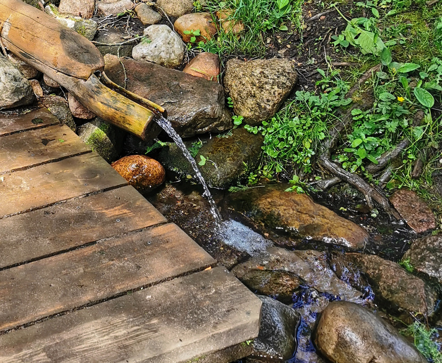
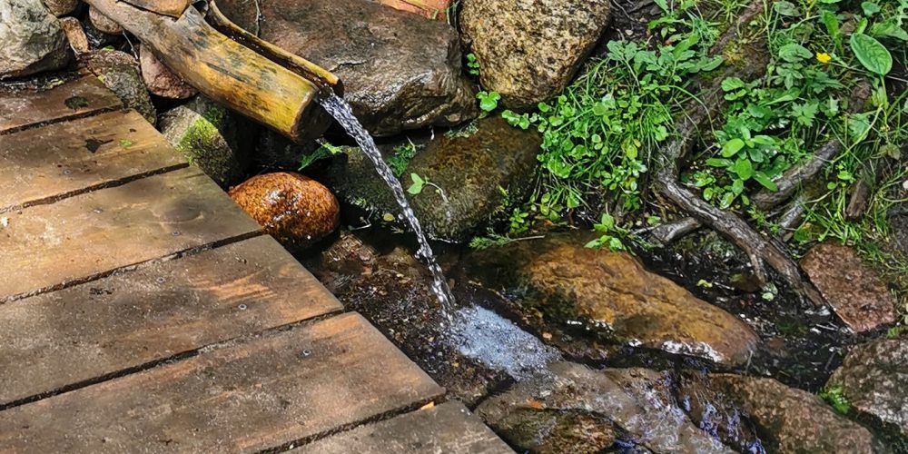
Address: Lavariskės village, Aukstadvaris eldership, Trakai district.
GPS: 54.582500, 24.484167
Also called Napoleon Hat and a Hill of Fire
There is no agreement on the point of the origin of Lavariškės Mound that is situated in Trakai district.
Some people say that they had been watching ancient Lithuanians doing their work, while according to others that mound was built by Napoleon‘s troops. Its shape resembles the headgear that had been worn by the Emperor‘s troops. For this reason, many people call the mound Napoleon Hat.
It appeared that a church was hidden, or maybe it is still hidden inside the mound! Various works of excavation had been done in those mounds and they had been inspected carefully. People say that various weapons from the ancient times, the ancient French weapons were found here. A beautiful hill was built. According to people, the troops had formed the hill during the war. There must be also a castle on the mound, but no building can be found. The church of Lavariske is inside that mound buried under a soil.
It is believed that many sacks with golden coins were buried under the mound. […] the old father went to a pasturage to bring the horse home and found a soldier sitting on the horse who pastured the horse in the meadow. The soldier got ashamed at pasturage of the horse and the old father took his horse to the other side, on the other meadow. And there were more meadows in the morning on the hill. My father told about two pots that were standing unearthed on the ground. Then he saw a leather purse of money in another place that was also unearthed. According to the father, the purse was made of leather, it was round and full of golden coins. The father found gold in every place where the soldier appeared. There really should be riches buried under the ground: people carried out works of excavations already several hundred years ago in an attempt to find a hidden treasure.
There was a settlement in the foothill of the mound on the top of which there was a fortress in the 14th century. Skillful people lived there: a lot of specimens of clay spindles, of pottery with a dashed, rough and smooth surface were found in a thick layer of turf! But they were not only great craftsmen, but also devotedly defended the castle against the enemy. Somewhat away from the settlement
Lavariškės site of tumuli still can be seen situated not very far from the settlement. 14 stone tumuli that were built to protect the burnt remains of the deceased ancestors can be seen here as they have survived into the present. Maybe this is one of the reasons why some ancestors keep calling Lavariškės Mound that is situated not far from the site of tumuli a Hill of Fire…
Source: © www.lietuvosgamta.lt
Photo: © www.lietuvosgamta.lt